Category:Landslide mitigation
Jump to navigation
Jump to search
Subcategories
This category has the following 4 subcategories, out of 4 total.
L
- Landslide barriers (7 F)
- Landslides in Sado Gold Mine (7 F)
Media in category "Landslide mitigation"
The following 55 files are in this category, out of 55 total.
-
 A major rock fall in the Braich area - geograph.org.uk - 301835.jpg 640 × 399; 49 KB
-
 Abstützen mit Metallstützen.jpg 300 × 400; 20 KB
-
 Ajimame landslide surveillance center.jpg 4,608 × 3,456; 1.72 MB
-
 Asansör (yandan).jpg 1,024 × 768; 183 KB
-
 Bionets.jpg 349 × 234; 37 KB
-
 Biostuoia.jpg 199 × 199; 17 KB
-
 Boulder net.JPG 2,272 × 1,704; 1.78 MB
-
 Brienz Schutzdamm.jpg 1,944 × 2,592; 2.29 MB
-
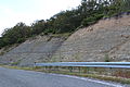
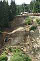
 Collapsed slope of R371.jpg 960 × 540; 193 KB
-
 Construction of slope of Keisei Narita Station,Narita-city,Japan.JPG 2,896 × 1,944; 1.35 MB
-
 Eilenburg Erdrutsch Abdeckplane.jpg 3,648 × 2,736; 3.6 MB
-
 Eilenburg Erdrutsch Abdeckplane2.jpg 3,648 × 2,736; 2.13 MB
-
 Eilenburg Erdrutsch Abdeckplane3.jpg 3,648 × 2,736; 1.59 MB
-
 Eilenburg Erdrutsch Abdeckplane4.jpg 2,736 × 3,648; 1.99 MB
-
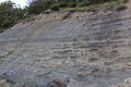
 Electrical resistivity tomography profile.jpg 3,888 × 2,592; 8.91 MB
-
 ESP 049370 2070 (35647958711).jpg 4,096 × 2,160; 924 KB
-
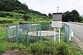
 Extensometer landslide.jpg 1,800 × 1,200; 658 KB
-
 Glen Croe - Old Military Road (8574984051).jpg 1,600 × 1,200; 416 KB
-
 Griglia paramassi 01.jpg 5,184 × 3,456; 9.09 MB
-
 Griglia paramassi 02.jpg 3,456 × 2,304; 5.67 MB
-
 Heroico Cuerpo de Bomberos del Distrito Federal - Simulacro 19.09.2015 10.JPG 3,456 × 2,304; 1.48 MB
-
 Heroico Cuerpo de Bomberos del Distrito Federal - Simulacro 19.09.2015 23.JPG 3,456 × 2,304; 840 KB
-
 Heroico Cuerpo de Bomberos del Distrito Federal - Simulacro 19.09.2015 31.JPG 1,920 × 1,280; 1.23 MB
-
 Jizukiyama drainage well and GPS based landslide surveillance system.jpg 2,038 × 1,524; 571 KB
-
 Jizukiyama steel pipe stake.jpg 1,468 × 1,961; 460 KB
-
 Junihara No. 12 drainage well.jpg 5,472 × 3,648; 3.48 MB
-
 Landslide education poster.jpg 2,136 × 2,848; 2.6 MB
-
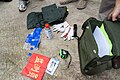 Landslide kit China.jpg 3,888 × 2,592; 9.49 MB
-
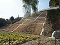 Landslide mitigation at side of Shrine in Kinryu, Saga.jpg 4,842 × 3,632; 11.01 MB
-
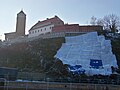
 Landslide protection, Apáthy Rock Nature Reserve, 2017 Nyék.jpg 1,600 × 1,200; 492 KB
-
 Landslide protection1 China.jpg 2,592 × 3,888; 9.35 MB
-
 Landslide protection2 China.jpg 3,888 × 2,592; 7.84 MB
-
 Le glissement de terrain et les solutions techniques.jpg 1,815 × 2,436; 1.12 MB
-
 Madeira - Jardim do Mar - tunnel entrance (24521187042).jpg 4,752 × 3,168; 8.22 MB
-
 Madeira - Jardim do Mar - tunnel entrance (24547350641).jpg 4,752 × 3,168; 6.93 MB
-
NASA Model Finds Landslide Threats in Near Real-Time During Heavy Rains.webm 2 min 8 s, 1,920 × 1,080; 106.55 MB
-
 PikiWiki Israel 6246 Geography of Israel.jpg 2,848 × 4,256; 2.23 MB
-
 Radiotelemetryextensometer.jpg 1,435 × 1,353; 495 KB
-
 Radiotelemetrywirelineextensometer.jpg 1,648 × 1,359; 693 KB
-
 Rockfall protection gallery1.JPG 3,888 × 2,592; 4.41 MB
-
 Rockfall protection gallery2.JPG 2,592 × 3,888; 3.58 MB
-
 Rockfall protection gallery3.JPG 2,592 × 3,888; 5.67 MB
-
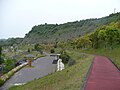 Saboulandpark Aira.jpg 1,024 × 768; 224 KB
-
 Schreitbagger 01.JPG 2,000 × 3,008; 2.99 MB
-
 Schreitbagger 02.JPG 2,000 × 3,008; 3.78 MB
-
 Sign of the forest intended for landslide prevention in Kuboizumi, Saga.jpg 5,100 × 3,400; 9.42 MB
-
 Siraiwadam.jpg 800 × 530; 621 KB
-
 SlideMinder Extensometer.png 2,163 × 3,426; 13.48 MB
-
 Support wall, Március 15 Street, 2020 Salgótarján.jpg 2,272 × 1,704; 966 KB
-

-

-
 Tresna i S1-23.02.2007 015.jpg 820 × 615; 378 KB
-
 Turtle Mountain prism.jpg 640 × 426; 69 KB
-
 Vargas landslide scars 1999.jpg 528 × 352; 36 KB
-
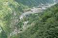
 土砂崩れ復旧状況 2007 上平西赤尾 (526146044).jpg 1,370 × 2,048; 648 KB


.jpg)


.jpg)

.jpg)


.jpg)
.jpg)


.jpg)