Category:Lange Vijverberg 15, The Hague
Jump to navigation
Jump to search
| Object location | | View all coordinates using: OpenStreetMap |
|---|
house in The Hague, Netherlands  | |||||
| Upload media | |||||
| Instance of | |||||
|---|---|---|---|---|---|
| Location | The Hague, South Holland, Netherlands | ||||
| Street address |
| ||||
| Occupant |
| ||||
| Heritage designation |
| ||||
 | |||||
|
This is a category about rijksmonument number 17738
|
| Address |
|
Media in category "Lange Vijverberg 15, The Hague"
The following 24 files are in this category, out of 24 total.
-
 Den Haag - Lange Vijverberg 14-15-16.jpg 3,648 × 2,736; 5.56 MB
-
 Exterieur OVERZICHT RICHTING HOFSINGEL - 's-Gravenhage - 20285772 - RCE.jpg 1,190 × 1,200; 399 KB
-
 Het Binnenhof, Den Haag, Netherlands - panoramio (50).jpg 4,896 × 3,264; 6.14 MB
-
 Het Binnenhof, Den Haag, Netherlands - panoramio.jpg 2,048 × 1,375; 729 KB
-
 Hoogsteder & Hoogsteder.jpg 2,816 × 2,112; 1.9 MB
-
 Interieur achterkamer - 's-Gravenhage - 20090898 - RCE.jpg 1,200 × 883; 210 KB
-
 Interieur, detail van de trap Lange Vijverberg 15 - 's-Gravenhage - 20341108 - RCE.jpg 1,190 × 1,200; 284 KB
-

-

-
 Interieur, kamer. Detail- plafond - 's-Gravenhage - 20341115 - RCE.jpg 1,188 × 1,200; 304 KB
-
 Interieur, overzicht kamer - 's-Gravenhage - 20341112 - RCE.jpg 1,200 × 952; 209 KB
-
 Interieur, overzicht kamer - 's-Gravenhage - 20341114 - RCE.jpg 1,200 × 802; 170 KB
-
 LG Lange Vijverberg 15 - 2.JPG 2,736 × 3,648; 2.78 MB
-
 LG Lange Vijverberg 15.JPG 2,736 × 3,648; 3.02 MB
-
 Middengedeelte gevel - 's-Gravenhage - 20090901 - RCE.jpg 856 × 1,200; 212 KB
-
 Naar tekening in het Rijksarchief - 's-Gravenhage - 20090892 - RCE.jpg 1,200 × 860; 235 KB
-
 Overzicht - 's-Gravenhage - 20090554 - RCE.jpg 1,200 × 887; 257 KB
-
 Overzicht - 's-Gravenhage - 20090555 - RCE.jpg 1,200 × 894; 250 KB
-
 Overzicht - 's-Gravenhage - 20090888 - RCE.jpg 1,200 × 809; 248 KB
-
 Plafond - 's-Gravenhage - 20090899 - RCE.jpg 1,200 × 873; 110 KB
-
 Plafond - 's-Gravenhage - 20090900 - RCE.jpg 1,200 × 886; 120 KB
-
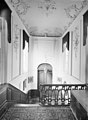
 Trappenhuis - 's-Gravenhage - 20090896 - RCE.jpg 880 × 1,200; 172 KB
-
 Trappenhuis - 's-Gravenhage - 20090897 - RCE.jpg 882 × 1,200; 172 KB
-
 Voorgevel huizen Lange Vijverberg 14 - 16 - 's-Gravenhage - 20341106 - RCE.jpg 1,200 × 943; 339 KB


.jpg)


