Category:Latijnse School (Vollenhove)
Jump to navigation
Jump to search
| Object location | | View all coordinates using: OpenStreetMap |
|---|
 | |||||
| Upload media | |||||
| Instance of | |||||
|---|---|---|---|---|---|
| Location | Vollenhove, Vollenhove | ||||
| Street address |
| ||||
| Located on street |
| ||||
| Owned by |
| ||||
| Heritage designation |
| ||||
| Inception |
| ||||
 | |||||
|
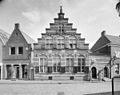
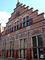
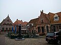
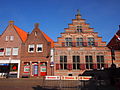
This is a category about rijksmonument number 10557
|
| Address |
|
Media in category "Latijnse School (Vollenhove)"
The following 21 files are in this category, out of 21 total.
-
 2007-09-15 15.18 Vollenhove, monumentale panden.JPG 3,049 × 2,287; 5.4 MB
-
 Exterieur - Vollenhove - 20245058 - RCE.jpg 927 × 1,200; 182 KB
-
 Exterieur - Vollenhove - 20245059 - RCE.jpg 1,200 × 896; 227 KB
-
 Interieur, gang, voormalige school - Vollenhove - 20344931 - RCE.jpg 945 × 1,200; 130 KB
-
 Interieur, kamer, voormalige school - Vollenhove - 20344932 - RCE.jpg 951 × 1,200; 161 KB
-
 Kerkplein15 Vollenhove.jpg 1,368 × 1,824; 233 KB
-
 Overzicht achtergevel, voormalige school - Vollenhove - 20344929 - RCE.jpg 951 × 1,200; 264 KB
-

-
 Overzicht Markt - Vollenhove - 20244892 - RCE.jpg 1,192 × 1,200; 357 KB
-
 Overzicht van de voorgevel met een trapgevel - Vollenhove - 20378927 - RCE.jpg 1,200 × 1,200; 268 KB
-
 Overzicht voorgevel - Vollenhove - 20245060 - RCE.jpg 1,200 × 894; 231 KB
-
 Overzicht voorgevel met trapgevel - Vollenhove - 20350338 - RCE.jpg 1,179 × 1,200; 352 KB
-
-
 Stoeppaal - Vollenhove - 20245139 - RCE.jpg 806 × 1,200; 244 KB
-
 Stoeppalen anno 1628, laat-renaissance - Vollenhove - 20516075 - RCE.jpg 1,200 × 900; 228 KB
-
 Vollenhove 009.JPG 3,264 × 2,448; 2.55 MB
-
 Vollenhove 010.JPG 2,448 × 3,264; 2.06 MB
-
 Vollenhoven markte.jpg 400 × 300; 93 KB
-
 Voorgevel - Vollenhove - 20245138 - RCE.jpg 806 × 1,200; 171 KB
-
 Voorgevel - Vollenhove - 20245140 - RCE.jpg 1,195 × 1,200; 303 KB
-
 Voorm. Latijnse school, Kerkplein 15, Vollenhove.JPG 4,032 × 3,024; 2.62 MB


