Category:Laurel County, Kentucky
Jump to navigation
Jump to search
Counties of Kentucky: Adair · Allen · Anderson · Ballard · Barren · Bath · Bell · Boone · Bourbon · Boyd · Boyle · Bracken · Breathitt · Breckinridge · Bullitt · Butler · Caldwell · Calloway · Campbell · Carlisle · Carroll · Carter · Casey · Christian · Clark · Clay · Clinton · Crittenden · Cumberland · Daviess · Edmonson · Elliott · Estill · Fayette · Fleming · Floyd · Franklin · Fulton · Gallatin · Garrard · Grant · Graves · Grayson · Green · Greenup · Hancock · Hardin · Harlan · Harrison · Hart · Henderson · Henry · Hickman · Hopkins · Jackson · Jefferson · Jessamine · Johnson · Kenton · Knott · Knox · LaRue · Laurel · Lawrence · Lee · Leslie · Letcher · Lewis · Lincoln · Livingston · Logan · Lyon · Madison · Magoffin · Marion · Marshall · Martin · Mason · McCracken · McCreary · McLean · Meade · Menifee · Mercer · Metcalfe · Monroe · Montgomery · Morgan · Muhlenberg · Nelson · Nicholas · Ohio · Oldham · Owen · Owsley · Pendleton · Perry · Pike · Powell · Pulaski · Robertson · Rockcastle · Rowan · Russell · Scott · Shelby · Simpson · Spencer · Taylor · Todd · Trigg · Trimble · Union · Warren · Washington · Wayne · Webster · Whitley · Wolfe · Woodford
county in Kentucky, United States   | |||||
| Upload media | |||||
| Instance of | |||||
|---|---|---|---|---|---|
| Named after | |||||
| Location | Kentucky | ||||
| Capital | |||||
| Inception |
| ||||
| Population |
| ||||
| Area |
| ||||
| Elevation above sea level |
| ||||
| Different from | |||||
| official website | |||||
 | |||||
Subcategories
This category has the following 12 subcategories, out of 12 total.
B
E
H
L
M
P
S
T
V
Media in category "Laurel County, Kentucky"
The following 12 files are in this category, out of 12 total.
-
 An early Gulf station located in Laurel County, Kentucky.jpg 2,048 × 1,360; 1.57 MB
-
 Boat parked on inlet at Laurel Lake - panoramio.jpg 3,000 × 4,000; 5.99 MB
-
 Controlled burn site - panoramio.jpg 4,800 × 1,216; 2.35 MB
-
 KYMap-doton-NorthCorbin.PNG 300 × 132; 10 KB
-
 Large Cave - panoramio.jpg 4,000 × 3,000; 4.5 MB
-
 Laurel Lake inlet - panoramio.jpg 4,896 × 1,280; 2.02 MB
-
 Looking out towards Laurel Lake - panoramio.jpg 4,864 × 1,264; 2.23 MB
-
 McHargue’s Mill.jpg 2,592 × 1,944; 1.38 MB
-
 Near Spring - panoramio.jpg 4,000 × 3,000; 4.96 MB
-
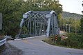 Rockcastle River bridge on KY490.jpg 6,016 × 4,000; 6.45 MB
-
 Tornado damage in Laurel County, Kentucky.jpg 1,005 × 642; 164 KB
-
 USA Laurel County, Kentucky age pyramid.svg 520 × 600; 8 KB


