Category:Leinster
Перейти до навігації
Перейти до пошуку
province in Ireland    | |||||
| Завантажити медіафайл | |||||
| Є одним із | |||||
|---|---|---|---|---|---|
| Місце розташування |
| ||||
| Кількість населення |
| ||||
| Площа |
| ||||
 | |||||
Підкатегорії
Показано 8 підкатегорій із 8.
Файли в категорії «Leinster»
Показано 200 файлів цієї категорії (із 491).
(попередня сторінка) (наступна сторінка)-
De-Leinster.ogg 1,6с; 15 КБ
-

-
 "Little Munchkins" - geograph.org.uk - 4215267.jpg 640 × 480; 438 КБ
-
 "The Meetings" - geograph.org.uk - 4214876.jpg 640 × 480; 435 КБ
-
 A bit of everything - geograph.org.uk - 4011156.jpg 4608 × 3456; 4,93 МБ
-
 A field, a tree, a mountain - geograph.org.uk - 4097190.jpg 4608 × 3456; 3,67 МБ
-
 A lane leading to the Irish Sea (and the railway) - geograph.org.uk - 4072671.jpg 2592 × 1944; 1,99 МБ
-
 A venerable cedar. - geograph.org.uk - 3656865.jpg 1944 × 2592; 1,14 МБ
-
 A very minor road at Kilmacoo - geograph.org.uk - 4215784.jpg 640 × 480; 593 КБ
-
 Abandoned cottage near Laragh - geograph.org.uk - 4207474.jpg 640 × 480; 198 КБ
-

-
 Across the railway (1) - geograph.org.uk - 4578250.jpg 4320 × 3240; 4,88 МБ
-
 Across the railway (2) - geograph.org.uk - 4578257.jpg 3240 × 4320; 3,16 МБ
-
 Across the railway (3) - geograph.org.uk - 4578258.jpg 4320 × 3240; 4,71 МБ
-
 And the next bird is.. (a meadow pipit) - geograph.org.uk - 4015349.jpg 4608 × 3456; 4,55 МБ
-
 Another fine view - geograph.org.uk - 4205486.jpg 4608 × 3456; 4,08 МБ
-

-
 At the Kilcarney Cross Roads - geograph.org.uk - 4090943.jpg 2592 × 1944; 1,95 МБ
-
 Atlas Van der Hagen-KW1049B11 051-COMITATVS LAGENIAE The COVNTIE of LEINSTER.jpeg 5500 × 4358; 3,64 МБ
-
 Avoca Community Hall - geograph.org.uk - 4215291.jpg 640 × 480; 421 КБ
-
 Avonbeg River at Glenmalure - geograph.org.uk - 4199084.jpg 640 × 480; 150 КБ
-
 Avonbeg River at Glenmalure - geograph.org.uk - 4199085.jpg 640 × 480; 145 КБ
-
 Avonbeg River below Glenmalure - geograph.org.uk - 4199117.jpg 640 × 480; 245 КБ
-
 Avonmore River - geograph.org.uk - 4207513.jpg 640 × 480; 173 КБ
-
 Avonmore valley at Sroughmore - geograph.org.uk - 4215298.jpg 640 × 480; 522 КБ
-
 Avonmore valley at Sroughmore - geograph.org.uk - 4215301.jpg 640 × 480; 406 КБ
-
 Avonmore valley at Sroughmore - geograph.org.uk - 4215306.jpg 640 × 480; 442 КБ
-
 Bales and trailer, Ballysheeman - geograph.org.uk - 4207676.jpg 640 × 480; 127 КБ
-
 Ballinastoe Crossroads, Co. Wicklow - geograph.org.uk - 4014418.jpg 1024 × 664; 228 КБ
-
 Ballinderry Road, Rathdrum - geograph.org.uk - 4207686.jpg 640 × 480; 134 КБ
-
 Bare field at Crone More - geograph.org.uk - 4214713.jpg 640 × 480; 439 КБ
-
 Barn and slurry tank at Mountlusk - geograph.org.uk - 4215326.jpg 640 × 480; 387 КБ
-
 Barn at Sroughmore - geograph.org.uk - 4215307.jpg 640 × 480; 475 КБ
-
 Barn near Pollaphuca - geograph.org.uk - 4221808.jpg 640 × 480; 412 КБ
-
 Barn, Knockrath - geograph.org.uk - 4207680.jpg 640 × 480; 163 КБ
-
 Barns ancient and modern - geograph.org.uk - 4193759.jpg 640 × 480; 124 КБ
-
 Below Slieve Maan - geograph.org.uk - 4196618.jpg 640 × 480; 192 КБ
-
 Biofuel building - geograph.org.uk - 4579572.jpg 4320 × 3240; 4,69 МБ
-

-
 Boggy field at Ballycreen Upper - geograph.org.uk - 4198229.jpg 640 × 480; 184 КБ
-

-
 Bray from Bray Head - geograph.org.uk - 3656902.jpg 2592 × 1944; 1,18 МБ
-
 Bray Head to the Irish Sea - geograph.org.uk - 3685180.jpg 3648 × 2736; 4,77 МБ
-
 Bridge over the River Ow - geograph.org.uk - 4542556.jpg 1024 × 768; 327 КБ
-
 Brittas Bay - geograph.org.uk - 3679675.jpg 3648 × 2736; 4,85 МБ
-
 Brittas Bay - geograph.org.uk - 3685226.jpg 3648 × 2736; 3,77 МБ
-
 Brittas to Ocean View - geograph.org.uk - 3685243.jpg 3648 × 2736; 5,11 МБ
-
 Brittas, Co Wicklow - geograph.org.uk - 3679684.jpg 3648 × 2736; 4,67 МБ
-
 Bull at Knockaphrumpa - geograph.org.uk - 4213247.jpg 640 × 480; 194 КБ
-
 Bungalow above Rathdrum - geograph.org.uk - 4208487.jpg 640 × 480; 141 КБ
-
 Bungalow at Coolalflake - geograph.org.uk - 4214870.jpg 640 × 480; 422 КБ
-
 Bungalow at Kilmacoo - geograph.org.uk - 4215786.jpg 640 × 480; 488 КБ
-
 Bungalow at Kilmacoo Upper - geograph.org.uk - 4215772.jpg 640 × 480; 517 КБ
-
 Bungalow at Pollaphuca - geograph.org.uk - 4221814.jpg 640 × 480; 423 КБ
-
 Bungalow beside the R753 - geograph.org.uk - 4199187.jpg 640 × 480; 137 КБ
-
 Bungalow near Rathdrum - geograph.org.uk - 4208475.jpg 640 × 480; 141 КБ
-
 Bungalow near Tomriland Cross Roads - geograph.org.uk - 4208543.jpg 640 × 480; 164 КБ
-
 Bungalow on Ballinderry Road, Rathdrum - geograph.org.uk - 4207693.jpg 640 × 480; 110 КБ
-
 Bungalows at Ballycooleen - geograph.org.uk - 4215514.jpg 640 × 480; 399 КБ
-
 Bungalows at Ballyteige - geograph.org.uk - 4207516.jpg 640 × 480; 186 КБ
-
 Bushes and fields, Knockandreet - geograph.org.uk - 4208217.jpg 640 × 480; 196 КБ
-

-
 Camenabologue Summit - geograph.org.uk - 4446138.jpg 640 × 480; 95 КБ
-

-
 Cattle at Ballinabamy - geograph.org.uk - 4215790.jpg 640 × 480; 536 КБ
-
 Cattle at Knockaphrumpa - geograph.org.uk - 4213249.jpg 640 × 480; 202 КБ
-
 Cattle near Garryduff Cross Roads - geograph.org.uk - 4208552.jpg 640 × 480; 131 КБ
-
 Clara Bridge - geograph.org.uk - 4203497.jpg 640 × 480; 220 КБ
-
 Clara Bridge - geograph.org.uk - 4203501.jpg 640 × 480; 234 КБ
-
 Clearing in the Ballybraid valley - geograph.org.uk - 4193552.jpg 640 × 480; 185 КБ
-
 Comitatus Lageniae = The countie of Leinster - CBT 6592890.jpg 5704 × 4462; 6,57 МБ
-
 Control tower, Vartry Reservoir - geograph.org.uk - 4203489.jpg 640 × 480; 134 КБ
-
 Corner of field at Ballycreen Upper - geograph.org.uk - 4198228.jpg 640 × 480; 149 КБ
-
 Cornfield on the hill - geograph.org.uk - 4097099.jpg 2592 × 1944; 2,69 МБ
-
 Corrugated iron barn in Glenmalure - geograph.org.uk - 4193534.jpg 640 × 480; 144 КБ
-
 Country east of Aughrim - geograph.org.uk - 4091201.jpg 2592 × 1944; 1,28 МБ
-
 Country in the southern Wicklow Mountains - geograph.org.uk - 4090922.jpg 2592 × 1944; 1,97 МБ
-
 Country near the Ow River - geograph.org.uk - 4090898.jpg 2592 × 1944; 2 МБ
-
 Country road at Ballinabarry - geograph.org.uk - 4207457.jpg 640 × 480; 147 КБ
-
 Country road at Ballindoyle - geograph.org.uk - 4215317.jpg 640 × 480; 529 КБ
-
 Country road near Oakwood Lodge - geograph.org.uk - 4221837.jpg 640 × 480; 565 КБ
-
 Countryside at Annagolan - geograph.org.uk - 4213297.jpg 640 × 480; 154 КБ
-
 Countryside at Crone More - geograph.org.uk - 4214716.jpg 640 × 480; 516 КБ
-
 Countryside at Tomdarragh - geograph.org.uk - 4208181.jpg 640 × 480; 192 КБ
-
 Countryside near Ballinvally - geograph.org.uk - 4215767.jpg 640 × 480; 428 КБ
-
 Courtyard wall at Ballyteige - geograph.org.uk - 4199181.jpg 640 × 480; 202 КБ
-
 Crannmor Pottery - geograph.org.uk - 4193572.jpg 640 × 480; 135 КБ
-
 Cycling on Lower Windgates - geograph.org.uk - 4097106.jpg 2592 × 1944; 2,87 МБ
-
 Doire Coille House - geograph.org.uk - 4207470.jpg 640 × 480; 162 КБ
-
 Down the side of Little Sugar Loaf - geograph.org.uk - 4097182.jpg 4608 × 3456; 4,81 МБ
-
 Driveway and outbuildings at Tomdarragh - geograph.org.uk - 4208177.jpg 640 × 480; 211 КБ
-
 Driveway at Garrymore Lower - geograph.org.uk - 4199159.jpg 640 × 480; 194 КБ
-
 Driveway at Kilqueeny - geograph.org.uk - 4215271.jpg 640 × 480; 413 КБ
-
 Driveway to Annagolan House - geograph.org.uk - 4213278.jpg 640 × 480; 242 КБ
-
 End of the drive - geograph.org.uk - 4011131.jpg 4608 × 3456; 5,63 МБ
-

-

-

-

-
 Entrance to a forest ride - geograph.org.uk - 4576847.jpg 1024 × 768; 251 КБ
-

-

-

-
 Farm at Ballinabamy - geograph.org.uk - 4215793.jpg 640 × 480; 512 КБ
-
 Farm at Ballyeustace - geograph.org.uk - 4199137.jpg 640 × 480; 194 КБ
-
 Farm at Garrymore Upper - geograph.org.uk - 4199167.jpg 640 × 480; 131 КБ
-
 Farm at Kilmacrea Upper - geograph.org.uk - 4221854.jpg 640 × 480; 527 КБ
-
 Farm at Rockstown Lower - geograph.org.uk - 4215310.jpg 640 × 480; 555 КБ
-
 Farm at Tullylusk - geograph.org.uk - 4215819.jpg 640 × 480; 413 КБ
-
 Farm driveway and pylons at Pollaphuca - geograph.org.uk - 4215765.jpg 640 × 480; 383 КБ
-
 Farm near Ballivally - geograph.org.uk - 4215769.jpg 640 × 480; 463 КБ
-

-
 Farm road near Cunniamstown - geograph.org.uk - 4215760.jpg 640 × 480; 451 КБ
-
 Farmland near Kilcarney - geograph.org.uk - 4090934.jpg 2592 × 1944; 1,63 МБ
-
 Farmland near Killabeg - geograph.org.uk - 4072832.jpg 2592 × 1944; 1,41 МБ
-
 Farmland north of Newcastle - geograph.org.uk - 4072661.jpg 2592 × 1944; 1,04 МБ
-

-
 Field and forest at Ballinvally - geograph.org.uk - 4221828.jpg 640 × 480; 424 КБ
-
 Field and trees at Bolagh - geograph.org.uk - 4215801.jpg 640 × 480; 490 КБ
-
 Field at Ballindoyle - geograph.org.uk - 4215321.jpg 640 × 480; 415 КБ
-
 Field at Glasnarget South - geograph.org.uk - 4215329.jpg 640 × 480; 497 КБ
-
 Field at Kilmacrea Upper - geograph.org.uk - 4221856.jpg 640 × 480; 491 КБ
-
 Field at Kilmullin - geograph.org.uk - 4208578.jpg 640 × 480; 188 КБ
-
 Field at Knockaphrumpa - geograph.org.uk - 4213248.jpg 640 × 480; 159 КБ
-
 Field at Tiglin - geograph.org.uk - 4213283.jpg 640 × 480; 164 КБ
-
 Field gateway at Ballymoney - geograph.org.uk - 4199120.jpg 640 × 480; 170 КБ
-
 Field of cattle at Knockandreet - geograph.org.uk - 4208213.jpg 640 × 480; 183 КБ
-
 Field of maize at Connary - geograph.org.uk - 4215280.jpg 640 × 480; 504 КБ
-
 Field of sheep above Clara Vale - geograph.org.uk - 4208247.jpg 640 × 480; 178 КБ
-
 Field of sheep at Ballinacor - geograph.org.uk - 4199115.jpg 640 × 480; 157 КБ
-
 Field of sheep at Crone More - geograph.org.uk - 4214703.jpg 640 × 480; 477 КБ
-
 Field of sheep at Glasnarget South - geograph.org.uk - 4215331.jpg 640 × 480; 471 КБ
-
 Field of sheep at Knockadreet - geograph.org.uk - 4208197.jpg 640 × 480; 161 КБ
-
 Field of sheep at Moneystown - geograph.org.uk - 4208572.jpg 640 × 480; 141 КБ
-
 Field of sheep near Moneytown Bridge - geograph.org.uk - 4208531.jpg 640 × 480; 170 КБ
-
 Field with cattle at Ballyeustace - geograph.org.uk - 4199133.jpg 640 × 480; 190 КБ
-
 Field with sheep - geograph.org.uk - 4193760.jpg 640 × 480; 117 КБ
-
 Field with sheep above Clara Vale - geograph.org.uk - 4208249.jpg 640 × 480; 170 КБ
-
 Fields and farm at Lickeen - geograph.org.uk - 4208272.jpg 640 × 480; 171 КБ
-
 Fields and hedgerows at Ballinvally - geograph.org.uk - 4221834.jpg 640 × 480; 401 КБ
-

-
 Fields at Ballydonnell - geograph.org.uk - 4215774.jpg 640 × 480; 384 КБ
-
 Fields at Parkmore - geograph.org.uk - 4208569.jpg 640 × 480; 156 КБ
-
 Fields at Tiglin - geograph.org.uk - 4213287.jpg 640 × 480; 197 КБ
-
-
 Football match in Clara Vale - geograph.org.uk - 4207511.jpg 640 × 481; 181 КБ
-

-
 Forest above Mucklagh Brook - geograph.org.uk - 4196631.jpg 640 × 480; 158 КБ
-
 Forest and Footbridge - geograph.org.uk - 4446475.jpg 640 × 480; 138 КБ
-

-
 Forest operations - geograph.org.uk - 4198224.jpg 640 × 480; 208 КБ
-
 Forest road above Mucklagh Brook - geograph.org.uk - 4196636.jpg 640 × 480; 156 КБ
-
 Forest road at Ballinvally - geograph.org.uk - 4221819.jpg 640 × 480; 464 КБ
-
 Forest road to the Ballybraid valley - geograph.org.uk - 4193547.jpg 640 × 480; 156 КБ
-
 Forest track at Ballydowling - geograph.org.uk - 4207500.jpg 640 × 480; 232 КБ
-
 Forest track at Ballydowling - geograph.org.uk - 4207502.jpg 640 × 480; 215 КБ
-
-

-
 Forested land leading down to the Ow River - geograph.org.uk - 4090830.jpg 2592 × 1944; 1,85 МБ
-
 Forested slope above Glenmalure - geograph.org.uk - 4198231.jpg 640 × 480; 157 КБ
-
 Forested slopes of Cullentragh Mountain - geograph.org.uk - 4193807.jpg 640 × 480; 200 КБ
-
 Forestry road above Glenmalure - geograph.org.uk - 4198232.jpg 640 × 480; 170 КБ
-
 Forestry sheds in the Ballybraid valley - geograph.org.uk - 4193564.jpg 640 × 480; 151 КБ
-
-

-
 Foundations at Mongnacool Lower - geograph.org.uk - 4214723.jpg 640 × 480; 443 КБ
-
 Fraughan Rock Glen - geograph.org.uk - 4446097.jpg 640 × 480; 88 КБ
-
 Garden with a view - geograph.org.uk - 3685249.jpg 3648 × 2736; 4,7 МБ
-
 Garryduff Cross Roads - geograph.org.uk - 4208554.jpg 640 × 480; 119 КБ
-
 Gated entrance at Ballinacor - geograph.org.uk - 4199108.jpg 480 × 640; 219 КБ
-
 Gated entrance on Lower Windgates - geograph.org.uk - 4097109.jpg 2592 × 1944; 2,59 МБ
-
 Gates at Garryduff - geograph.org.uk - 4208547.jpg 640 × 480; 167 КБ
-
 Gates to Oakwood Lodge - geograph.org.uk - 4221842.jpg 480 × 640; 207 КБ
-
 Gateway and barn near Glenwood - geograph.org.uk - 4208260.jpg 640 × 480; 164 КБ
-
 Gateway and drive at Ballinderry Upper - geograph.org.uk - 4207523.jpg 640 × 480; 226 КБ
-
 Gateway on Killeagh Hill - geograph.org.uk - 4214865.jpg 640 × 480; 432 КБ
-
 Gateway to the Clara Lara Funpark - geograph.org.uk - 4207507.jpg 640 × 480; 188 КБ
-

-
 Glen of the Downs Golf Club - geograph.org.uk - 4097116.jpg 2592 × 1944; 1,72 МБ
-
 Glendalough, St Kevin's Church and graveyard - geograph.org.uk - 4327783.jpg 2592 × 1944; 1,38 МБ
-
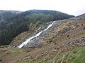 Glenmacnass Waterfall, Wicklow Mountains - geograph.org.uk - 4637152.jpg 1024 × 768; 194 КБ
-
 Glenmalure Lodge - geograph.org.uk - 4199086.jpg 640 × 480; 137 КБ
-
 Glenmalure Open Farm - geograph.org.uk - 4193448.jpg 640 × 480; 537 КБ
-
 Glenmalure Open Farm - geograph.org.uk - 4199089.jpg 640 × 480; 201 КБ
-

-
-

-

-

-

-
 Grassland and stream above Glenwood - geograph.org.uk - 4208263.jpg 640 × 480; 116 КБ
-
 Grassy track in forest, Ballinacor - geograph.org.uk - 4199110.jpg 640 × 480; 185 КБ
-
 Great Sugar Loaf - geograph.org.uk - 3685214.jpg 3648 × 2736; 3,88 МБ
-
 Great Sugar Loaf from Bohilla Lane - geograph.org.uk - 4097120.jpg 2263 × 1696; 948 КБ
-
 Greenane Road, Rathdrum - geograph.org.uk - 4207687.jpg 640 × 480; 102 КБ
-
 Hags and Lakes - geograph.org.uk - 4446125.jpg 640 × 480; 94 КБ
-
 Headwater of the Aghavannagh River - geograph.org.uk - 4196645.jpg 640 × 480; 138 КБ
-
 High Waterfall - The Glenmacnass Waterfall - geograph.org.uk - 4687100.jpg 1632 × 918; 543 КБ
-
 Hillside at Ballinabarry - geograph.org.uk - 4207460.jpg 640 × 480; 163 КБ
-
 Horse at Tullylusk - geograph.org.uk - 4215816.jpg 640 × 480; 443 КБ


_-_geograph.org.uk_-_4072671.jpg)


_-_geograph.org.uk_-_4578250.jpg)
_-_geograph.org.uk_-_4578257.jpg)
_-_geograph.org.uk_-_4578258.jpg)
_-_geograph.org.uk_-_4015349.jpg)


_-_geograph.org.uk_-_4637676.jpg)


_-_geograph.org.uk_-_4637193.jpg)


,_near_Greystones,_Co._Wicklow_-_geograph.org.uk_-_4010902.jpg)
,_near_Greystones,_Co._Wicklow_-_geograph.org.uk_-_4010944.jpg)
_-_the_Leisure_Club,_near_Greystones,_Co._Wicklow_-_geograph.org.uk_-_4010967.jpg)
_-_gardens,_near_Greystones,_Co._Wicklow_-_geograph.org.uk_-_4022437.jpg)
_-_sculpture_of_a_stag,_near_Greystones,_Co._Wicklow_-_geograph.org.uk_-_4022462.jpg)


