Category:Lesser Antilles
跳转到导航
跳转到搜索
島群   | |||||
| 上传媒体 | |||||
| 隶属于 | |||||
|---|---|---|---|---|---|
| 位置 | |||||
| 相接水体 | |||||
| 可分為 | |||||
| 面积 |
| ||||
| 海拔 |
| ||||
 | |||||
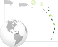
The Lesser Antilles (“Antillas Menores” in Spanish, “Petites Antilles” in French) is a large archipelago in the Caribbean Sea, comprising smaller islands in the East and South of Antilles; they are subdivided into two or three subgroups:
- the “Windward Antilles”, “islas de Barlovento” in Spanish, “îles du Vent” in French (the eastern subgroup), forming a volcanic arc to the East, preferably subdivided in English into:
- the “Leeward Islands” (the northeastern subgroup), to the north of latitude 15°N and the east of longitude 65°00′W, between the Virgin Islands and Dominica, generally extended to Isla de Aves;
- the “Windward Islands” (the southeastern subgroup), to the south of latitude 15°N and the east of longitude 62°30′W, between Martinique and Grenada, generally extended to Trinidad and Tobago;
- the “Leeward Antilles”, “islas de Sotavento” in Spanish, “îles sous le Vent” in French (the southwestern subgroup), along the Northern coast of South America (rarely extended to Trinidad and Tobago or Isla de Aves).
Note:
- The Netherlands Antilles is a former dependency of the Kingdom of the Netherlands located in the two “Leeward” subgroups of the Lesser Antilles.
子分类
本分类有以下5个子分类,共有5个子分类。
I
分类“Lesser Antilles”中的媒体文件
以下36个文件属于本分类,共36个文件。
-
De-Kleine Antillen.ogg 2.0秒;20 KB
-
 142567479264539 final x.png 2,000 × 2,000;503 KB
-

-
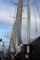
 Aboard S.V. Polynesia (520910009).jpg 426 × 640;94 KB
-
 Aboard SV Polynesia (288580292).jpg 1,200 × 1,600;397 KB
-
 Aboard the S. V. Polynesia (520908343).jpg 426 × 640;99 KB
-
 Aboard the S. V. Polynesia (520908801).jpg 640 × 426;84 KB
-
 Aboard the S. V. Polynesia (520909531).jpg 426 × 640;87 KB
-
 Aboard Windjammer SV Polynesia (520931194).jpg 640 × 426;77 KB
-
 Arrowsmith - Map of the West Indies.jpg 5,880 × 5,010;5.22 MB
-
 At night aboard Windjammer Polynesia (288575429).jpg 1,600 × 1,200;447 KB
-
 Atlas Van der Hagen-KW1049B13 082-CANIBALES INSULAE.jpeg 5,500 × 4,362;3.38 MB
-
 Capsized.jpg 1,020 × 728;392 KB
-
 Caribbean - Lesser Antilles-2010-24-05.PNG 703 × 495;47 KB
-
 Caribbean - Lesser Antilles.PNG 703 × 495;47 KB
-
 Cliff Jumping.jpg 1,020 × 682;355 KB
-
 Come Get Wet.jpg 1,020 × 680;264 KB
-
 Dive In.jpg 1,020 × 680;282 KB
-
 Eastern Lesser Antilles (Barbuda to Grenada) satellite image.jpg 2,400 × 3,200;1.1 MB
-
Geologisches Pulverfass Karibik.webm 28秒, 1,920 × 1,080;30.28 MB
-
 Insect pests of the Lesser Antilles (IA insectpestsofles00ballrich).pdf 760 × 1,125,236页;31.2 MB
-
 Lesser Antilles 250m.jpg 838 × 1,120;424 KB
-
 LocationLesserAntilles.png 394 × 286;4 KB
-
 Map of Lesser Antilles WDL10077.png 1,422 × 1,024;2.96 MB
-
 Map of OECS.svg 1,807 × 1,456;790 KB
-
 Maritime boundaries between UK and France in Antilles-fr.svg 1,502 × 1,332;403 KB
-
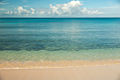
 Moody Beach.jpg 1,020 × 680;151 KB
-
 Palms In The Sand.jpg 1,020 × 680;318 KB
-
 PAT - Lesser Antilles.gif 1,900 × 1,600;238 KB
-
 Petites-Antilles NASA 64.82403W 14.61341N.jpg 1,280 × 978;83 KB
-
 Saba Corniche.jpg 6,623 × 2,139;7.65 MB
-
So entstanden Höhlen in der Karibik.webm 1分0秒, 1,920 × 1,080;59.54 MB
-
 The Caribbean Islands -(West Indies) 2014-04-24 09-48.gif 433 × 379;13 KB
-
 The Lesser Antilles arc.webp 1,299 × 1,657;362 KB
-
 The Wharf.jpg 1,020 × 680;307 KB
-
 USGS Shakemap - 1974 Lesser Antilles earthquake.jpg 612 × 718;68 KB


.jpg)
.jpg)
.jpg)
.jpg)
.jpg)
.jpg)

.jpg)


_satellite_image.jpg)


_2014-04-24_09-48.gif)


