Category:Llano Estacado
Saltar para a navegação
Saltar para a pesquisa
southwestern united states in New Mexico   | |||||
| Carregar ficheiro | |||||
| Instância de | |||||
|---|---|---|---|---|---|
| Localização |
| ||||
| População |
| ||||
| Área |
| ||||
| Altitude |
| ||||
 | |||||
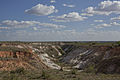
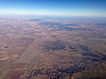
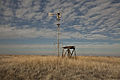
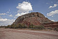
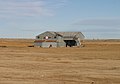
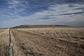
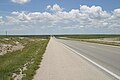
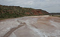
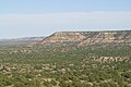
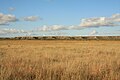
Llano Estacado, (meaning Palisaded Plain), commonly known as the Staked Plain, is a region in the Southwestern United States that encompasses parts of eastern New Mexico and northwestern Texas.
Subcategorias
Esta categoria contém as seguintes 20 subcategorias (de um total de 20).
A
- Amherst, Texas (1 F)
D
F
- Fluvanna, Texas (5 F)
L
M
- Mount Blanco, Texas (4 F)
O
P
S
T
- Texas High Plains AVA (1 F)
W
- Wilson, Texas (3 F)
Páginas na categoria "Llano Estacado"
Esta categoria só contém a seguinte página.
Multimédia na categoria "Llano Estacado"
Esta categoria contém os seguintes 189 ficheiros (de um total de 189).
-
 Blanco Canyon Crosby County Texas.jpg 5 433 × 3 622; 5,77 MB
-
 Abhang zur Hochfläche des Llano Estacado, Texas.jpg 3 888 × 2 592; 2,72 MB
-
 Above Llano Estacado 4.JPG 3 264 × 2 448; 4,35 MB
-
 Acuff Steakhouse Texas 2010.JPG 4 080 × 2 720; 4,09 MB
-
 Acuff Texas Steakhouse.jpg 5 132 × 3 521; 5,71 MB
-
 Aermotor Hockley County Texas.jpg 5 616 × 3 744; 5 MB
-
 Alamogordo Valley Eastern New Mexico 2009.jpg 3 072 × 2 048; 3,68 MB
-
 Anton Texas Boothe Elevators and Rail 2010.jpg 3 072 × 2 048; 2,36 MB
-
 AS09-20-3143 (21315578664).jpg 4 400 × 4 600; 1,09 MB
-
 AS09-21-3265 (21916088025).jpg 4 400 × 4 600; 962 kB
-
 AS09-21-3294 (21916077065).jpg 4 400 × 4 600; 1,16 MB
-
 AS09-21-3295 (21904090642).jpg 4 400 × 4 600; 1,23 MB
-
 AS09-22-3331 (21412052014).jpg 4 400 × 4 600; 1,01 MB
-
 AS09-22-3332 (22008661516).jpg 4 400 × 4 600; 991 kB
-
 AS09-22-3333 (21847942039).jpg 4 400 × 4 600; 1 007 kB
-
 AS09-22-3334 (21412051404).jpg 4 400 × 4 600; 1 013 kB
-
 AS09-22-3452 (21846937468).jpg 4 400 × 4 600; 1,27 MB
-
 Barwise Texas steel grain elevator.jpg 5 616 × 3 744; 4,17 MB
-
 Becton Texas farm building.jpg 3 048 × 1 846; 2,65 MB
-
 Becton Texas Fort Worth and Denver South Plains Railway.jpg 4 080 × 2 720; 4,51 MB
-
 Bellview New Mexico Post Office 2010.jpg 2 816 × 2 112; 2,21 MB
-
 Blanco Canyon 2009.jpg 3 071 × 1 577; 2,6 MB
-
 Blanco Canyon Crosby County Texas 2015.jpg 5 507 × 2 991; 7,93 MB
-
 Blanco Formation Road Cut.jpg 1 280 × 960; 273 kB
-
 BlancoCanyon 2005.jpg 1 280 × 960; 640 kB
-
 Blowout Earth TX.jpg 608 × 372; 51 kB
-

-
 Borden County High School Gail Texas 2010.jpg 3 888 × 2 592; 2,47 MB
-
 Borden County Texas Courthouse 2010.jpg 4 000 × 3 000; 4,28 MB
-
 Bovina Texas Grain Elevator 2010.jpg 3 888 × 2 655; 3,95 MB
-
 Briscoe County Butte in Tule Canyon, Texas.jpg 2 048 × 1 155; 1,39 MB
-
 Briscoe County Tule Canyon Texas.jpg 2 048 × 1 360; 1,95 MB
-
 Broadway Studios Lubbock Texas.jpg 5 274 × 3 744; 3,42 MB
-
 Buenos Texas BNSF Railway 2011.jpg 5 616 × 3 353; 5,39 MB
-
 Buffalo Lake Texas Canyon 2009.jpg 3 944 × 2 199; 4,48 MB
-
 Bula Cotton Gin, Bailey County, Texas, 2011.jpg 4 080 × 2 720; 4,86 MB
-
 Canyon Valley Texas Bridge.jpg 5 163 × 3 597; 6,16 MB
-
 Caprock Canyons Butte 2005.jpg 2 400 × 1 800; 752 kB
-
 Caprock Canyons Haynes Ridge 2005.JPG 2 400 × 1 800; 750 kB
-
 Caprock Canyons Side Canyon 2005.JPG 2 400 × 1 800; 772 kB
-
 Caprock Escarpment Garza County Texas 2010.jpg 3 072 × 2 048; 2,88 MB
-
 Caprock Escarpment.jpg 3 231 × 873; 1,96 MB
-
 CentraliaDraw 2004.jpg 2 048 × 1 360; 1,47 MB
-
 Close City Texas abandoned school.jpg 3 840 × 2 688; 6,51 MB
-
 Colorado River Borden County Texas 2011.jpg 5 616 × 3 744; 5,59 MB
-
 Cone Texas School 2010.jpg 4 080 × 2 720; 4,15 MB
-
 Cotton Center Texas water tower 2010.jpg 1 988 × 3 042; 3,34 MB
-
 Curry County Eastern New Mexico 2010.jpg 4 080 × 2 271; 1,75 MB
-
 Brazos Double Mountain Fork FM669 Texas 2010.jpg 3 072 × 2 048; 2,86 MB
-
 Brazos Double Mountain Fork FM669 Texas 2010b.jpg 3 888 × 2 592; 3,48 MB
-
 Brazos River Double Mountain Fork Rotan Texas 2009.jpg 3 888 × 2 592; 4,72 MB
-
 Double Mountain Fork Brazos River Texas 2014.jpg 3 628 × 5 274; 7,42 MB
-
 Brazos Double Mtn Fork 2009.jpg 3 072 × 1 672; 3,39 MB
-
 Yellow House Canyon North Fork Brazos 2010.jpg 3 072 × 1 686; 3,34 MB
-
 Dougherty Texas gas station 2012.jpg 5 016 × 2 964; 7,82 MB
-
 Duffy's Peak Garza County Texas.jpg 5 616 × 3 744; 6,04 MB
-
 Earth Texas Plant X 2008.jpg 2 816 × 1 464; 1,88 MB
-
 Escottioutcrop.jpg 445 × 293; 42 kB
-
 Estacado Texas Church 2011.jpg 5 616 × 3 744; 4,41 MB
-
 Estacado Texas historical marker 2011.jpg 5 414 × 3 609; 5,24 MB
-
 Fieldton Texas abandoned cotton gin 2011.jpg 2 772 × 1 934; 2,79 MB
-
 Floydada Texas Marshall Grain Elevator.jpg 3 868 × 2 558; 6,39 MB
-
 Fluvanna Texas Post Office 2010.JPG 4 000 × 3 000; 4,19 MB
-
 FM1269 FluvannaTX 2007.jpg 2 816 × 2 112; 3,85 MB
-
 FM2591 Crosby County Texas.jpg 5 616 × 3 744; 6,17 MB
-
 FM400 Lubbock County Texas 2009.jpg 2 816 × 2 112; 2,58 MB
-
 FM400 Lubbock County Texas 2011.jpg 3 028 × 2 019; 3,21 MB
-
 FM669 Garza County Texas 2010.jpg 3 072 × 2 048; 3,54 MB
-
 FM669 Garza County Texas 2010b.jpg 2 816 × 2 112; 3,2 MB
-
 Freight train near Shallowater Texas.jpg 2 816 × 2 112; 2,53 MB
-
 Gail Mountain Borden County Texas 2011.jpg 5 616 × 3 744; 4,99 MB
-
 Gail Mountain Borden County Texas.jpg 3 072 × 1 500; 1,81 MB
-
 Grady New Mexico City Hall 2011.jpg 5 616 × 3 744; 5,23 MB
-
 Great Plains Eastern New Mexico 2004.jpg 2 048 × 1 360; 1,23 MB
-
 Grier New Mexico Grain Elevator 2011.jpg 5 616 × 3 744; 6,06 MB
-
 Haboob Ransom Canyon Texas 2009.jpg 4 000 × 2 334; 1,65 MB
-
 Hale Center Texas grain elevator 2011.jpg 5 616 × 3 744; 5,78 MB
-
 Heckville Texas steel grain elevator.jpg 5 156 × 2 660; 2,87 MB
-
 Hill 1900 LlanoEstacado.jpg 800 × 669; 113 kB
-
 ISS-34 Southern High Plains of northwestern Texas.jpg 4 256 × 2 832; 1,17 MB
-
 ISS034-E-057550 Record Snowfall in North Texas.jpg 4 256 × 2 832; 6,93 MB
-
 Kalgary Texas Cotton Gin 2011.jpg 5 508 × 2 835; 4,36 MB
-
 Lamb County Texas Windmill 2011.jpg 5 417 × 2 824; 6,3 MB
-
 Levelland Texas grain elevator 2011.jpg 5 616 × 3 744; 6,35 MB
-
 Little Red River Hall County Texas 2015.jpg 5 616 × 3 519; 4 MB
-
 Little Red River Texas 2015.jpg 5 616 × 3 744; 11,12 MB
-
 Little Red River Valley Hall County Texas.jpg 5 616 × 3 744; 5,29 MB
-
 Llano Escarpment.jpg 2 048 × 1 360; 1,29 MB
-
 Llano Estacado 1900.jpg 800 × 680; 323 kB
-
 Llano Estacado Caprock at Sunrise.jpg 2 048 × 1 536; 1,45 MB
-
 Llano Estacado Caprock Escarpment south of Ralls TX 2009.jpg 2 816 × 1 880; 3,36 MB
-
 Llano Estacado Crosby County FM651 2009.jpg 3 072 × 2 048; 3,68 MB
-
 Llano Estacado San Jon Hill Roadcut 2003.jpg 2 028 × 1 285; 2,17 MB
-
 LlanoEstacadoShadedRelief.jpg 302 × 365; 32 kB
-
 Lubbock County South Plains Fair 2010.jpg 2 048 × 3 072; 2,77 MB
-
 Lubbock County South Plains Fair 2012.jpg 5 431 × 3 621; 8,85 MB
-
 Lubbock County Texas wind turbines 2011.jpg 5 616 × 3 744; 5,15 MB
-
 Lubbock Texas Cone Grain Elevator 2010.jpg 4 080 × 2 046; 3,19 MB
-
 Mass Waste Palo Duro 2002.jpg 1 536 × 1 024; 1,13 MB
-
 McAdoo Texas grain elevator 2012.jpg 5 616 × 3 744; 6,42 MB
-
 Mescalero Escarpment 2003.jpg 3 072 × 2 048; 2,59 MB
-
 Mescalero Sands 2003.JPG 3 072 × 2 048; 1,79 MB
-
 Mesquite School Borden County Texas 2010.jpg 3 888 × 2 592; 2,47 MB
-
 Morton Texas City Hall.jpg 5 528 × 3 686; 5,96 MB
-
 Mount Blanco 2002.jpg 1 280 × 960; 529 kB
-
 Mt Blanco 1891.jpg 954 × 608; 383 kB
-
 Mt Blanco 2002.jpg 1 280 × 960; 272 kB
-
 Mt Blanco 2005.jpg 3 072 × 2 048; 2,53 MB
-
 Mushaway Peak Borden County Texas 2010.jpg 3 072 × 2 048; 2,24 MB
-
 Nazareth Texas City Hall 2009.jpg 3 121 × 2 050; 3,93 MB
-
 Needmore Co-Op Gin, Bailey County, Texas.jpg 3 456 × 1 884; 3,87 MB
-
 Needmore Texas Cotton Gin.jpg 5 616 × 3 744; 8,87 MB
-
 New Deal Texas Cotton Gin 2010.jpg 3 027 × 2 022; 3,39 MB
-
 New Home Texas Water Towers 2011.jpg 5 616 × 3 744; 3,43 MB
-
 North Fork Red River 2015.jpg 5 616 × 2 875; 9,25 MB
-
 North Fork Red River 2015b.jpg 5 341 × 2 840; 7,58 MB
-
 North Pease River, Cottle County, Texas.jpg 5 616 × 3 744; 13,26 MB
-
 Northwest Escarpment Llano Estacado 2003.jpg 2 022 × 1 318; 1,86 MB
-
 Notrees Texas Road Sign 2009.JPG 3 984 × 2 656; 2,16 MB
-
 O'Donnell Texas grain elevator 2011.jpg 2 720 × 4 080; 4,17 MB
-
 Olton Texas grain silos 2011.jpg 5 541 × 3 167; 4,83 MB
-
 Palo Duro 2002.jpg 1 536 × 1 024; 1,15 MB
-
 Palo Duro Canyon 2.jpg 3 072 × 2 304; 4,27 MB
-
 Palo Duro Canyon 2002.jpg 1 536 × 1 024; 1,07 MB
-
 Palo Duro Canyon State Park 2002.jpg 1 280 × 960; 270 kB
-
 Pep Texas 2010.jpg 3 072 × 1 908; 3,37 MB
-
 Pep Texas Post Office 2010.jpg 2 095 × 1 322; 804 kB
-
 Petersburg Texas Grain Elevator 2010.jpg 3 072 × 1 983; 2,51 MB
-
 Petersburg Texas Grain Elevator 2010b.jpg 3 429 × 2 328; 2,7 MB
-
 Petersburg Texas Sign 2010.jpg 3 030 × 1 980; 2,21 MB
-
 Petersburg TX from south.JPG 3 264 × 2 448; 4,05 MB
-
 Plains Community Center Borden County Texas 2011.jpg 3 964 × 1 772; 2,64 MB
-
 Posey Texas Cotton Gin 2011.jpg 5 421 × 3 231; 5,52 MB
-
 Posey Texas Lutheran Church 2011.jpg 5 616 × 3 744; 5,2 MB
-
 Prairie Dog Town Fork Red River.jpg 5 419 × 3 612; 8,3 MB
-
 Quitaque Creek Motley County April 2019.jpg 5 616 × 3 744; 5,04 MB
-
 Ralls Texas Grain Silos 2010.jpg 2 816 × 1 506; 2,24 MB
-
 Ransom Canyon Water Tower 2009.jpg 2 656 × 3 984; 4,33 MB
-
 Reese Air Force Base Lubbock Texas 2010.jpg 5 616 × 3 744; 3,4 MB
-
 Rhea, Parmer County, Texas, grain elevator, 2010.jpg 3 904 × 2 720; 2,29 MB
-
 Rocky Ford Crossing Lamb County Texas 2002.jpg 1 260 × 938; 791 kB
-
 Ropesville Texas grain elevator 2011.jpg 5 616 × 3 744; 5,04 MB
-
 Roscoe Texas grain elevator 2011.jpg 4 080 × 2 720; 3,12 MB
-
 Salt Fork Brazos Kent County Texas 2015.jpg 5 616 × 3 744; 5,37 MB
-
 Salt Fork Brazos River FM651 Texas.jpg 3 984 × 2 656; 5,59 MB
-
 Savage Texas cotton gin.jpg 5 616 × 3 744; 4,69 MB
-
 Shafter Lake Andrews County Texas.jpg 5 494 × 2 475; 5,7 MB
-
 Signal Mountain TX 1900.jpg 2 000 × 1 409; 2,31 MB
-
 Slide, Lubbock County, Texas, 2012.jpg 5 616 × 3 292; 6,23 MB
-
 Smyer Texas Water Tower 2011.JPG 4 080 × 2 720; 3,27 MB
-
 South Plains Airshow, Slaton, Texas 2015.JPG 2 816 × 2 112; 2,17 MB
-
 Southland Abandoned Farmhouse 2009.jpg 2 816 × 1 578; 2,44 MB
-
 Southland TX 2009.JPG 3 984 × 2 246; 3,26 MB
-
 Spade Public School, Lamb County, Texas.jpg 5 412 × 2 827; 5,44 MB
-
 Spade Ranch Hockley County Texas 2011.jpg 5 255 × 3 012; 4,48 MB
-
 Spade Texas School 2011.jpg 3 072 × 2 048; 3,73 MB
-
 Steilhang der Hochfläche des Llano Estacado und Windräder.jpg 3 888 × 2 592; 2,81 MB
-
 Stiles Texas 2004.jpg 2 048 × 1 360; 1,26 MB
-
 Tafelberge am Südrand des Llano Estacado, Texas II.jpg 3 888 × 2 592; 3,28 MB
-
 Tafelberge am Südrand des Llano Estacado, Texas III.jpg 3 888 × 2 592; 2,63 MB
-
 Tafelberge am Südrand des Llano Estacado, Texas IV.jpg 3 888 × 2 592; 2,62 MB
-
 Tafelberge am Südrand des Llano Estacado, Texas.jpg 3 888 × 2 592; 3,09 MB
-
 Texas Hwy 207 Crosby County 2009.jpg 2 816 × 2 112; 2,23 MB
-
 Texas State Highway 70 Hall County.jpg 5 616 × 3 744; 6,52 MB
-
 Texico New Mexico grain elevator 2010.jpg 4 000 × 2 172; 2,95 MB
-
 Tucumcari Mountain, Quay County, New Mexico, 2011.jpg 5 616 × 3 196; 4,95 MB
-
 Tucumcari Mountain, Quay County, New Mexico, 2011b.jpg 4 344 × 1 743; 3,84 MB
-
 Tx Hwy 207.jpg 960 × 1 280; 599 kB
-
 US Highway 82 Lubbock County Texas 2011.jpg 5 616 × 3 744; 6,48 MB
-
 Washita River Hemphill County Texas.jpg 5 616 × 3 744; 14,61 MB
-
 Wastella Texas grain elevator 2011.jpg 5 420 × 3 744; 3,58 MB
-
 Wayside, Lynn County, Texas, Abandoned shack.jpg 5 416 × 2 995; 5,26 MB
-
 West Texas Hwy 302 west of NoTrees.jpg 2 048 × 1 360; 1,23 MB
-
 White River Silver Falls Texas 1891.jpg 1 816 × 1 064; 801 kB
-
 White River Silver Falls Texas 2008.jpg 3 072 × 1 851; 1,49 MB
-
 Whiteface Texas Museum 2011.jpg 4 724 × 3 100; 3,39 MB
-
 Whitharral Texas Cotton Gin 2010.jpg 3 456 × 2 304; 4,31 MB
-
 Whitharral Texas Panthers six-man football 2010.jpg 3 072 × 2 048; 2,09 MB
-
 Whitharral Texas Water Tower 2010.jpg 2 792 × 1 794; 1,7 MB
-
 Woodrow Lubbock County Texas 2012.jpg 5 612 × 3 348; 6,78 MB
-
 Woodrow Texas Church 2012.jpg 5 552 × 3 140; 4,92 MB
-
 Yardang Lea-Yoakum Dunes.jpg 601 × 391; 33 kB
-
 Yellow House Canyon near Slaton Texas 2010.jpg 3 004 × 1 929; 3,42 MB
-
 Yellow House Canyon north of Slaton Texas 2009.jpg 3 072 × 2 048; 3,94 MB
-
 Yellow House Canyon northeast of Slaton Texas 2009.jpg 3 072 × 2 048; 2,46 MB
-
 Yellow House Draw Head 2009.jpg 3 047 × 2 004; 3,47 MB
-
 Yellow House Draw Lubbock Lake 2010.jpg 3 888 × 2 592; 4,88 MB
-
 Yellow House Ranch, Hockley County, Texas, 2011.jpg 5 616 × 3 744; 4,28 MB
-
 Zeugenberg am Rand des Llano Estacado, dahinter MCS im Abendlicht.jpg 3 888 × 2 592; 2,61 MB


.jpg)
.jpg)
.jpg)
.jpg)
.jpg)
.jpg)
.jpg)
.jpg)
.jpg)


