Category:Locator maps of areas of Oulu
Jump to navigation
Jump to search

|
This page requires updating because: New maps should be created for the new areas after municipal mergers of 2009 and 2013. In doing so, you could add a timestamp to the page.
|
English: Locator maps of areas of the city of Oulu, Finland
Suomi: Oulun suuralueiden sijaintikartat
Subcategories
This category has only the following subcategory.
S
Media in category "Locator maps of areas of Oulu"
The following 15 files are in this category, out of 15 total.
-
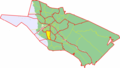
 Keskustan suuralue, Oulu.png 605 × 345; 64 KB
-
 Höyhtyän suuralue, Oulu.png 605 × 345; 19 KB
-
 Kaakkurin suuralue, Oulu.png 605 × 345; 63 KB
-
 Kaijonharjun suuralue, Oulu.png 605 × 345; 18 KB
-
 Kaukovainion suuralue, Oulu.png 605 × 345; 19 KB
-
 Korvensuoran suuralue, Oulu.png 605 × 345; 18 KB
-
 Koskelan suuralue, Oulu.png 605 × 345; 19 KB
-
 Maikkulan suuralue, Oulu.png 605 × 345; 18 KB
-
 Myllyojan suuralue, Oulu.png 605 × 345; 52 KB
-
 Nuottasaaren suuralue, Oulu.png 605 × 345; 19 KB
-
 Oulunsuun suuralue, Oulu.png 605 × 345; 53 KB
-
 Pateniemen suuralue, Oulu.png 605 × 345; 64 KB
-
 Puolivälinkankaan suuralue, Oulu.png 605 × 345; 18 KB
-
 Sanginsuun suuralue, Oulu.png 605 × 345; 17 KB
-
 Tuiran suuralue, Oulu.png 605 × 345; 19 KB


