Category:Locator maps of municipalities in Landkreis Freyung-Grafenau
Jump to navigation
Jump to search
Subcategories
This category has only the following subcategory.
Media in category "Locator maps of municipalities in Landkreis Freyung-Grafenau"
The following 41 files are in this category, out of 41 total.
-
 Annathaler Wald in FRG.svg 675 × 481; 764 KB
-
 Eppenschlag in FRG.svg 675 × 481; 763 KB
-
 Frauenberger u. Duschlberger Wald in FRG.svg 675 × 481; 763 KB
-
 Freyung in FRG.svg 675 × 481; 763 KB
-
 Fürsteneck in FRG.svg 675 × 481; 763 KB
-
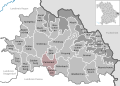
 Grafenau in FRG.svg 675 × 481; 763 KB
-
 Grainet in FRG.svg 675 × 481; 763 KB
-
 Graineter Wald in FRG.svg 675 × 481; 763 KB
-
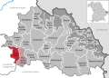
 Haidmühle in FRG.svg 675 × 481; 763 KB
-
 Hinterschmiding in FRG.svg 675 × 481; 763 KB
-
 Hohenau in FRG.svg 675 × 481; 763 KB
-
 Innernzell in FRG.svg 675 × 481; 763 KB
-
 Jandelsbrunn in FRG.svg 675 × 481; 763 KB
-
 Leopoldsreuter Wald in FRG.svg 675 × 481; 763 KB
-
 Mauth in FRG.svg 675 × 481; 763 KB
-
 Mauther Forst in FRG.svg 675 × 481; 763 KB
-
 Municipalities in FRG.svg 675 × 481; 765 KB
-
 Neureichenau in FRG.svg 675 × 481; 763 KB
-
 Neuschönau in FRG.svg 675 × 481; 763 KB
-
 Perlesreut in FRG.svg 675 × 481; 763 KB
-
 Philippsreut in FRG.svg 675 × 481; 765 KB
-
 Philippsreuter Wald in FRG.svg 675 × 481; 763 KB
-
 Pleckensteiner Wald in FRG.svg 675 × 481; 763 KB
-
 Ringelai in FRG.svg 675 × 481; 763 KB
-
 Röhrnbach in FRG.svg 675 × 481; 763 KB
-
 Saldenburg in FRG.svg 675 × 481; 763 KB
-
 Sankt Oswald in FRG.svg 675 × 481; 763 KB
-
 Sankt Oswald-Riedlhütte in FRG.svg 675 × 481; 763 KB
-
 Schlichtenberger Wald in FRG.svg 675 × 481; 763 KB
-
 Schöfweg in FRG.svg 675 × 481; 763 KB
-
 Schönberg in FRG.svg 675 × 481; 763 KB
-
 Schönbrunner Wald in FRG.svg 675 × 481; 763 KB
-
 Spiegelau in FRG.svg 675 × 481; 763 KB
-
 Thurmansbang in FRG.svg 675 × 481; 763 KB
-
 Verwaltungsgemeinschaft Hinterschmiding in FRG.svg 675 × 481; 763 KB
-
 Verwaltungsgemeinschaft Perlesreut in FRG.svg 675 × 481; 763 KB
-
 Verwaltungsgemeinschaft Schönberg in FRG.svg 675 × 481; 763 KB
-
 Verwaltungsgemeinschaft Thurmansbang in FRG.svg 675 × 481; 763 KB
-
 Waldhäuserwald in FRG.svg 675 × 481; 763 KB
-
 Waldkirchen in FRG.svg 675 × 481; 763 KB
-
 Zenting in FRG.svg 675 × 481; 763 KB


