Category:London Borough of Lewisham
Hopp til navigering
Hopp til søk
Boroughs of London: City of London · City of Westminster · Barking and Dagenham · Barnet · Bexley · Brent · Bromley · Camden · Croydon · Ealing · Enfield · Greenwich · Hackney · Hammersmith and Fulham · Haringey · Harrow · Havering · Hillingdon · Hounslow · Islington · Kensington and Chelsea · Kingston · Lambeth · Lewisham · Merton · Newham · Redbridge · Richmond · Southwark · Sutton · Tower Hamlets · Waltham Forest · Wandsworth
borough in the London Region in England     | |||||
| Last opp mediefiler | |||||
| Forekomst av | |||||
|---|---|---|---|---|---|
| Plassering | Stor-London, London, England | ||||
| Lovgivende forsamling |
| ||||
| Utøvende makt |
| ||||
| Øverste politiske forvaltningsleder | |||||
| Dato for etablering, fremstilling e.l. |
| ||||
| Folketall |
| ||||
| Areal |
| ||||
| Erstatter | |||||
| Forskjellig fra | |||||
| offisielt nettsted | |||||
 | |||||
Underkategorier
Denne kategorien har følgende 21 underkategorier, av totalt 21.
A
E
F
G
H
I
M
N
O
P
S
T
V
Filer i kategorien «London Borough of Lewisham»
Følgende 200 filer er i denne kategorien, av totalt 1 994.
(forrige side) (neste side)-
 "House of Bread" on Kitto Road - geograph.org.uk - 5056193.jpg 800 × 600; 129 KB
-
-
 'Noakes Entire' - geograph.org.uk - 2628292.jpg 640 × 480; 94 KB
-

-

-

-
-
 ..e G.e.n M.. - geograph.org.uk - 2260242.jpg 640 × 480; 104 KB
-
 1 The Close, Blackheath - geograph.org.uk - 4563644.jpg 1 024 × 768; 137 KB
-
 1-35 Dallas Road, Upper Sydenham - geograph.org.uk - 2634124.jpg 4 288 × 3 216; 6,55 MB
-
 108 Westwood Hill - geograph.org.uk - 4268561.jpg 469 × 640; 310 KB
-
 13 Jews Walk, Sydenham - geograph.org.uk - 4334161.jpg 640 × 480; 157 KB
-
 17 Ardmere Road, SE13 - geograph.org.uk - 5222414.jpg 640 × 480; 129 KB
-
 18 Belmont Hill, Lewisham - geograph.org.uk - 2618450.jpg 4 288 × 3 216; 5,62 MB
-
 1930s house in Forest Hill - geograph.org.uk - 5830029.jpg 3 753 × 2 814; 1,59 MB
-
 1930s house in Forest Hill - geograph.org.uk - 5830038.jpg 4 000 × 3 000; 4,61 MB
-

-
 34 Sydenham Hill - geograph.org.uk - 4263306.jpg 640 × 504; 187 KB
-
 34a Sydenham Hill - geograph.org.uk - 2209766.jpg 2 048 × 1 536; 805 KB
-
 34a Sydenham Hill - geograph.org.uk - 4263371.jpg 640 × 539; 168 KB
-
 6, Eliot Place, Blackheath - geograph.org.uk - 5223714.jpg 640 × 480; 179 KB
-
 9, Eliot Vale, Blackheath - geograph.org.uk - 2672108.jpg 640 × 480; 110 KB
-
 A cube - geograph.org.uk - 4008000.jpg 640 × 424; 55 KB
-
 A ferry on the River Thames - geograph.org.uk - 3475792.jpg 1 500 × 1 000; 116 KB
-
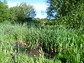 A former pond - geograph.org.uk - 2519624.jpg 4 000 × 3 000; 4,26 MB
-
 A glimpse of the viaduct - geograph.org.uk - 4410302.jpg 1 024 × 768; 583 KB
-

-
 A remarkable row, Lewisham Way, SE8 - geograph.org.uk - 4337599.jpg 640 × 428; 126 KB
-
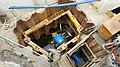 A very big, wet hole in the ground - geograph.org.uk - 4444131.jpg 640 × 360; 77 KB
-
 A2 Blackheath Hill - geograph.org.uk - 2551937.jpg 640 × 480; 85 KB
-
 A2 Bridge over New Cross station - geograph.org.uk - 3941359.jpg 1 024 × 768; 169 KB
-
 A2 New Cross Gyratory - geograph.org.uk - 4316194.jpg 1 024 × 768; 124 KB
-
 A2 road and footpath, Blackheath - geograph.org.uk - 2551931.jpg 640 × 480; 78 KB
-
 A21, Lewisham - geograph.org.uk - 3932112.jpg 640 × 326; 41 KB
-
 A2209 Deptford Church Street - geograph.org.uk - 6123453.jpg 1 024 × 684; 352 KB
-
-

-
 Abandoned Landing Stages in Deptford - geograph.org.uk - 5470558.jpg 640 × 424; 61 KB
-
 Abbey Trading Estate - geograph.org.uk - 2610749.jpg 4 288 × 3 216; 4,61 MB
-
 Abinger Grove, SE8 - geograph.org.uk - 2105636.jpg 640 × 480; 89 KB
-
 Adamsrill Road, SE26 - geograph.org.uk - 3458051.jpg 640 × 459; 63 KB
-
 Advertising barges in the Thames - geograph.org.uk - 3613629.jpg 640 × 480; 75 KB
-
 Air quality monitor, Coffey Street, Deptford - geograph.org.uk - 4548063.jpg 1 024 × 768; 178 KB
-
 Aislibie Road, SE13 - geograph.org.uk - 2403992.jpg 640 × 480; 83 KB
-
 Aladdin's Cave, Lewisham Way - geograph.org.uk - 5136817.jpg 5 184 × 3 456; 7,34 MB
-
 Aladdin's Cave, Loampit Hill SE13 - geograph.org.uk - 2818817.jpg 640 × 480; 78 KB
-
 Albertines, SE8 - geograph.org.uk - 4337626.jpg 640 × 480; 142 KB
-
 Albury Street, SE8 - geograph.org.uk - 6123607.jpg 1 024 × 1 024; 314 KB
-
 Aldersford Close, SE4 - geograph.org.uk - 1941004.jpg 640 × 480; 87 KB
-
 Algal growth - geograph.org.uk - 3736103.jpg 640 × 480; 167 KB
-
 Algernon Road Baptist Church - geograph.org.uk - 5039261.jpg 640 × 426; 36 KB
-
 Algernon Road Baptist Church - geograph.org.uk - 5111693.jpg 640 × 494; 52 KB
-
 Algernon Road Baptist Church - geograph.org.uk - 5122162.jpg 640 × 426; 49 KB
-
 Algernon Road Baptist Church - geograph.org.uk - 5277694.jpg 640 × 403; 49 KB
-
 Algernon Road Baptist Church - geograph.org.uk - 5312363.jpg 640 × 426; 51 KB
-
 Algernon Road Baptist Church - geograph.org.uk - 5591284.jpg 640 × 426; 61 KB
-
 Algernon Road Baptist Church - geograph.org.uk - 5752562.jpg 640 × 426; 44 KB
-
 Algernon Road Baptist Church - geograph.org.uk - 5944569.jpg 1 024 × 681; 93 KB
-
 Algernon Road, Ladywell - geograph.org.uk - 4367313.jpg 2 272 × 1 704; 764 KB
-
 Algiers Road, Ladywell - geograph.org.uk - 4367319.jpg 2 272 × 1 704; 831 KB
-
 All Inn One, Forest Hill - geograph.org.uk - 4207916.jpg 5 400 × 3 600; 1,44 MB
-
 All motors prohibited - geograph.org.uk - 1882923.jpg 640 × 480; 106 KB
-
 Alley to Sydenham Station - geograph.org.uk - 2103780.jpg 480 × 640; 73 KB
-
 Amersham Road, New Cross - geograph.org.uk - 4358069.jpg 2 272 × 1 704; 909 KB
-
-
 An entrance to Convoys Wharf - geograph.org.uk - 2950732.jpg 640 × 417; 72 KB
-
 Angus Street, New Cross - geograph.org.uk - 4358155.jpg 2 272 × 1 704; 747 KB
-
 Another residential development - geograph.org.uk - 3739092.jpg 640 × 480; 100 KB
-
 Ansford Road, BR1 - geograph.org.uk - 2247773.jpg 640 × 480; 111 KB
-
 Ansford Road, Bromley - geograph.org.uk - 4610312.jpg 2 272 × 1 704; 789 KB
-
 Apartment block at Bell Green - geograph.org.uk - 4976097.jpg 640 × 360; 50 KB
-

-
 Apartments and Road Junction at Bell Green - geograph.org.uk - 5070710.jpg 4 000 × 2 837; 1,87 MB
-
 Apartments by the railway line - geograph.org.uk - 2888808.jpg 640 × 363; 58 KB
-
 Apartments on the Isle of Dogs - geograph.org.uk - 2638592.jpg 1 024 × 680; 149 KB
-
 Apartments, Drakefell Road SE14 - geograph.org.uk - 2065801.jpg 640 × 480; 81 KB
-
 Apartments, Pepys Park - geograph.org.uk - 2639180.jpg 1 024 × 680; 248 KB
-
 Approaching Evelyn Street, Deptford - geograph.org.uk - 4008833.jpg 640 × 478; 65 KB
-
 Approaching Forest Hill Station - geograph.org.uk - 3096937.jpg 3 456 × 2 304; 4,31 MB
-
 Approaching Grove Park Station - geograph.org.uk - 3787561.jpg 1 496 × 993; 602 KB
-
 Approaching Nunhead Junction - geograph.org.uk - 4432878.jpg 1 600 × 1 067; 998 KB
-
 Approaching the South Circular Road - geograph.org.uk - 3196676.jpg 640 × 430; 65 KB
-
 Aquatic chicane, Quaggy River, Lewisham - geograph.org.uk - 5854305.jpg 5 179 × 3 451; 4,97 MB
-
 Aragon Gardens - geograph.org.uk - 3613645.jpg 641 × 480; 76 KB
-
 Aragon Gardens, Deptford - geograph.org.uk - 4008234.jpg 640 × 478; 91 KB
-
 Aragon Gardens, Deptford Strand - geograph.org.uk - 4008223.jpg 640 × 478; 83 KB
-
 Arch bridge over Creekside, Deptford - geograph.org.uk - 5604448.jpg 640 × 480; 101 KB
-
 Arch of the Brighton line bridge - geograph.org.uk - 1882934.jpg 640 × 480; 85 KB
-
 Arklow Rd - geograph.org.uk - 3782695.jpg 640 × 430; 61 KB
-
 Armada Court Community Hall - geograph.org.uk - 3749239.jpg 640 × 480; 335 KB
-
 Arriving at Hither Green - geograph.org.uk - 3781371.jpg 1 600 × 1 058; 641 KB
-

-
 Artwork in Fordham Park - geograph.org.uk - 2462168.jpg 1 024 × 768; 297 KB
-
 Astra Palace Hotel - geograph.org.uk - 3657474.jpg 1 600 × 1 067; 566 KB
-
 Astra Palace Hotel, Sydenham Hill - geograph.org.uk - 1935777.jpg 640 × 430; 117 KB
-
 At the sign of the harp - geograph.org.uk - 4018626.jpg 640 × 480; 70 KB
-
 At the top of Chinbrook Meadows - geograph.org.uk - 2070358.jpg 1 280 × 960; 605 KB
-
 Atlantic Star medal ribbon with Rosette.jpg 1 632 × 918; 237 KB
-
 Avignon Rd bridge - geograph.org.uk - 3181620.jpg 640 × 430; 74 KB
-
 Avignon Road - geograph.org.uk - 4432903.jpg 1 600 × 1 088; 758 KB
-
 Aylward Rd - geograph.org.uk - 3199466.jpg 640 × 430; 111 KB
-
 Back gate of the Den - geograph.org.uk - 3442520.jpg 1 024 × 768; 256 KB
-
 Backs of houses, Bellingham - geograph.org.uk - 4329983.jpg 1 308 × 356; 220 KB
-
 Balfour Beatty, Hither Green - geograph.org.uk - 2886025.jpg 640 × 430; 39 KB
-
 Baltic Quay - geograph.org.uk - 4067109.jpg 427 × 640; 72 KB
-
 Bamford Road, BR1 - geograph.org.uk - 2248853.jpg 640 × 480; 67 KB
-
 Bank Buildings, Lewisham Way - geograph.org.uk - 2627797.jpg 640 × 480; 148 KB
-
 Barclays Bank, New Cross - geograph.org.uk - 2662342.jpg 4 288 × 3 216; 4,48 MB
-
 Bargain Junction, Loampit Hill, SE13 - geograph.org.uk - 1989990.jpg 640 × 480; 105 KB
-
 Baring Road, SE12 - geograph.org.uk - 4822016.jpg 640 × 428; 115 KB
-
 Baring Road, SE12 - geograph.org.uk - 4822032.jpg 640 × 428; 113 KB
-
 Baring Road, SE12 - geograph.org.uk - 4822081.jpg 640 × 428; 170 KB
-
 Barlborough Street, New Cross - geograph.org.uk - 4594136.jpg 1 024 × 768; 101 KB
-
 Barque Mews, Deptford - geograph.org.uk - 3850415.jpg 3 488 × 2 616; 2,16 MB
-
-
 Barrier on Heath Lane - geograph.org.uk - 4563652.jpg 1 024 × 768; 264 KB
-
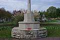 Base and wreath, Ladywell Cemetery war memorial - geograph.org.uk - 4238651.jpg 1 024 × 681; 202 KB
-
 Basketball cage, Broadway Fields - geograph.org.uk - 3754535.jpg 640 × 480; 68 KB
-
 Basketball court off Woodpecker Road, Deptford - geograph.org.uk - 3942842.jpg 1 024 × 768; 313 KB
-
 Battersby Road, Downham - geograph.org.uk - 3654715.jpg 1 064 × 1 600; 315 KB
-
 Beaulieu Avenue, Sydenham - geograph.org.uk - 4629826.jpg 2 272 × 1 704; 728 KB
-
 Beaulieu Avenue, Sydenham - geograph.org.uk - 4629830.jpg 2 272 × 1 704; 826 KB
-
 Beaumont Beds, Lewisham - geograph.org.uk - 3869471.jpg 640 × 480; 104 KB
-
 Beckenham Hill Road (A2015) - geograph.org.uk - 3579227.jpg 1 024 × 768; 235 KB
-
 Beckenham Hill Road - geograph.org.uk - 3106686.jpg 3 456 × 2 304; 3,7 MB
-
 Beckenham Place - geograph.org.uk - 4929048.jpg 1 600 × 1 064; 349 KB
-
 Bell Green - geograph.org.uk - 5889882.jpg 6 000 × 4 000; 5,72 MB
-
 Bell Green - geograph.org.uk - 5889912.jpg 6 000 × 4 000; 7,53 MB
-
 Bell Green - geograph.org.uk - 5889957.jpg 3 600 × 2 400; 7,68 MB
-
 Bell Green - geograph.org.uk - 5889966.jpg 6 000 × 4 000; 7,56 MB
-
 Bell Green gas holders from the air - geograph.org.uk - 6253903.jpg 1 024 × 700; 425 KB
-
 Bell Green retail park from the air - geograph.org.uk - 6253893.jpg 1 024 × 621; 360 KB
-
 Bellingham Bowls Club - geograph.org.uk - 3150634.jpg 640 × 430; 84 KB
-
 Bellingham from the air - geograph.org.uk - 6253825.jpg 1 024 × 768; 397 KB
-
 Bellingham Green - geograph.org.uk - 1942626.jpg 640 × 480; 84 KB
-
 Bellingham Leisure Centre - geograph.org.uk - 3150604.jpg 640 × 459; 64 KB
-

-
 Bellingham Play Park - geograph.org.uk - 4335941.jpg 640 × 480; 114 KB
-
 Bellingham Rd - geograph.org.uk - 3150619.jpg 640 × 430; 97 KB
-

-
 Bellingham, Southend Lane - geograph.org.uk - 3106973.jpg 3 456 × 2 304; 4,71 MB
-
 Beneath the Bridge - geograph.org.uk - 5070688.jpg 4 000 × 3 000; 3,85 MB
-
 Benson Road, Forest Hill - geograph.org.uk - 5995395.jpg 1 280 × 957; 388 KB
-
 Bentley Court, Whitburn Road - geograph.org.uk - 3869483.jpg 640 × 480; 82 KB
-
 Bestway - geograph.org.uk - 4461367.jpg 640 × 426; 47 KB
-
 Bestway - geograph.org.uk - 4527199.jpg 640 × 426; 45 KB
-
 Bestway - geograph.org.uk - 4527213.jpg 640 × 426; 46 KB
-
 Bestway - geograph.org.uk - 5390174.jpg 640 × 426; 57 KB
-
 Bestway - geograph.org.uk - 5949406.jpg 1 024 × 681; 91 KB
-
 Bestway warehouse - geograph.org.uk - 3472039.jpg 640 × 430; 36 KB
-
 Bestway, Catford - geograph.org.uk - 2757946.jpg 640 × 368; 34 KB
-
 Bestway, Hither Green - geograph.org.uk - 2757952.jpg 640 × 351; 29 KB
-
 Big Building Site - geograph.org.uk - 4089943.jpg 3 344 × 2 556; 1,47 MB
-
 Billington Road, SE14 - geograph.org.uk - 2392779.jpg 640 × 480; 79 KB
-
 Bilt Mansions, Deptford Bridge, SE8 - geograph.org.uk - 6123327.jpg 1 024 × 684; 225 KB
-
 Black Horse ^ Harrow, Catford - geograph.org.uk - 4610228.jpg 2 272 × 1 704; 770 KB
-
 Blackheath delivery office - geograph.org.uk - 2762053.jpg 1 024 × 768; 694 KB
-
 Blackheath drill hall - geograph.org.uk - 4565481.jpg 1 024 × 768; 190 KB
-
 Blackheath Grove - geograph.org.uk - 2762063.jpg 1 024 × 768; 714 KB
-
 Blackheath Halls - geograph.org.uk - 2551965.jpg 640 × 480; 97 KB
-
 Blackheath Halls - geograph.org.uk - 3453848.jpg 640 × 482; 147 KB
-
 Blackheath Halls - geograph.org.uk - 5843448.jpg 3 264 × 2 448; 2,77 MB
-
 Blackheath Quaker meeting house - geograph.org.uk - 2762153.jpg 1 024 × 768; 713 KB
-
 Blackheath Vale - geograph.org.uk - 6136342.jpg 1 024 × 576; 73 KB
-
 Blackheath, The 'Crown', Tranquil Vale - geograph.org.uk - 3000155.jpg 3 456 × 2 304; 3,26 MB
-
 Blackheath, The 'Crown', Tranquil Vale - geograph.org.uk - 3000182.jpg 3 456 × 2 304; 3,42 MB
-
 Blackheath, The Railway - geograph.org.uk - 4406110.jpg 1 024 × 768; 151 KB
-
 Blaxill Bros, Stanstead Rd - geograph.org.uk - 3196692.jpg 640 × 430; 68 KB
-
 Blocked gateway to former naval dockyard - geograph.org.uk - 6124429.jpg 1 024 × 768; 271 KB
-
 Blocks of Flats, Brockley - geograph.org.uk - 3176729.jpg 640 × 430; 89 KB
-
 Blossom, Bell Green - geograph.org.uk - 3458150.jpg 480 × 640; 125 KB
-
 Blythe Hill Fields - geograph.org.uk - 5071014.jpg 1 600 × 1 200; 471 KB
-
 Blythe Hill, Another dead pub - geograph.org.uk - 3096886.jpg 3 456 × 2 304; 4,79 MB
-
 Bolina Road, blocked off - geograph.org.uk - 3442536.jpg 1 024 × 768; 259 KB
-
 Bolina Road, closed off - geograph.org.uk - 3825241.jpg 1 024 × 768; 219 KB
-
 Bolina Road, South Bermondsey - geograph.org.uk - 3825231.jpg 1 024 × 768; 118 KB
-
 Bolina Road, southernmost bridge - geograph.org.uk - 3825238.jpg 1 024 × 768; 242 KB
-

-
 Border Tree - geograph.org.uk - 4334096.jpg 640 × 480; 198 KB
-
 Borthwick Wharf facade, south-west corner - geograph.org.uk - 2350387.jpg 1 024 × 768; 355 KB
-
 Bottom of Blackheath Hill - geograph.org.uk - 4316212.jpg 1 024 × 768; 85 KB
-
-
 Brandram Road Community Centre, Lee - geograph.org.uk - 3868605.jpg 640 × 480; 86 KB
-
 Brangbourne Road, BR1 - geograph.org.uk - 2248890.jpg 640 × 480; 64 KB
-
 Brenchley Gardens, Honor Oak - geograph.org.uk - 4687392.jpg 640 × 480; 88 KB
-
 Bridge at Catford - geograph.org.uk - 2314600.jpg 640 × 480; 95 KB
-

-
 Bridge House Meadows - geograph.org.uk - 3301461.jpg 1 024 × 768; 161 KB
-
 Bridge on Catford Loop line - geograph.org.uk - 4335365.jpg 640 × 480; 148 KB
-
 Bridge on Catford Loop line - geograph.org.uk - 4335382.jpg 640 × 428; 137 KB
-
 Bridge on the River Pool - geograph.org.uk - 2627591.jpg 640 × 480; 189 KB
-

-
 Bridge over Pool River - geograph.org.uk - 3459029.jpg 640 × 424; 62 KB
-
 Bridge over Pool River - geograph.org.uk - 5070699.jpg 3 856 × 2 752; 2,5 MB
-
 Bridge over the Pool River - geograph.org.uk - 4336053.jpg 640 × 480; 138 KB
-
 Bridge Over The Pool River - geograph.org.uk - 5470015.jpg 640 × 424; 106 KB
-

-

-

-


_sign_for_The_Copperfield,_Catford_Road,_SE6_-_geograph.org.uk_-_2254336.jpg)
_industrial_building,_Catford,_SE6_-_geograph.org.uk_-_2254385.jpg)
_the_Ladywell_Water_Tower,_Dressington_Avenue,_SE4_-_geograph.org.uk_-_2252072.jpg)
_stepping_stones_on_the_Pool_River_east_of_Riverview_Park,_SE6_-_geograph.org.uk_-_2271990.jpg)


_-_geograph.org.uk_-_3579227.jpg)


_north_of_Beckenham_Hill_station_-_geograph.org.uk_-_2258638.jpg)


_-_geograph.org.uk_-_2276315.jpg)

