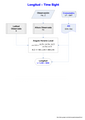
Category:Longitudes
Bước tới điều hướng
Bước tới tìm kiếm
geographic coordinate that specifies the east-west position of a point on the Earth's surface | |||||
| Tải lên phương tiện | |||||
| Là một | |||||
|---|---|---|---|---|---|
| Là tập hợp con của | |||||
| Một phần của |
| ||||
| |||||
Thể loại con
Thể loại này có 30 thể loại con sau, trên tổng số 30 thể loại con.
*
E
- 129th meridian east (3 F)
- 130th meridian east (4 F)
- 37th meridian east (1 F)
- 9th meridian east (2 F)
L
- Lunar distance (navigation) (10 F)
M
W
- 100th meridian west (5 F)
- 110th meridian west (1 F)
↔
Tập tin trong thể loại “Longitudes”
53 tập tin sau nằm trong thể loại này, trong tổng số 53 tập tin.
-
De-Länge.ogg 1,3 s; 12 kB
-
De-Längengrad.ogg 1,6 s; 15 kB
-
De-Längenkreis.ogg 2,2 s; 21 kB
-
En-us-longitude.ogg 1,0 s; 35 kB
-
LL-Q150 (fra)-Eihel-longitude.wav 1,4 s; 131 kB
-
Nl-lengtegraad.ogg 1,6 s; 17 kB
-

-

-
 368 of 'Physiography ... New edition' (11091787823).jpg 1.198×603; 125 kB
-
 APN2002-fig104a.jpg 438×600; 40 kB
-

-
 Calc-long.JPG 1.271×1.347; 200 kB
-

-
 Central meridian.svg 258×302; 282 kB
-
 Centre of Canada Longitude.jpg 4.608×3.456; 1,24 MB
-

-
 FedStats Lat long sw.png 1.156×898; 130 kB
-
 FedStats Lat long.png 435×340; 5 kB
-
 FedStats Lat long.svg 435×340; 31 kB
-

-

-
 Geodesia-oc.png 580×517; 35 kB
-
 Geografine ilguma.png 332×387; 10 kB
-
 Lat long.png 1.522×1.190; 375 kB
-
 Latitud Geográfica y Geocéntrica. Cálculo.jpg 892×520; 45 kB
-
 Latitude and longitude graticule on a sphere.svg 825×825; 69 kB
-
 Latitude and longitude graticule on an ellipsoid.svg 825×750; 102 kB
-
 Latitude and Longitude of the Earth fr.svg 652×340; 45 kB
-
 Lines of equal latitude and longitude FROM (World borders parallel).png 2.000×1.999; 509 kB
-

-
 Longitude (AR).png 800×914; 284 kB
-
 Longitude (PSF).png 816×784; 274 kB
-
 Longitude blue-fr.svg 210×210; 114 kB
-
 Longitude blue.svg 210×210; 131 kB
-
 Longitude of the Earth fr.svg 312×295; 30 kB
-
 Longitude Vespucci.png 360×377; 81 kB
-
 Lorangeitude.png 2.400×2.400; 526 kB
-
 Meridian (PSF).png 1.293×1.557; 317 kB
-
 Meridians.png 1.482×1.550; 498 kB
-
 Meridiens.JPG 1.494×887; 312 kB
-
 Meyer‘s Zeitungsatlas 088 – Karte der magnetischen Meridiane und Parallel-Kreise.jpg 7.393×6.265; 11,9 MB
-
 Net of Longitude.jpg 1.682×1.161; 535 kB
-
 Peters projection, date line in Bering strait.svg 1.613×1.098; 808 kB
-
 Poledníky.png 450×366; 151 kB
-

-
 Temperature zone of earth.jpg 2.560×1.920; 912 kB
-
 TimeSight.png 1.653×2.339; 32 kB
-
 USBLM meridian map 5th PM.jpg 850×800; 117 kB
-
 UTMCat.png 750×602; 41 kB
-
 Vitoria - Calle Dato - Meridiano.jpg 1.707×1.524; 551 kB
-
 WGS84 angle to distance conversion.svg 512×410; 115 kB
-
 World map longitude001.svg 1.200×684; 1,57 MB
-
 York MMB 49 York Observatory.jpg 4.383×2.931; 5,36 MB
_-_Geographicus_-_Tableau-monin-1838.jpg)

.jpg)


.png)
.png)
.png)
.png)


.png)


_Between_Winnipeg,_Manitoba_and_Ontario_Border_(43974635301).jpg)