Category:Maps and plans of Grimsby
Jump to navigation
Jump to search
Media in category "Maps and plans of Grimsby"
The following 4 files are in this category, out of 4 total.
-
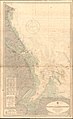 Admiralty Chart No 1190 Blakeney to Flamborough Head, Published 1951.jpg 11,260 × 18,347; 72.75 MB
-
 Grimsby and Cleethorpes unparished area UK locator map.svg 1,259 × 1,306; 329 KB
-
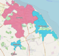 GrimsbyBUA2011.png 895 × 850; 680 KB
-
 HumbersideGreatGrimsby.png 200 × 197; 3 KB


