Category:Maps of 1991 Mt Pinatubo eruption
Jump to navigation
Jump to search
Media in category "Maps of 1991 Mt Pinatubo eruption"
The following 5 files are in this category, out of 5 total.
-
 Pinatubo evacuation areas.gif 1,000 × 719; 95 KB
-
 Tephra fall from 1991 eruption of Mt Pinatubo fr.gif 600 × 425; 27 KB
-
 Tephra fall from 1991 eruption of Mt Pinatubo.gif 600 × 425; 25 KB
-
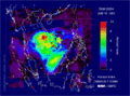 TOMS AI Jun16 91.gif 800 × 590; 129 KB
-
 TOMS SO2 Jun17 91.gif 800 × 590; 64 KB


