Category:Maps of Amelia Island
Jump to navigation
Jump to search
Media in category "Maps of Amelia Island"
The following 14 files are in this category, out of 14 total.
-

-

-

-
 Plan of Amelia Island.jpg 992 × 839; 160 KB
-
-

-
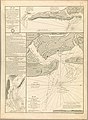
 26226 pagina 062.jpg 1,836 × 1,380; 293 KB
-
 Batería Isla Amelia.jpg 3,308 × 2,426; 864 KB
-
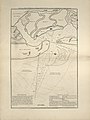
 Isla Amelia.jpg 3,386 × 2,077; 713 KB
-
 Plan de l'île d'Amelia à la côte de la Floride orientale 1779.jpg 5,489 × 7,506; 10.23 MB
-
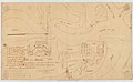
 Recinto de estacas Isla Amelia.jpg 3,426 × 2,425; 743 KB
-
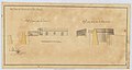 Reducto Isla Amelia FL. EEUU.jpg 3,701 × 1,987; 720 KB
-
 Rio de Santa María e Isla Amalia.jpg 2,914 × 4,167; 1.64 MB
-

.jpg)


