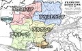
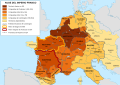
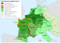
Category:Maps of Austrasia
Saltar para a navegação
Saltar para a pesquisa
Medieval European territory  | |||||
| Carregar ficheiro | |||||
| Instância de | |||||
|---|---|---|---|---|---|
| Data de criação ou fundação |
| ||||
| Data de dissolução ou encerramento |
| ||||
| Diferente de | |||||
| |||||
Multimédia na categoria "Maps of Austrasia"
Esta categoria contém os seguintes 17 ficheiros (de um total de 17).
-
 Austrasie752.jpg 484 × 689; 78 kB
-

-
 Austrasie - btv1b8495009t.jpg 6 448 × 8 122; 7,29 MB
-

-
 ClovisDomain japref.jpg 543 × 335; 79 kB
-
 Francia 714.png 1 252 × 1 240; 520 kB
-
 Francia at the death of Pepin of Heristal 714-nl.svg 1 996 × 1 789; 2,04 MB
-
 Frankish Empire 481 to 814-en.svg 1 591 × 1 205; 834 kB
-
 Frankish Empire 481 to 814-es.svg 1 851 × 1 309; 1,08 MB
-
 Frankish Empire 481 to 814-fr.svg 1 739 × 1 233; 296 kB
-
 Hettergouw.jpg 1 181 × 1 144; 200 kB
-

-

-
 Le royaume des Francs en 567.svg 756 × 785; 207 kB
-
 Map of Austrasia - 587 (cropped).jpg 648 × 617; 138 kB
-
 Merovingian dynasty.jpg 838 × 773; 78 kB
-
 Spruner-Menke Handatlas 1880 Karte 32.jpg 10 465 × 8 593; 16,66 MB

.jpg)


.jpg)


Categorias:
- Maps of the Frankish territory
- Maps of the history of Europe by former country
- Maps of the Merovingian territory
- Maps of the history of France
- Maps of the history of the Netherlands
- Maps of the history of Belgium
- Maps of the history of Luxembourg
- Maps of the history of Germany by historic territory
- Maps of the history of North Rhine-Westphalia
- 511 establishments
- 751 disestablishments in Europe