Category:Maps of Malaysia
Vai alla navigazione
Vai alla ricerca
Paesi d’Asia: Afghanistan · Arabia Saudita · Armenia‡ · Azerbaigian‡ · Bahrein · Bangladesh · Bhutan · Birmania · Brunei · Cambogia · Cina · Cipro‡ · Corea del Nord · Corea del Sud · Egitto‡ · Emirati Arabi Uniti · Filippine · Georgia‡ · Giappone · Giordania · India · Indonesia‡ · Iran · Iraq · Israele · Kazakistan‡ · Kirghizistan · Kuwait · Laos · Libano · Malaysia · Maldive · Mongolia · Nepal · Oman · Pakistan · Qatar · Russia‡ · Singapore · Siria · Sri Lanka · Tagikistan · Thailandia · Timor Est · Turchia‡ · Turkmenistan · Uzbekistan · Vietnam · Yemen
Riconoscimento limitato: Abcasia‡ · Cipro del Nord‡ · Ossezia del Sud‡ · Palestina · Taiwan – Altri territori: Akrotiri e Dhekelia‡ · Hong Kong · Macao · Territorio Britannico dell'Oceano Indiano
‡: in parte situato in Asia
Riconoscimento limitato: Abcasia‡ · Cipro del Nord‡ · Ossezia del Sud‡ · Palestina · Taiwan – Altri territori: Akrotiri e Dhekelia‡ · Hong Kong · Macao · Territorio Britannico dell'Oceano Indiano
‡: in parte situato in Asia
Galleria principale: Atlas of Malaysia.
中文(简体):马来西亚的地图
categoria di un progetto Wikimedia | |||||
| Carica un file multimediale | |||||
| Istanza di | |||||
|---|---|---|---|---|---|
| Argomenti della categoria | |||||
 | |||||
Sottocategorie
Questa categoria contiene le 38 sottocategorie indicate di seguito, su un totale di 38.
!
*
A
- Archipelagus Orientalis (8 F)
B
- Maps of borders of Malaysia (7 F)
- Blank maps of Malaysia (12 F)
C
- Campus maps of Malaysia (2 F)
D
F
- Floor plans of Malaysia (2 F)
G
H
L
- Location maps of Malaysia (10 F)
M
- Maps of airports in Malaysia (6 F)
- Maps of Cameron Highlands (17 F)
- Maps of islands of Malaysia (3 F)
O
P
R
- Maps of rivers of Malaysia (7 F)
S
T
Pagine nella categoria "Maps of Malaysia"
Questa categoria contiene le 2 pagine indicate di seguito, su un totale di 2.
File nella categoria "Maps of Malaysia"
Questa categoria contiene 72 file, indicati di seguito, su un totale di 72.
-
 2 digit postcode malaysia.png 885 × 885; 125 KB
-
 20170124 South-eastern Asia SW.pdf 1 625 × 1 125; 573 KB
-
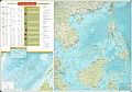 75967 South-China-Sea-1.jpg 9 570 × 6 660; 30,8 MB
-
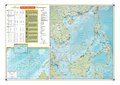 75967 South-China-Sea-1.pdf 1 754 × 1 239; 3,71 MB
-
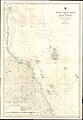 Admiralty Chart No 769 Sungei Sedili Besar to Kuala Pahang, Published 1949, New Edition 1960.jpg 11 291 × 16 355; 32,61 MB
-
 Bentong district highlighted.jpg 470 × 378; 45 KB
-
 Besut Darul Iman Map.png 552 × 602; 93 KB
-
 Besut political map 1880.png 1 636 × 1 052; 88 KB
-
 BidayuhBisapug.jpg 2 315 × 1 571; 1,2 MB
-

-
 Borneo final x.png 2 000 × 797; 469 KB
-
 Diplomatic missions of Malaysia-2010-21-03.PNG 1 425 × 625; 64 KB
-
 Distribution of Terengganu language.jpg 2 754 × 3 264; 701 KB
-
 ECDM 2013 12 03 World ECHOFlashEvents.pdf 1 625 × 1 125; 366 KB
-
 ECDM 20130625 ECHOflash World Events.pdf 1 625 × 1 125; 294 KB
-
 ECDM 20160304 World SevereWeather.pdf 1 625 × 1 125; 540 KB
-
 ECDM 20160721 World SevereWeather.pdf 1 625 × 1 125; 554 KB
-
 ECDM 20160728 Myanmar Burma Rohingya Crisis.pdf 1 625 × 1 125; 511 KB
-
 ECDM 20171025 Asia Severe Weather.pdf 1 625 × 1 125; 833 KB
-
 ECDM 20171106 Asia SevereWeather.pdf 1 625 × 1 125; 897 KB
-
 ECDM 20171109 Asia SevereWeather.pdf 1 625 × 1 125; 1,06 MB
-
 ECDM 20171129 Asia Events.pdf 1 625 × 1 125; 739 KB
-
 ECDM 20190104 TC PABUK.pdf 1 625 × 1 125; 726 KB
-
 ECDM 20221117 ST SE-Asia.pdf 1 625 × 1 125; 558 KB
-
 ECE3-12-e8745-g003.jpg 709 × 1 042; 160 KB
-
 FLII Malaysia.png 1 822 × 637; 594 KB
-
 FMSR 1890 2023.gif 805 × 1 000; 593 KB
-
 Forest City Virtual Tour.jpg 3 968 × 2 976; 2,42 MB
-
 Greater Indonesia Locator.svg 784 × 415; 1,77 MB
-
 James Shoal Dash location in 2009 & 1984 maps.jpg 340 × 312; 42 KB
-
 Kangar map.jpg 751 × 830; 101 KB
-
 Klang valley map.svg 409 × 440; 28 KB
-
 Koridor Utara Map .jpg 2 480 × 3 401; 462 KB
-
 Location Sribuat.png 674 × 411; 32 KB
-
 Malaixiya-zhou-zh-tw.png 2 660 × 960; 243 KB
-
 Malaixiya-zhou-zh.png 2 660 × 960; 235 KB
-
 Malaysia Regions Malakka.png 786 × 286; 50 KB
-
 Malay Archipelago map wallace.jpg 4 908 × 2 023; 4,48 MB
-
 Malaya PBT population (2020 census) wiki.svg 1 409 × 1 751; 2,53 MB
-
 Malaysia growth corridors.svg 2 410 × 1 751; 2,11 MB
-
 Malaysia map1.png 6 930 × 3 064; 686 KB
-
 Malaysia states named.png 1 500 × 513; 163 KB
-
 Malaysia states nonamed.png 1 500 × 512; 51 KB
-
 MalaysiaJohorMuar.PNG 400 × 144; 16 KB
-
 Malaysian states and federal territories by HDI (2017).png 940 × 314; 89 KB
-
 Malaysian states and federal territories by HDI (2018).png 1 226 × 418; 89 KB
-
 Malaysian states by GSP per capita 2019.svg 1 200 × 457; 314 KB
-
 Malaysian visa-exemption.png 1 357 × 628; 62 KB
-
 Map masjid jpeg.jpg 951 × 512; 116 KB
-
 Mapa de Malàisia.png 626 × 629; 115 KB
-
 Masyarakat India-Malaysia.png 524 × 355; 203 KB
-
 Pangkor-MIP Map.jpg 549 × 700; 117 KB
-
 Peta Dungun.jpg 318 × 262; 84 KB
-
 Peta Kecamatan Talisayan.jpg 768 × 768; 56 KB
-
 Peta Kerajaan Sambaliung.png 3 840 × 2 160; 537 KB
-
 Peta Kesultanan Gunung Tabur.png 3 840 × 2 160; 527 KB
-
 Peta Malaysia.jpg 2 400 × 914; 617 KB
-
 PETA PERMAINAN RAKYAT 15.jpg 747 × 955; 111 KB
-
 PETA PERMAINAN RAKYAT DAERAH KALIMANTAN SELATAN 14.jpg 774 × 936; 116 KB
-
 PHHSSchoolMap.png 672 × 588; 245 KB
-
 PM map00 web.jpg 563 × 700; 41 KB
-
 PM map02 web.jpg 700 × 610; 41 KB
-
 Pm map03 web.jpg 668 × 700; 82 KB
-
 Royal Malaysian Air Force Bases.png 2 000 × 762; 226 KB
-
 Royal Malaysian Navy Bases.png 1 920 × 732; 386 KB
-
 Senawangst.jpg 1 193 × 723; 55 KB
-
 Southwest Penang Island District electoral constituencies.png 963 × 1 309; 84 KB
-
 Svensk malaysiakarta.jpg 635 × 325; 77 KB
-
 Штаты Малайзии.png 1 500 × 500; 239 KB
-
 マレーシア 350px-My-map.png 350 × 179; 65 KB
-
 塞芒人分布.jpg 1 592 × 1 125; 136 KB
-
 塞芒人分布.png 612 × 1 125; 719 KB


_wiki.svg)


.png)
.png)