Category:Maps of Montgaillard (Hautes-Pyrénées) - municipality limit maps
Jump to navigation
Jump to search
Media in category "Maps of Montgaillard (Hautes-Pyrénées) - municipality limit maps"
The following 3 files are in this category, out of 3 total.
-
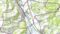
 Montgaillard (Hautes-Pyrénées) OSM 01.png 502 × 469; 351 KB
-
 Montgaillard (Hautes-Pyrénées) OSM 02.png 839 × 482; 632 KB
-
 Montgaillard (Hautes-Pyrénées) OSM 03.png 839 × 482; 329 KB
_OSM_01.png)
_OSM_02.png)
_OSM_03.png)