Category:Maps of Oneida County, New York
Jump to navigation
Jump to search
Counties of New York (state): Albany · Allegany · Bronx · Broome · Cattaraugus · Cayuga · Chautauqua · Chemung · Chenango · Clinton · Columbia · Cortland · Delaware · Dutchess · Erie · Essex · Franklin · Fulton · Genesee · Greene · Hamilton · Herkimer · Jefferson · Kings · Lewis · Livingston · Madison · Monroe · Montgomery · Nassau · New York · Niagara · Oneida · Onondaga · Ontario · Orange · Orleans · Oswego · Otsego · Putnam · Queens · Rensselaer · Richmond · Rockland · Saratoga · Schenectady · Schoharie · Schuyler · Seneca · St. Lawrence · Steuben · Suffolk · Sullivan · Tioga · Tompkins · Ulster · Warren · Washington · Wayne · Westchester · Wyoming · Yates
Wikimedia category | |||||
| Upload media | |||||
| Instance of | |||||
|---|---|---|---|---|---|
| Category combines topics | |||||
| Oneida County | |||||
county in New York, United States   | |||||
| Instance of | |||||
| Named after | |||||
| Location | New York | ||||
| Capital | |||||
| Inception |
| ||||
| Population |
| ||||
| Area |
| ||||
| Different from | |||||
| official website | |||||
 | |||||
Subcategories
This category has the following 3 subcategories, out of 3 total.
Media in category "Maps of Oneida County, New York"
The following 61 files are in this category, out of 61 total.
-
 Annual report (1909) (14565095489).jpg 2,472 × 3,088; 2.1 MB
-
 Civics for New York State (1901) (14800662853).jpg 1,796 × 2,968; 782 KB
-
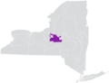
 Map of New York highlighting Oneida County.svg 6,599 × 5,030; 112 KB
-
 Map of the county of Oneida LOC 2013593244.jpg 5,007 × 6,397; 4.47 MB
-
 Map of the county of Oneida LOC 2013593244.tif 5,007 × 6,397; 91.64 MB
-
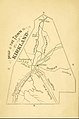 Map of the Town of Kirkland, New York, from 1874.jpg 323 × 488; 49 KB
-
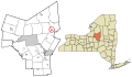
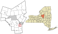
 Oneida County New York incorporated and unincorporated areas Annsville highlighted.svg 1,270 × 741; 11.33 MB
-
 Oneida County New York incorporated and unincorporated areas Augusta highlighted.svg 1,270 × 741; 11.33 MB
-
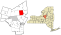
 Oneida County New York incorporated and unincorporated areas Ava highlighted.svg 1,270 × 741; 11.33 MB
-

-

-

-

-
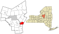
 Oneida County New York incorporated and unincorporated areas Bridgewater highlighted.svg 1,270 × 741; 11.33 MB
-
-

-
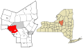
 Oneida County New York incorporated and unincorporated areas Clayville highlighted.svg 1,270 × 741; 11.33 MB
-
 Oneida County New York incorporated and unincorporated areas Clinton highlighted.svg 1,270 × 741; 11.33 MB
-
 Oneida County New York incorporated and unincorporated areas Deerfield highlighted.svg 1,270 × 741; 11.33 MB
-
 Oneida County New York incorporated and unincorporated areas Florence highlighted.svg 1,270 × 741; 11.33 MB
-
 Oneida County New York incorporated and unincorporated areas Floyd highlighted.svg 1,270 × 741; 11.33 MB
-
 Oneida County New York incorporated and unincorporated areas Forestport highlighted.svg 1,270 × 741; 11.33 MB
-

-
 Oneida County New York incorporated and unincorporated areas Kirkland highlighted.svg 1,270 × 741; 11.33 MB
-
 Oneida County New York incorporated and unincorporated areas Lee highlighted.svg 1,270 × 741; 11.33 MB
-
 Oneida County New York incorporated and unincorporated areas Marcy highlighted.svg 1,270 × 741; 11.33 MB
-
 Oneida County New York incorporated and unincorporated areas Marshall highlighted.svg 1,270 × 741; 11.33 MB
-

-

-

-

-

-
 Oneida County New York incorporated and unincorporated areas Oriskany highlighted.svg 1,270 × 741; 11.33 MB
-
 Oneida County New York incorporated and unincorporated areas Paris highlighted.svg 1,270 × 741; 11.33 MB
-
 Oneida County New York incorporated and unincorporated areas Prospect highlighted.svg 1,270 × 741; 11.33 MB
-
-
-
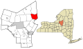
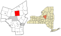
 Oneida County New York incorporated and unincorporated areas Rome highlighted.svg 1,270 × 741; 11.33 MB
-
 Oneida County New York incorporated and unincorporated areas Sangerfield highlighted.svg 1,270 × 741; 11.33 MB
-
 Oneida County New York incorporated and unincorporated areas Sherrill highlighted.svg 1,270 × 741; 11.33 MB
-
 Oneida County New York incorporated and unincorporated areas Steuben highlighted.svg 1,270 × 741; 11.33 MB
-

-
 Oneida County New York incorporated and unincorporated areas Trenton highlighted.svg 1,270 × 741; 11.33 MB
-
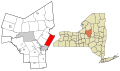
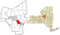
 Oneida County New York incorporated and unincorporated areas Utica highlighted.svg 1,270 × 741; 11.33 MB
-

-

-
-
 Oneida County New York incorporated and unincorporated areas Verona highlighted.svg 1,270 × 741; 11.33 MB
-
 Oneida County New York incorporated and unincorporated areas Vienna highlighted.svg 1,270 × 741; 11.33 MB
-
-
 Oneida County New York incorporated and unincorporated areas Waterville highlighted.svg 1,270 × 741; 11.33 MB
-
 Oneida County New York incorporated and unincorporated areas Western highlighted.svg 1,270 × 741; 11.33 MB
-

-

-
 Oneida County New York incorporated and unincorporated areas Whitesboro highlighted.svg 1,270 × 741; 11.33 MB
-
 Oneida County New York incorporated and unincorporated areas Whitestown highlighted.svg 1,270 × 741; 11.33 MB
-
 Oneida County New York incorporated and unincorporated areas Yorkville highlighted.svg 1,270 × 741; 11.33 MB
-
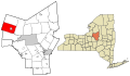
 Oneida County New York, Cities and Towns.svg 655 × 776; 11.22 MB
-
 New York State Senate District 47 (2012).png 3,259 × 2,492; 404 KB
-
 New York State Senate District 53 (2012).png 3,259 × 2,492; 400 KB
-
 UCA-FAA airport diagram.png 805 × 1,237; 41 KB
_(14565095489).jpg)
_(14800662853).jpg)


_highlighted.svg)
_highlighted.svg)
_highlighted.svg)
_highlighted.svg)

_highlighted.svg)
_highlighted.svg)


_highlighted.svg)
_highlighted.svg)


_highlighted.svg)
_highlighted.svg)


_highlighted.svg)
_highlighted.svg)
_highlighted.svg)


_highlighted.svg)


.png)
.png)
