Category:Maps of Orange County, Florida
Jump to navigation
Jump to search
Counties of Florida: Alachua · Baker · Bay · Bradford · Brevard · Broward · Calhoun · Charlotte · Citrus · Clay · Collier · Columbia · DeSoto · Dixie · Duval · Escambia · Flagler · Franklin · Gadsden · Gilchrist · Glades · Gulf · Hamilton · Hardee · Hendry · Hernando · Highlands · Hillsborough · Holmes · Indian River · Jackson · Jefferson · Lafayette · Lake · Lee · Leon · Levy · Liberty · Madison · Manatee · Marion · Martin · Miami-Dade · Monroe · Nassau · Okaloosa · Okeechobee · Orange · Osceola · Palm Beach · Pasco · Pinellas · Polk · Putnam · Santa Rosa · Sarasota · Seminole · St. Johns · St. Lucie · Sumter · Suwannee · Taylor · Union · Volusia · Wakulla · Walton · Washington
Wikimedia category | |||||
| Upload media | |||||
| Instance of | |||||
|---|---|---|---|---|---|
| Category combines topics | |||||
| Orange County | |||||
county in Florida, United States     | |||||
| Instance of | |||||
| Part of |
| ||||
| Named after | |||||
| Location | Florida | ||||
| Capital | |||||
| Inception |
| ||||
| Population |
| ||||
| Area |
| ||||
| Different from | |||||
| official website | |||||
 | |||||
Subcategories
This category has the following 4 subcategories, out of 4 total.
Media in category "Maps of Orange County, Florida"
The following 25 files are in this category, out of 25 total.
-

-

-

-

-

-
 Apopka-Vineland Road.png 978 × 6,478; 183 KB
-
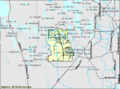 Bay Lake.png 575 × 425; 39 KB
-
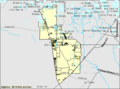 Citrus Ridge.png 575 × 425; 31 KB
-
 Florida -Hamilton County - Sarasota County (part)- - NARA - 17474775 (page 872).jpg 4,808 × 3,256; 2.2 MB
-
 Florida -Hamilton County - Sarasota County (part)- - NARA - 17474775 (page 875).jpg 4,520 × 3,800; 2.34 MB
-
 General Project Location Map 1926.jpg 4,705 × 3,065; 4.05 MB
-
 Lake-buena-vista=fl.gif 575 × 425; 52 KB
-
 Map of Florida highlighting Orange County.svg 7,342 × 7,321; 310 KB
-
 Map of Orange County, Florida LOC 2012592407.jpg 16,310 × 12,169; 28.42 MB
-
 Map of Orange County, Florida LOC 2012592407.tif 16,310 × 12,169; 567.85 MB
-
 OIA.svg 2,196 × 2,019; 1.33 MB
-
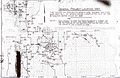
 Orange County 1926 Bond Issue roads.png 3,199 × 2,004; 177 KB
-
 Orange1930.jpg 2,559 × 1,653; 607 KB
-
 Orlando International Airport.png 3,803 × 3,247; 1.14 MB
-
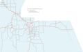
 Orlando, FL.png 1,256 × 823; 405 KB
-
 RCID boundaries 2020-01-10.pdf 1,650 × 2,550; 2.59 MB
-
 Runnymede Florida LOC 2012592599.jpg 4,761 × 5,740; 3.89 MB
-
 Runnymede Florida LOC 2012592599.tif 4,761 × 5,740; 78.19 MB
-
 Sunbridge, FL Map.png 3,997 × 2,247; 13.1 MB
-
 Williamsburg.gif 575 × 425; 49 KB
.jpg)
.jpg)
.jpg)
.jpg)
_-_Orange_County_-_Orange_County_-_ED_48-1_to_62_-_NARA_-_12007932.jpg)


-_-_NARA_-_17474775_(page_872).jpg)
-_-_NARA_-_17474775_(page_875).jpg)


