Category:Maps of Philadelphia
Jump to navigation
Jump to search
- 100 most populous cities of the United States
- 1–25
- Austin
- Boston
- Charlotte
- Chicago
- Columbus
- Dallas
- Denver
- El Paso
- Fort Worth
- Houston
- Indianapolis
- Jacksonville
- Los Angeles
- Nashville
- New York City
- Oklahoma City
- Philadelphia
- Phoenix
- Portland
- San Antonio
- San Diego
- San Francisco
- San Jose
- Seattle
- Washington, D.C.
- 26–50
- Arlington
- Atlanta
- Bakersfield
- Colorado Springs
- Detroit
- Fresno
- Kansas City
- Las Vegas
- Long Beach
- Louisville
- Memphis
- Miami
- Minneapolis
- Oakland
- Omaha
- Raleigh
- Sacramento
- Tucson
- Tulsa
- 51–75
- Anaheim
- Anchorage
- Cincinnati
- Cleveland
- Corpus Christi
- Durham
- Greensboro
- Honolulu
- Irvine
- Jersey City
- Lexington
- Lincoln
- Newark
- New Orleans
- Orlando
- Pittsburgh
- Plano
- Saint Paul
- Santa Ana
- St. Louis
- Tampa
- 76–100
- Boise
- Buffalo
- Chesapeake
- Chula Vista
- Fort Wayne
- Laredo
- Lubbock
- Madison
- Norfolk
- Richmond
- Santa Clarita
- Scottsdale
- St. Petersburg
- Spokane
- Toledo
- Winston-Salem
- >100 (former top 50 and still over 100.000)
- Cambridge
- Grand Rapids
- Hartford
- Lowell
- Providence
- Rochester
- Syracuse
- Worcester
Counties of Pennsylvania : Adams · Allegheny · Armstrong · Beaver · Bedford · Berks · Blair · Bradford · Bucks · Butler · Cambria · Cameron · Carbon · Centre · Chester · Clarion · Clearfield · Clinton · Columbia · Crawford · Cumberland · Dauphin · Delaware · Elk · Erie · Fayette · Forest · Franklin · Fulton · Greene · Huntingdon · Indiana · Jefferson · Juniata · Lackawanna · Lancaster · Lawrence · Lebanon · Lehigh · Luzerne · Lycoming · McKean · Mercer · Mifflin · Monroe · Montgomery · Montour · Northampton · Northumberland · Perry · Philadelphia · Pike · Potter · Schuylkill · Snyder · Somerset · Sullivan · Susquehanna · Tioga · Union · Venango · Warren · Washington · Wayne · Westmoreland · Wyoming · York
Wikimedia category | |||||
| Upload media | |||||
| Instance of | |||||
|---|---|---|---|---|---|
| Category combines topics | |||||
| Philadelphia | |||||
largest city in Pennsylvania, United States  .jpg)     | |||||
| Instance of |
| ||||
| Location | Philadelphia County, Pennsylvania | ||||
| Located in or next to body of water | |||||
| School district |
| ||||
| Head of government | |||||
| Founded by | |||||
| Inception |
| ||||
| Population |
| ||||
| Area |
| ||||
| Elevation above sea level |
| ||||
| Different from | |||||
| official website | |||||
 | |||||
Subcategories
This category has the following 9 subcategories, out of 9 total.
.
E
- Election maps of Philadelphia (22 F)
M
- Maps of West Philadelphia (4 F)
P
R
- Railroad maps of Philadelphia (11 F)
T
- Travel maps of Philadelphia (3 F)
Pages in category "Maps of Philadelphia"
This category contains only the following page.
Media in category "Maps of Philadelphia"
The following 29 files are in this category, out of 29 total.
-
 1948 Original Railroads in Philadelphia Edited 8-25-21.jpg 5,374 × 3,285; 2.25 MB
-
 30thStreetStationSkizze01.png 1,746 × 1,256; 518 KB
-
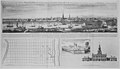 An east prospect of the city of Philadelphia, 1768 - NARA - 535738.jpg 3,000 × 1,732; 1.69 MB
-
 Bellevue estate map 1820.jpg 3,752 × 1,996; 156 KB
-
 Bellevue estate map 1840.jpg 3,850 × 1,980; 213 KB
-
 Bellevue estate map 1870.jpg 3,773 × 2,386; 349 KB
-
 Bellevue estate map 1920.jpg 3,762 × 3,168; 538 KB
-
 Bellevue mansion 1895.jpg 3,735 × 2,436; 443 KB
-
 City Plan of Philadelphia - ASCE monument - DSC06520.JPG 3,240 × 4,320; 4.95 MB
-

-

-
 Map of the Independence National Historic Park (as of 2024-01-23).png 1,920 × 948; 866 KB
-
 MarconiPlazaPhiladelphia2.jpg 480 × 244; 22 KB
-
-

-

-
 Philadelphia City Council districts map (2016–2024).svg 800 × 867; 81 KB
-
 Philadelphia City Council districts map (since 2024).svg 800 × 867; 97 KB
-

-
 Philadelphia in the Civil War 1861-1865 (electronic resource) (1913) (14576036100).jpg 2,878 × 4,338; 2.25 MB
-
 Philadelphia ward map blank.svg 877 × 993; 204 KB
-
 Philadelphia, PA.png 1,259 × 815; 709 KB
-
 Plan for the Fairmount Parkway by Jacques Greber 1917.jpg 368 × 112; 20 KB
-
-
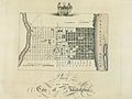 Plan of the City of Philadelphia Birch's Views Plate 3.jpg 825 × 622; 429 KB
-
 Race and ethnicity Philadelphia.png 3,009 × 3,009; 6.97 MB
-
 Schuylkill river.jpeg 1,107 × 681; 209 KB
-
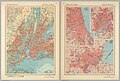 Selected cities in Northeastern USA, 1967.jpg 4,262 × 2,877; 4.95 MB
-
 The Pennsylvania-German Society - (Publications) (1891) (14597978488).jpg 2,432 × 1,680; 417 KB


.png)

.jpg)
.svg)
.svg)
_(1913)_(14576036100).jpg)


_(1891)_(14597978488).jpg)