Category:Maps of São Tomé and Príncipe
Jump to navigation
Jump to search
Countries of Africa: Algeria · Angola · Benin · Botswana · Burkina Faso · Burundi · Cameroon · Cape Verde · Central African Republic · Chad · Comoros · Democratic Republic of the Congo · Republic of the Congo · Djibouti · Egypt‡ · Equatorial Guinea · Eritrea · Eswatini · Ethiopia · Gabon · The Gambia · Ghana · Guinea · Guinea-Bissau · Ivory Coast · Kenya · Lesotho · Liberia · Libya · Madagascar · Malawi · Mali · Mauritania · Mauritius · Morocco · Mozambique · Namibia · Niger · Nigeria · Rwanda · São Tomé and Príncipe · Senegal · Seychelles · Sierra Leone · Somalia · South Africa · South Sudan · Sudan · Tanzania · Togo · Tunisia · Uganda · Zambia · Zimbabwe
Limited recognition: Ambazonia · Azawad · Puntland · Sahrawi Arab Democratic Republic · Somaliland – Other areas: Canary Islands · Ceuta · Madeira · Mayotte · Melilla · Réunion · Saint Helena, Ascension and Tristan da Cunha · Scattered Islands in the Indian Ocean · Western Sahara
‡: partly located in Africa
Wikimedia category | |||||
| Upload media | |||||
| Instance of | |||||
|---|---|---|---|---|---|
| Category combines topics | |||||
 | |||||
Subcategories
This category has the following 13 subcategories, out of 13 total.
F
L
O
S
T
V
Pages in category "Maps of São Tomé and Príncipe"
The following 2 pages are in this category, out of 2 total.
Media in category "Maps of São Tomé and Príncipe"
The following 16 files are in this category, out of 16 total.
-
 Population density of Sao Tome and Principe.png 1,913 × 2,479; 123 KB
-
 Sao Tome and Principe Locator.png 1,403 × 1,646; 14 KB
-
 Sao Tome and Principe Map.gif 329 × 355; 6 KB
-
 Carta principe 40k.jpg 2,212 × 3,034; 4.41 MB
-
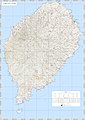 Carta s tome 40k.jpg 4,082 × 5,750; 18.07 MB
-
 Diplomatic missions of Sao Tome and Principe.png 1,425 × 625; 64 KB
-
 FLII SaoTomePrincipe.png 486 × 715; 24 KB
-
 Golf of Guinea creoles.png 665 × 963; 7 KB
-
 Mapa de São Tomé e Príncipe.svg 250 × 250; 468 KB
-
 Roça Água Izé on a Topographic Map by Ministério do Ultramar.jpg 1,652 × 1,172; 1.01 MB
-
 Sao Tome and Principe Population Density, 2000 (5457626158).jpg 2,396 × 3,100; 544 KB
-
 Sao Tome and Principe Population Density, 2000 (6172448238).jpg 2,322 × 3,160; 533 KB
-
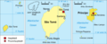 Sao-tome-u-principe-karte-politisch-principe.png 624 × 255; 56 KB
-
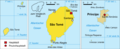 Sao-tome-und-principe-karte-politisch.png 624 × 255; 56 KB
-
 STPmap-Trindade.png 258 × 422; 3 KB
-
 São Tome (32501229500).jpg 3,264 × 2,448; 1.8 MB


.jpg)
.jpg)

.jpg)