Category:Maps of Spanish Guinea
Jump to navigation
Jump to search
Subcategories
This category has only the following subcategory.
O
Media in category "Maps of Spanish Guinea"
The following 14 files are in this category, out of 14 total.
-
 Mapa Virreinato del Río de la Plata (año 1800) por Agustín Antonio Cabrera Cardozo.png 3,840 × 2,160; 903 KB
-
-
 Cameron - Colonizacion alemanda.png 1,046 × 1,301; 211 KB
-
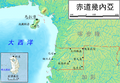 Chidao Jineiya-zh-tw.png 750 × 520; 301 KB
-
 Flag map of Spanish Guinea (1928 - 1968).png 2,000 × 1,972; 205 KB
-
 Spanish Guinea Flag Map (1926 - 1968).png 500 × 493; 3 KB
-
 Fernandopoo.png 800 × 400; 30 KB
-
 Flag Map of Spanish Guinea (Second Spanish Republic).png 2,548 × 2,649; 355 KB
-
 Posesiones españolas en el Golfo de Guinea. Material cartográfico.jpg 7,198 × 5,668; 2.44 MB
-
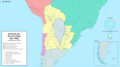
 Territorios de la Segunda República Española-variante.svg 4,950 × 7,500; 1.73 MB
-
 Territorios de la Segunda República Española.svg 4,950 × 7,500; 989 KB
-
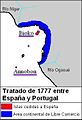 Treaty1777.JPG 250 × 365; 19 KB
-
 Virreinato del Río de la Plata en el año 1800.png 3,840 × 2,160; 904 KB
-
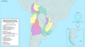
 África Ecuatorial Española.svg 2,846 × 1,863; 1.91 MB
_por_Agust%C3%ADn_Antonio_Cabrera_Cardozo.png)


.png)
.png)

.png)


