Category:Maps of islands of Germany in the North Sea
Jump to navigation
Jump to search
Subcategories
This category has the following 12 subcategories, out of 12 total.
A
- Maps of Amrum (11 F)
B
- Maps of Baltrum (7 F)
- Maps of Borkum (11 F)
F
- Maps of Föhr (12 F)
H
J
- Maps of Juist (9 F)
L
- Maps of Langeoog (13 F)
N
- Maps of Norderney (9 F)
S
- Maps of Spiekeroog (16 F)
- Maps of Sylt (41 F)
W
- Maps of Wangerooge (21 F)
Media in category "Maps of islands of Germany in the North Sea"
The following 18 files are in this category, out of 18 total.
-
 A Halgen.png 1,000 × 1,199; 196 KB
-
 Halligen 1858.png 2,368 × 2,784; 1.06 MB
-
 Map frisian islands north 1910.jpg 792 × 1,175; 306 KB
-
 Nordfreeschen Inseln.PNG 500 × 600; 101 KB
-
 Nordfries-inseln.png 800 × 1,480; 909 KB
-
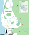 Sunbeenker.png 1,000 × 1,199; 196 KB
-
 Nordfriesisches Wattenmeer D JM.png 1,000 × 1,199; 237 KB
-
 Nordfriesisches Wattenmeer D und DK-en.png 1,797 × 4,404; 301 KB
-
 Nordfriesisches Wattenmeer D und DK.png 1,797 × 4,404; 214 KB
-
 Nordfriesisches Wattenmeer empty.png 1,000 × 1,199; 196 KB
-
 Nordfriesisches Wattenmeer fratsch.png 1,000 × 1,199; 255 KB
-
 Nordfrisa vadomaro.png 1,797 × 4,404; 263 KB
-
 Nordfrisisk Vadehav.png 1,697 × 2,048; 1.13 MB
-
 Ostfriesland es.svg 756 × 651; 349 KB
-
 Ostfriesland fr.svg 756 × 651; 349 KB
-
 Ostfriesische Inseln (Karte).png 13,425 × 5,135; 6.04 MB
-
 Reste von Alt-Nordstrand.png 796 × 714; 43 KB
-
 Reußenköge 1858 (cropped).png 858 × 1,093; 159 KB


.png)
.png)