Category:Maps of regions of Mauritania
Jump to navigation
Jump to search
Countries of Africa: Burkina Faso · Cameroon · Chad · Djibouti · Egypt‡ · Equatorial Guinea · Ethiopia · Guinea · Ivory Coast · Libya · Madagascar · Malawi · Mali · Mauritania · Morocco · Namibia · Niger · Senegal · Somalia · South Sudan · Sudan · Tanzania · Togo · Uganda
Limited recognition: Ambazonia · Somaliland
‡: partly located in Africa
Limited recognition: Ambazonia · Somaliland
‡: partly located in Africa
Subcategories
This category has only the following subcategory.
Media in category "Maps of regions of Mauritania"
The following 11 files are in this category, out of 11 total.
-
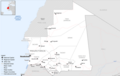 Mauritania Base Map.png 1,108 × 702; 266 KB
-
 Mauritania-Adrar.svg 1,283 × 1,384; 119 KB
-
 Mauritania-Assaba.svg 1,283 × 1,384; 110 KB
-
 Mauritania-Brakna.svg 1,283 × 1,384; 110 KB
-
 Mauritania-Dakhlet Nouadhibou.svg 1,283 × 1,384; 110 KB
-
 Mauritania-Gorgol.png 150 × 167; 3 KB
-
 Mauritania-Gorgol.svg 1,283 × 1,384; 110 KB
-
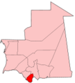 Mauritania-Guidimaka.png 150 × 167; 3 KB
-
 Mauritania-Guidimaka.svg 1,283 × 1,384; 110 KB
-
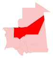
 Mauritania-Hodh ech Chargui.png 150 × 167; 4 KB
-
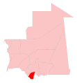
 Mauritania-Tagant.png 150 × 167; 3 KB


