Category:Maps of the French Mandate of Syria and Lebanon
Jump to navigation
Jump to search
Media in category "Maps of the French Mandate of Syria and Lebanon"
The following 18 files are in this category, out of 18 total.
-
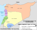
 French Mandate for Syria and the Lebanon 1922 ar.png 726 × 600; 118 KB
-
 French Mandate for Syria and the Lebanon 1923 ar.png 3,841 × 3,174; 629 KB
-
 French Mandate for Syria and the Lebanon 1926 ar.png 3,841 × 3,174; 526 KB
-
 French Mandate for Syria and the Lebanon 1938 ar.png 3,841 × 3,174; 487 KB
-
 French Mandate for Syria and the Lebanon map ar.svg 922 × 762; 190 KB
-
 French Mandate for Syria and the Lebanon map de.svg 922 × 762; 268 KB
-
 French Mandate for Syria and the Lebanon map en.svg 922 × 762; 245 KB
-
 French Mandate for Syria and the Lebanon map es.svg 983 × 813; 529 KB
-
 French Mandate for Syria and the Lebanon map fr.svg 922 × 762; 251 KB
-
 French Mandate for Syria and the Lebanon map he.svg 922 × 762; 253 KB
-
 French Mandate for Syria and the Lebanon map tr.svg 922 × 762; 245 KB
-
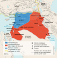
 Intedab Map.jpg 2,016 × 1,480; 452 KB
-
 Mandat de Syrie (avant 1937).jpg 2,425 × 2,117; 833 KB
-
 Mandat-de-syrie.png 2,425 × 2,117; 232 KB
-
 Mandate of Syria ar.png 477 × 390; 73 KB
-
 Mandate of Syria heb.png 1,024 × 836; 157 KB
-
 Mandate of Syria.svg 582 × 508; 7 KB
-
 Treaty of Sèvres Middle East fr.png 585 × 600; 457 KB


.jpg)


