Category:Maps of the history of Montenegro in the Middle Ages
Jump to navigation
Jump to search
Countries of Europe: Albania · Bosnia and Herzegovina · Bulgaria · Croatia · Greece · Montenegro · North Macedonia · Romania · Serbia · Slovenia · Ukraine
Limited recognition: Kosovo
Limited recognition: Kosovo
Subcategories
This category has the following 15 subcategories, out of 15 total.
Media in category "Maps of the history of Montenegro in the Middle Ages"
The following 21 files are in this category, out of 21 total.
-
 1373 Propast Nikole Altomanovica Vojinovica.jpg 1,024 × 1,154; 167 KB
-
 1441 Kosaca S V u Zeti.jpg 1,051 × 1,128; 175 KB
-
 Balkans in 1350 according to Gustav Droysen from 19th century.jpg 1,367 × 1,268; 546 KB
-
 Balsa III Balsic 1421 eng.svg 1,461 × 1,115; 662 KB
-
 Central balkans 1373 1395V1 en.svg 1,609 × 1,592; 463 KB
-
 Churches in the Bay of Kotor.jpg 999 × 678; 197 KB
-
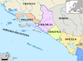 Paganija, Zahumlje, Travunija, Duklja, Croatian view-es.svg 805 × 590; 1.08 MB
-
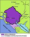
 Donja Zeta Boka i s Albanija 1443.png 587 × 446; 1.84 MB
-
 Drzava Crnojevica.JPG 871 × 1,064; 99 KB
-
 Kotor and Balsa II Balsic XIV cAD.svg 800 × 600; 283 KB
-
 Kraljevina Duklja za vrijeme Bodina.gif 1,235 × 1,145; 455 KB
-
 Kraljevina Srbija kraj XIII pocetak XIV vijeka-sr.svg 2,079 × 1,884; 930 KB
-
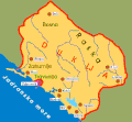
 Porodicni posjedi Crnojevica.png 768 × 827; 108 KB
-
 Realm of Vojislav Vojinović and Nikola Altomanović.png 622 × 798; 59 KB
-
 Serbia under Stefan Nemanja and Stefan the First-Crowned.jpg 733 × 600; 137 KB
-
 Serbian Despotate 1423.png 1,624 × 1,711; 258 KB
-
 Serbian Despotate 1433.png 1,461 × 1,711; 225 KB
-
 Serbian Despotate 1451.png 1,461 × 1,711; 235 KB
-
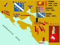
 Venetian seside properties in Montenegro 1448-es.svg 1,156 × 1,170; 524 KB
-
 Zeta Stracimira i Djuradja I Balsica.svg 1,600 × 1,200; 260 KB
-


.jpg)