Category:Menhir du Champ Dolent
Jump to navigation
Jump to search
|
This building is classé au titre des monuments historiques de la France. It is indexed in the base Mérimée, a database of architectural heritage maintained by the French Ministry of Culture, under the references PA00090549
|
| Object location | | View all coordinates using: OpenStreetMap |
|---|
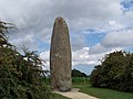
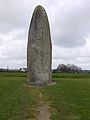
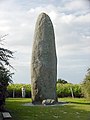
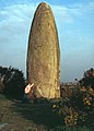
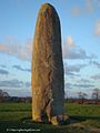
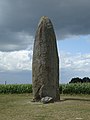
menhir in Dol-de-Bretagne, France  | |||||
| Upload media | |||||
| Instance of | |||||
|---|---|---|---|---|---|
| Location | Dol-de-Bretagne, Ille-et-Vilaine, Brittany, Q88521114, Metropolitan France, France | ||||
| Heritage designation |
| ||||
 | |||||
Media in category "Menhir du Champ Dolent"
The following 26 files are in this category, out of 26 total.
-
 Breizh 35 - Dol - Peulvan maez al lanv 02.jpg 2,592 × 1,944; 1.75 MB
-
 Breizh 35 - Dol - Peulvan maez al lanv 06.jpg 1,944 × 2,592; 1.54 MB
-
 Breizh 35 - Dol - Peulvan maez al lanv A.jpg 1,842 × 4,572; 1.59 MB
-
 Dol - Menhir de Champ-Dolent.jpg 2,112 × 2,816; 2.65 MB
-
 Dol de Bretagne (p8310026).jpg 512 × 680; 232 KB
-
 Dol-de-Bretagne-110-Menhir du Champ-Dolent-1978-gje.jpg 1,774 × 2,481; 2.58 MB
-
 Dolmen0.jpg 1,024 × 1,365; 170 KB
-
 Le Tour du monde, nouvelle série-08-p238.jpg 837 × 1,324; 299 KB
-
 Menhir Champ-Dolent.jpg 1,728 × 2,304; 1.02 MB
-
 Menhir de champ-dolent.JPG 2,616 × 3,488; 2.01 MB
-
 Menhir Dol-de Bretagne.jpg 1,446 × 1,930; 476 KB
-
 Menhir du Champ Dolent (1).jpg 2,816 × 1,880; 1.43 MB
-
 Menhir du Champ Dolent Dol de Bretagne 01.jpg 3,888 × 5,184; 5.2 MB
-
 Menhir du Champ Dolent Dol de Bretagne 02.jpg 3,000 × 4,000; 2.85 MB
-
 Menhir du Champ Dolent Dol de Bretagne 03.jpg 3,888 × 5,184; 5.3 MB
-
 Menhir du Champ Dolent Dol de Bretagne 04.jpg 3,888 × 5,184; 5.38 MB
-
 Menhir du Champ Dolent hdsr IMG 3883.jpg 2,448 × 3,264; 3.13 MB
-
 Menhir du Champ Dolent. (2).jpg 2,816 × 1,880; 1.44 MB
-
 Menhir du Champ Dolent.jpg 2,600 × 3,900; 6.32 MB
-
 Menhir du Champ-Dolent 2014 1.jpeg 2,448 × 3,264; 2.46 MB
-
 Menhir du Champ-Dolent 2014 2.jpeg 2,448 × 3,264; 2.27 MB
-
 Menhir du Champ-Dolent 2014 3.jpeg 2,448 × 3,264; 2.58 MB
-
 Menhir du Champ-Dolent 2014.jpeg 2,448 × 909; 1.08 MB
-
 Menhir du Champ-Dolent vu de loin.jpeg 3,264 × 2,448; 2.45 MB
-
 Menhir du Champ-Dolent.jpg 1,704 × 2,272; 2.15 MB
-
 Old Menhir.jpg 3,840 × 5,760; 16.58 MB


.jpg)


.jpg)


.jpg)


