Category:Milestones in North Yorkshire
Jump to navigation
Jump to search
Ceremonial counties of England: Bedfordshire · Berkshire · Buckinghamshire · Cambridgeshire · Cheshire · Cornwall · Cumbria · Derbyshire · Devon · Dorset · Durham · East Riding of Yorkshire · East Sussex · Essex · Gloucestershire · Greater London · Greater Manchester · Hampshire · Herefordshire · Hertfordshire · Kent · Lancashire · Leicestershire · Lincolnshire · Merseyside · Norfolk · North Yorkshire · Northamptonshire · Northumberland · Nottinghamshire · Oxfordshire · Rutland · Shropshire · Somerset · South Yorkshire · Staffordshire · Suffolk · Surrey · Tyne and Wear · Warwickshire · West Midlands · West Sussex · West Yorkshire · Wiltshire · Worcestershire
City-counties: Bristol ·
Former historic counties:
Other former counties:
City-counties: Bristol ·
Former historic counties:
Other former counties:

Subcategories
This category has the following 6 subcategories, out of 6 total.
Media in category "Milestones in North Yorkshire"
The following 200 files are in this category, out of 1,196 total.
(previous page) (next page)-
-
 11 miles to Leyburn (geograph 5358482).jpg 4,150 × 2,677; 2.2 MB
-
 1882-dated stone in hedge on NW side of West Moor Lane (geograph 5311244).jpg 683 × 1,024; 270 KB
-
 20 Miles to Guisborough - geograph.org.uk - 257851.jpg 640 × 397; 27 KB
-
 2013-milestone-tadcaster-doncaster-road.jpg 4,608 × 3,456; 7.25 MB
-
 246 miles to St Pancras (geograph 5689115).jpg 1,024 × 768; 304 KB
-
 25km milepost, north bank, River Ouse (geograph 5134253).jpg 1,024 × 615; 177 KB
-
 2km milepost, Crabtree Reach, River Ouse (geograph 5148395).jpg 1,024 × 768; 166 KB
-
 6 miles to Scarborough; a milestone in Wykeham (geograph 4588310).jpg 1,063 × 1,600; 1.21 MB
-
 A Beckwithshaw Milestone (geograph 3824816).jpg 3,000 × 4,000; 7.11 MB
-
 A Boroughbridge Milestone - geograph.org.uk - 1052181.jpg 640 × 480; 84 KB
-
 A country crossroads and milestone - geograph.org.uk - 167695.jpg 640 × 480; 106 KB
-
 A Milestone - geograph.org.uk - 1050203.jpg 640 × 480; 69 KB
-
 A Milestone - geograph.org.uk - 1050221.jpg 640 × 480; 112 KB
-
 A rather uninteresting corner on the B1363 (geograph 5917671).jpg 4,320 × 2,820; 2.46 MB
-
 A seriously long distance either way (geograph 5811302).jpg 480 × 640; 339 KB
-
 A Yorkshire Milestone - geograph.org.uk - 1066551.jpg 640 × 480; 69 KB
-
 A Yorkshire Milestone - geograph.org.uk - 1066555.jpg 640 × 480; 64 KB
-
 A Yorkshire Milestone - geograph.org.uk - 1066556.jpg 640 × 480; 96 KB
-
 A Yorkshire Milestone - geograph.org.uk - 1133883.jpg 480 × 640; 152 KB
-
 A162 at Burton Salmon, with milestone (geograph 6341821).jpg 1,280 × 960; 405 KB
-
 A162 near Monk Fryston, with milestone (geograph 6341880).jpg 1,280 × 960; 508 KB
-
 A162 north of Burton Salmon (geograph 6341875).jpg 1,280 × 960; 624 KB
-
 A167 passing Mulberry Cottage 219 miles from London (geograph 6984696).jpg 1,024 × 576; 259 KB
-
 A169 towards Pickering (geograph 5584396).jpg 640 × 480; 472 KB
-
 A170 at milestone in mist (geograph 4731526).jpg 640 × 481; 30 KB
-
 A170 Milepost - geograph.org.uk - 1147951.jpg 640 × 480; 81 KB
-
 A4 towards York (geograph 6388882).jpg 800 × 572; 146 KB
-
 A59 towards Harrogate (geograph 5221760).jpg 640 × 480; 72 KB
-
 A59 York Road on the outskirts of Knaresborough (geograph 5538337).jpg 1,280 × 960; 439 KB
-
 A6108 Milestone - geograph.org.uk - 1049914.jpg 640 × 480; 113 KB
-
 A63 near Monk Fryston, with milestone (geograph 6344760).jpg 1,280 × 960; 494 KB
-
 A65 junction with the A687 (geograph 4109091).jpg 640 × 481; 53 KB
-
 A659 towards Wetherby (geograph 6388188).jpg 800 × 600; 124 KB
-
 AA village sign (geograph 6791599).jpg 1,600 × 1,200; 446 KB
-
 B1258 Malton Road SW and a milestone (geograph 3471791).jpg 640 × 480; 125 KB
-
 B1258 Malton Road, and a milestone (geograph 3471782).jpg 640 × 480; 125 KB
-
 B6255 heading south at Snaizeholme Pasture (geograph 6557377).jpg 1,024 × 684; 256 KB
-
 B6265 towards Dibble's Bridge (geograph 6825949).jpg 800 × 600; 101 KB
-
 B6480 at Buck Haw Brow (geograph 5653897).jpg 1,024 × 683; 271 KB
-
 B6480 at Buck Haw Brow (geograph 5654107).jpg 1,024 × 683; 197 KB
-
 Bagby village sign, Bagby Lane (geograph 6290314).jpg 1,600 × 1,201; 1.23 MB
-
 Bawtry Road (A1041), Selby (geograph 6385042).jpg 800 × 550; 135 KB
-
 Bawtry Road (A1041), Selby (geograph 6385043).jpg 800 × 515; 102 KB
-
 Bench mark on an old milestone on the B1258 (geograph 3471524).jpg 640 × 480; 136 KB
-
 Bench mark on Brayton milestone (geograph 3794274).jpg 1,280 × 1,280; 504 KB
-
 Bench mark on milestone near Monk Fryston (geograph 6341892).jpg 960 × 1,280; 442 KB
-

-
 Bench mark on old milestone on Osgodby Hill (geograph 4998778).jpg 768 × 1,024; 252 KB
-
 Bench mark, milestone at Ripley (geograph 5542608).jpg 1,280 × 1,280; 758 KB
-
 Bench mark, milestone on Weeland Road Kellington (geograph 5999368).jpg 1,280 × 960; 439 KB
-
 Benchmark on a milestone west of Tadcaster (geograph 3437566).jpg 2,048 × 1,536; 547 KB
-
 Benchmark on Hawes 14 milestone on SE side of B6255 (geograph 6502969).jpg 1,024 × 649; 257 KB
-
 Benchmark on milestone beside A65 at Thorlby (geograph 3605031).jpg 683 × 1,024; 283 KB
-

-
 Benchmarked milestone beside minor road near Breconbar (geograph 3753513).jpg 683 × 1,024; 305 KB
-
 Blea Moor Road (B6255) approaching the Ribblehead Viaduct (geograph 7041923).jpg 2,000 × 1,500; 2.67 MB
-
 Bridge dated stone (geograph 6800895).jpg 1,600 × 1,071; 747 KB
-
-
 Bridge plaques on Kirk Bridge (geograph 5801438).jpg 1,024 × 683; 235 KB
-
 Bus shelter and milestone, High Street (A174), Hinderwell (geograph 7041387).jpg 2,000 × 1,449; 2.72 MB
-

-
 Cast iron milepost, High Street, Spofforth (geograph 6153964).jpg 1,600 × 1,200; 563 KB
-
 Cast Milestone, Rawcliffe, York (geograph 6644430).jpg 552 × 765; 233 KB
-
 Castle Farm, High Street, Spofforth (geograph 6804202).jpg 1,024 × 768; 129 KB
-
 Catch-All Farm, Linton (geograph 6279892).jpg 1,024 × 768; 133 KB
-
 Clapham cum Newby milestone - geograph.org.uk - 1396973.jpg 640 × 425; 128 KB
-
 Cleveland Way above Cayton Bay at Osgodby Hill (geograph 4998701).jpg 1,024 × 769; 351 KB
-

-
 Confusion in Sutton (geograph 5911942).jpg 3,239 × 4,319; 3.45 MB
-
 Cottages at Long Preston (geograph 5977107).jpg 3,318 × 2,489; 1.53 MB
-
 Curious milestone near Danby Hall (geograph 6287289).jpg 3,888 × 5,184; 6.42 MB
-
 Cut Bench Mark on A59 Milestone Skipton 15 (geograph 5242356).jpg 1,024 × 683; 265 KB
-
 Cut Bench Mark on Guide Stone, Breaks Ridge Crossroads (geograph 6119300).jpg 1,024 × 683; 243 KB
-

-
 Dudley Hill Killinghall & Harrogate Road (geograph 1794622).jpg 2,736 × 3,648; 7.33 MB
-
 East Ayton Milepost - geograph.org.uk - 1204157.jpg 549 × 640; 134 KB
-
 Ebberston Carr and an old Milestone (geograph 3471562).jpg 640 × 480; 61 KB
-

-
 Five miles to Helmsley (geograph 5691006).jpg 5,008 × 3,339; 4.59 MB
-
 Flat Bridge (geograph 5653969).jpg 1,000 × 662; 653 KB
-
 Four miles to the teashops (geograph 5859359).jpg 2,230 × 2,237; 2.23 MB
-
 Gargrave Milepost - geograph.org.uk - 1331010.jpg 480 × 640; 119 KB
-
 Gateway to the lowlands (geograph 5094874).jpg 4,320 × 3,240; 2.74 MB
-

-
 Glusburn Milepost - geograph.org.uk - 1702786.jpg 3,000 × 4,000; 3.65 MB
-
 Grantley Wood - geograph.org.uk - 1142620.jpg 640 × 354; 55 KB
-
 Great Thirkleby village sign, Long Causeway (geograph 6290334).jpg 1,600 × 1,202; 1.1 MB
-
 Guide post on north side of A65 at Eshton Road junction (geograph 6478394).jpg 630 × 1,024; 232 KB
-
 Guide Post, Linton.jpg 1,387 × 1,040; 594 KB
-

-
 Guidepost near Linton 2.jpg 4,000 × 3,000; 4.64 MB
-
 Guidepost near Linton.jpg 4,000 × 1,800; 3.73 MB
-
 Guidepost near Thorpe, North Yorkshire.jpg 3,000 × 4,000; 4.94 MB
-
 Guidestone, Back Road, High Birstwith (geograph 5472634).jpg 540 × 960; 228 KB
-
 Hare relief (geograph 5828638).jpg 4,000 × 3,000; 2.86 MB
-
 Harlow Hill Milepost - geograph.org.uk - 1621308.jpg 480 × 640; 128 KB
-
 Hellifield Milestone on A65 Keighley & Kendal Road.jpg 831 × 1,400; 663 KB
-
 Old Mile Post - geograph.org.uk - 1329392.jpg 480 × 640; 112 KB
-
 Stokesley 19 - geograph.org.uk - 1329390.jpg 480 × 640; 105 KB
-
 Helmsley 2 (geograph 4596598).jpg 1,024 × 768; 296 KB
-
 High Cross - an old milestone with a Benchmark (geograph 6449910).jpg 3,000 × 4,000; 3.69 MB
-
 Hollow Mill Cross inscribed Hamlet of Birkdale (geograph 5063189).jpg 683 × 1,024; 273 KB
-
 Junction of A65 with road to Otterburn (geograph 4669005).jpg 1,024 × 683; 242 KB
-
 Junction of Broughton Road and Broughton Grove (geograph 4775290).jpg 1,024 × 683; 237 KB
-
 Junction of Pill White Lane and Coach Lane (geograph 6519764).jpg 1,024 × 768; 162 KB
-
 Kettlestang Cross (geograph 6449802).jpg 3,000 × 4,000; 4.85 MB
-
 Kirby Hill Milestone - geograph.org.uk - 1300906.jpg 640 × 480; 71 KB
-
 Kirby Hill Milestone - geograph.org.uk - 1433529.jpg 480 × 640; 101 KB
-
 Lane junction near Wayside Farm (geograph 5787450).jpg 1,024 × 683; 254 KB
-
 Leathley, milestone (geograph 6991259).jpg 1,024 × 808; 309 KB
-
 Leathley, milestone (geograph 6991260).jpg 1,024 × 552; 177 KB
-
 Leeds & Liverpool canal, south of Snaygill swingbridge (geograph 6557976).jpg 1,600 × 1,201; 461 KB
-
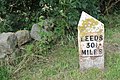
 Leeds 30 miles - geograph.org.uk - 1395505.jpg 640 × 480; 228 KB
-
 Leeds 30.5 miles (geograph 3608496).jpg 1,024 × 683; 292 KB
-
 Leeds Road (A1238), Thorpe Willoughby (geograph 6382516).jpg 800 × 534; 106 KB
-
 Long Marston Milepost (geograph 1790465).jpg 3,000 × 4,000; 3.19 MB
-
 Looking across the B6480 towards Toll Bar Cottage (geograph 6467842).jpg 1,024 × 683; 195 KB
-
 Looking east on Long Causeway (A59) (geograph 5221704).jpg 640 × 480; 76 KB
-
 Looking towards Ingleborough from Blea Moor Road (B6255), Ribblehead (geograph 7041927).jpg 2,000 × 1,500; 2.71 MB
-
 Lost milepost (geograph 6746961).jpg 1,600 × 900; 650 KB
-
 Malton 10 (geograph 4773897).jpg 1,024 × 683; 207 KB
-
 Malton 25 (geograph 4596662).jpg 770 × 1,024; 202 KB
-
 Marker image kendal turnpike.jpg 200 × 353; 13 KB
-
 Mile Indicator, Gargrave Station (geograph 4807379).jpg 640 × 426; 86 KB
-

-
 Mile Marker, Leeds & Liverpool Canal (geograph 6574093).jpg 414 × 754; 267 KB
-
 Mile post (geograph 5654276).jpg 662 × 1,000; 709 KB
-
 Mile post on Draughton heights - geograph.org.uk - 42343.jpg 640 × 480; 73 KB
-
 Mile post, Stainsacre Lane, Whitby 2 Miles (geograph 6175544).jpg 683 × 1,024; 180 KB
-
 Milepost (geograph 4185431).jpg 427 × 640; 321 KB
-
 Milepost (geograph 4767059).jpg 1,024 × 683; 205 KB
-
 Milepost (geograph 4767065).jpg 1,024 × 683; 270 KB
-
 Milepost - geograph.org.uk - 15515.jpg 480 × 640; 161 KB
-
 Milepost - geograph.org.uk - 578904.jpg 640 × 611; 192 KB
-
 Milepost along the Leeds and Liverpool Canal (geograph 5961824).jpg 640 × 480; 114 KB
-
 Milepost at Bolton Bridge - geograph.org.uk - 784509.jpg 640 × 553; 142 KB
-
 Milepost at Long Preston (geograph 5977110).jpg 4,000 × 3,000; 5 MB
-
 Milepost At Thirsk (geograph 4595263).jpg 1,024 × 683; 212 KB
-
 Milepost at Topcliffe - geograph.org.uk - 138125.jpg 310 × 467; 36 KB
-

-
 Milepost beside the B6265 near Cliff Farm (geograph 6602470).jpg 499 × 640; 127 KB
-
 Milepost beside the B6265 near Cliff Farm (geograph 6602633).jpg 1,024 × 691; 216 KB
-
 Milepost by the A19, Thirsk Parish (geograph 6038180).jpg 1,255 × 1,373; 297 KB
-

-

-
 Milepost in Bickerton - geograph.org.uk - 304200.jpg 1,200 × 1,600; 472 KB
-
 Milepost in Dringhouses - geograph.org.uk - 164973.jpg 429 × 640; 115 KB
-
 Milepost in Sleights (geograph 6033538).jpg 1,024 × 768; 207 KB
-
 Milepost in Wilton village - geograph.org.uk - 290488.jpg 480 × 640; 236 KB
-
 Milepost in York Road, Acomb - geograph.org.uk - 124503.jpg 480 × 640; 116 KB
-
 Milepost just outside Sinnington Village - geograph.org.uk - 197974.jpg 480 × 640; 111 KB
-
 Milepost near Ingleby Cross (geograph 3824162).jpg 3,240 × 4,320; 2.25 MB
-
 Milepost Near Skelder Wood Car Park - geograph.org.uk - 120508.jpg 640 × 480; 77 KB
-
 MilePost On A167 - geograph.org.uk - 637629.jpg 375 × 640; 76 KB
-
 Milepost on A684 (geograph 6626418).jpg 1,200 × 1,600; 483 KB
-
 Milepost on Foldshaw Ridge (geograph 5721213).jpg 1,600 × 1,200; 443 KB
-
 Milepost on Foldshaw Ridge (geograph 5721220).jpg 1,600 × 1,200; 463 KB
-
 Milepost on Gawk Hall Ridge - geograph.org.uk - 216781.jpg 640 × 480; 89 KB
-

-
 Milepost on old A1 at Londonderry (geograph 6626429).jpg 1,200 × 1,600; 646 KB
-
 Milepost on Spring Hill (B1257) (geograph 6706419).jpg 573 × 640; 159 KB
-

-
 Milepost on the A59, Marton Both (geograph 5875639).jpg 640 × 480; 145 KB
-
 Milepost on the Knavesmire, York - geograph.org.uk - 164978.jpg 337 × 640; 92 KB
-
 Milepost on the old A59 at Pace Gate (geograph 6119653).jpg 1,024 × 683; 183 KB
-
 Milepost on unclassified road (geograph 6626584).jpg 1,068 × 1,600; 424 KB
-
 Milepost on unclassified road (geograph 6626595).jpg 1,068 × 1,600; 554 KB
-
 Milepost Skipton 9 Miles, Pace Gate (geograph 6119656).jpg 683 × 1,024; 275 KB
-
 Milepost, Leeds & Liverpool Canal (geograph 4562593).jpg 640 × 426; 114 KB
-
 Milepost, Leeds and Liverpool Canal (geograph 6077987).jpg 1,280 × 1,280; 1.13 MB
-
 Milepost, Leeds and Liverpool Canal (geograph 6078012).jpg 1,280 × 1,280; 1,000 KB
-
 Milepost, North Yorkshire Moors Railway (geograph 4450956).jpg 1,024 × 768; 197 KB
-
 Milepost, Ribblehead Station (geograph 4548842).jpg 426 × 640; 89 KB
-
 Milespost, A167 (geograph 6684135).jpg 578 × 765; 566 KB
-
 Milestone - geograph.org.uk - 551354.jpg 480 × 640; 153 KB
-
 Milestone - Guidepost (geograph 6679368).jpg 576 × 769; 363 KB
-
 Milestone - Guidepost, No Man's Moor Lane (geograph 6679442).jpg 550 × 761; 254 KB
-
 Milestone - Harrogate Road (geograph 4258465).jpg 474 × 640; 95 KB
-
 Milestone - Out of Place (geograph 6126533).jpg 508 × 685; 73 KB
-
 Milestone - Tadcaster Road (geograph 5411201).jpg 640 × 480; 117 KB
-
 Milestone - Tadcaster Road - geograph.org.uk - 1728595.jpg 480 × 640; 105 KB
-
 Milestone along Tadcaster Road (geograph 6939567).jpg 1,024 × 683; 520 KB
-
 Milestone alongside the A162 at Huddleston cum Lumby (geograph 3798652).jpg 1,280 × 960; 426 KB
-
 Milestone and hedgehog beside the A65 at Thorlby (geograph 3605090).jpg 683 × 1,024; 242 KB
-
 Milestone and road sign by A171 approaching Freebrough (geograph 3733529).jpg 1,237 × 805; 324 KB
-
 Milestone at Burton Salmon (geograph 6341822).jpg 960 × 1,280; 429 KB
-
 Milestone at Cam Lane End (geograph 4882663).jpg 3,000 × 4,000; 4.63 MB
-
 Milestone at Crosper Farm - geograph.org.uk - 245224.jpg 480 × 640; 57 KB
-
 Milestone at Draughton - geograph.org.uk - 1030493.jpg 640 × 480; 133 KB
-
 Milestone at Easingwold - geograph.org.uk - 1586679.jpg 479 × 640; 169 KB
-
 Milestone at Eggborough (geograph 5998810).jpg 960 × 1,280; 612 KB
-
 Milestone at Eggborough (geograph 5998811).jpg 1,280 × 960; 638 KB
-
 Milestone at Eggborough (geograph 5998815).jpg 1,280 × 960; 520 KB
-
 Milestone at Huddleston cum Lumby (geograph 3798649).jpg 960 × 1,280; 542 KB
-
 Milestone at the end of Church Road, Linton (geograph 4601408).jpg 1,600 × 1,067; 1.57 MB
-
 Milestone at the side of the A59 - geograph.org.uk - 71352.jpg 640 × 480; 138 KB
-
 Milestone at turning for Thorpe on B6160 (geograph 4601434).jpg 1,600 × 1,067; 1.09 MB
-
 Milestone beside A168 (geograph 4513722).jpg 1,500 × 1,125; 1.95 MB
-
 Milestone beside B6480 at Buck Haw Brow (geograph 5653895).jpg 668 × 1,024; 322 KB
.jpg)
.jpg)
.jpg)


.jpg)
.jpg)
.jpg)
.jpg)
.jpg)


.jpg)
.jpg)


.jpg)
.jpg)
.jpg)
.jpg)
.jpg)
.jpg)

.jpg)
.jpg)
.jpg)

.jpg)
.jpg)
.jpg)
.jpg)
.jpg)
.jpg)
.jpg)
.jpg)
.jpg)
.jpg)
.jpg)
,_Selby_(geograph_6385042).jpg)
,_Selby_(geograph_6385043).jpg)
.jpg)
.jpg)
.jpg)
.jpg)
.jpg)
.jpg)
.jpg)
.jpg)
.jpg)
.jpg)
.jpg)
.jpg)
_approaching_the_Ribblehead_Viaduct_(geograph_7041923).jpg)
.jpg)
.jpg)
.jpg)
,_Hinderwell_(geograph_7041387).jpg)
.jpg)
.jpg)
.jpg)
.jpg)
.jpg)

.jpg)
.jpg)
.jpg)
.jpg)
.jpg)
.jpg)
.jpg)
.jpg)
.jpg)

.jpg)
.jpg)
.jpg)
.jpg)
.jpg)

.jpg)


.jpg)
.jpg)

.jpg)


.jpg)
.jpg)


.jpg)
.jpg)
.jpg)
.jpg)
.jpg)
.jpg)
.jpg)


.jpg)
.jpg)
.jpg)
.jpg)

.jpg)
,_Thorpe_Willoughby_(geograph_6382516).jpg)
.jpg)
.jpg)
_(geograph_5221704).jpg)
,_Ribblehead_(geograph_7041927).jpg)
.jpg)
.jpg)
.jpg)

.jpg)
.jpg)
.jpg)
.jpg)

.jpg)
.jpg)
.jpg)
.jpg)


.jpg)

.jpg)
.jpg)

_north_of_Northallerton_(geograph_5364949).jpg)
.jpg)
.jpg)
.jpg)
.jpg)
.jpg)


.jpg)


.jpg)


.jpg)
.jpg)
.jpg)

.jpg)
.jpg)
_(geograph_6706419).jpg)

.jpg)

.jpg)
.jpg)
.jpg)
.jpg)
.jpg)
.jpg)
.jpg)
.jpg)
.jpg)
.jpg)

.jpg)
.jpg)
.jpg)
.jpg)
.jpg)

.jpg)
.jpg)
.jpg)
.jpg)
.jpg)
.jpg)


.jpg)
.jpg)
.jpg)
.jpg)
.jpg)

.jpg)
.jpg)
.jpg)