Category:Milverton, Somerset
Jump to navigation
Jump to search
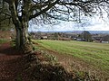
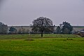
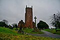
English: Milverton is a village and civil parish in Somerset, England, situated in the valley of the River Tone west of Taunton in the Taunton Deane district. The village has a population of 1,385. The parish includes the hamlet of Preston Bowyer.
village and civil parish in Somerset, United Kingdom  | |||||
| Upload media | |||||
| Instance of | |||||
|---|---|---|---|---|---|
| Location |
| ||||
| Population |
| ||||
 | |||||
Subcategories
This category has the following 3 subcategories, out of 3 total.
N
- Netherfield, Milverton (2 F)
P
- Preston Bowyer (8 F)
Media in category "Milverton, Somerset"
The following 200 files are in this category, out of 215 total.
(previous page) (next page)-
 AA Road Mileage Sign - geograph.org.uk - 5823130.jpg 683 × 1,024; 281 KB
-
 Approaching Fairmount - geograph.org.uk - 1714647.jpg 640 × 464; 85 KB
-
 Baghay Farm - geograph.org.uk - 6675764.jpg 1,600 × 1,210; 574 KB
-
 Baghay Farm barn conversion - geograph.org.uk - 6675763.jpg 1,600 × 1,280; 828 KB
-
 Barn conversion, Screedy - geograph.org.uk - 4244913.jpg 1,024 × 768; 155 KB
-
 Beeches near Spring Grove Cross - geograph.org.uk - 1700447.jpg 480 × 640; 144 KB
-
 Bindon Lodge and road to Bindon House (geograph 6685290).jpg 1,600 × 1,198; 672 KB
-
 Bracken and autumn colour, west of Holywell Bridge - geograph.org.uk - 6678886.jpg 1,600 × 1,207; 956 KB
-
 Bridge over Hillfarrance Brook - geograph.org.uk - 1594892.jpg 640 × 480; 88 KB
-
 By Quakinghouse Lane - geograph.org.uk - 1714413.jpg 640 × 420; 75 KB
-
 Cobbled pavement, North Street, Milverton - geograph.org.uk - 6678859.jpg 1,600 × 1,200; 750 KB
-
 Cottage, Higher Bickley - geograph.org.uk - 3441804.jpg 1,024 × 768; 232 KB
-
 Cottages in Houndsmoor - geograph.org.uk - 6678844.jpg 1,600 × 1,598; 899 KB
-
 Cottages, on St Michael's Hill, Milverton - geograph.org.uk - 4276072.jpg 1,024 × 768; 142 KB
-
 Country Lane passes Baghay Farm - geograph.org.uk - 3443013.jpg 1,024 × 768; 193 KB
-
 Courtfield, Milverton - geograph.org.uk - 3551217.jpg 1,024 × 768; 143 KB
-
 Creedwell Orchard, Milverton - geograph.org.uk - 6678850.jpg 1,600 × 999; 627 KB
-
 Curved barn at Weekmoor Farm - geograph.org.uk - 3744638.jpg 1,024 × 789; 202 KB
-
 Cyclist, climbing the hill, north of Milverton - geograph.org.uk - 3441756.jpg 1,024 × 768; 293 KB
-
 Direction Sign – Signpost - geograph.org.uk - 6536359.jpg 652 × 650; 224 KB
-

-

-
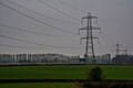
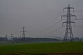
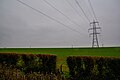
 Electricity grid-line, near Chipley Park - geograph.org.uk - 4276064.jpg 1,024 × 768; 116 KB
-
 Entrance drive, Auton Dolwells - geograph.org.uk - 3551200.jpg 1,024 × 768; 197 KB
-
 Entrance Drive, Spring Grove House - geograph.org.uk - 3550951.jpg 1,024 × 768; 260 KB
-
 Entrance to Preston Bowyer - geograph.org.uk - 2789207.jpg 640 × 425; 72 KB
-
 Farm in Houndsmoor - geograph.org.uk - 6678845.jpg 1,600 × 1,201; 700 KB
-
 Farm road to River's Farm - geograph.org.uk - 1714917.jpg 640 × 480; 120 KB
-
 Farm road to River's Farm - geograph.org.uk - 1714929.jpg 640 × 480; 131 KB
-
 Farm track south of Baghay Farm - geograph.org.uk - 6675760.jpg 1,600 × 1,200; 753 KB
-
 Farm track, Lower Lovelynch - geograph.org.uk - 1701954.jpg 640 × 480; 99 KB
-
 Farmhouse at Higher Lovelynch - geograph.org.uk - 4275879.jpg 1,024 × 768; 170 KB
-
 Farmland, Farthing's Farm - geograph.org.uk - 1714063.jpg 640 × 448; 72 KB
-
 Farthing's Farm - geograph.org.uk - 1714049.jpg 640 × 411; 63 KB
-
 Farthing's Farm - geograph.org.uk - 1714081.jpg 640 × 480; 83 KB
-
 Farthing's Farm - geograph.org.uk - 3550957.jpg 1,024 × 768; 163 KB
-
 Farthing's Farm, Wiveliscombe - geograph.org.uk - 4487185.jpg 3,456 × 2,304; 3.71 MB
-
 Field at Bickley Farm - geograph.org.uk - 3744745.jpg 1,024 × 749; 237 KB
-
 Field boundary near Lovelynch - geograph.org.uk - 1701971.jpg 640 × 456; 105 KB
-
 Field by Exton's Barn - geograph.org.uk - 6678874.jpg 1,600 × 888; 515 KB
-
 Field by Quakinghouse Lane - geograph.org.uk - 1714177.jpg 640 × 476; 105 KB
-
 Field near Higher Lovelynch - geograph.org.uk - 1702109.jpg 640 × 478; 89 KB
-
 Field near Lovelynch - geograph.org.uk - 1702055.jpg 640 × 480; 99 KB
-
 Field near Spring Grove Cross - geograph.org.uk - 1713933.jpg 640 × 480; 124 KB
-
 Field of stubble, near Oake - geograph.org.uk - 3744331.jpg 1,024 × 768; 359 KB
-
 Field upstream of Holywell Bridge - geograph.org.uk - 6678884.jpg 1,600 × 1,200; 612 KB
-
 Field west of Milverton - geograph.org.uk - 1714690.jpg 640 × 480; 127 KB
-
 Fields near Bindon Farm - geograph.org.uk - 1702143.jpg 640 × 480; 55 KB
-
 Fields near Burcher's Farm - geograph.org.uk - 4003853.jpg 2,816 × 1,880; 4.46 MB
-
 Fitzhead, by Road's Barn - geograph.org.uk - 125876.jpg 640 × 427; 86 KB
-
 Flood on the road, east of Screedy - geograph.org.uk - 4244916.jpg 1,024 × 738; 209 KB
-
 Footpath near Milverton Court - geograph.org.uk - 4487180.jpg 2,304 × 3,456; 2.18 MB
-
 Ford Bridge Cottage, Milverton.jpg 4,000 × 3,000; 3.86 MB
-
 Fore Street, Milverton, Somerset - geograph.org.uk - 2018065.jpg 640 × 418; 61 KB
-
 Former Chapel, Milverton - geograph.org.uk - 5213974.jpg 1,024 × 860; 285 KB
-
 Higher Lovelynch Farm - geograph.org.uk - 4275864.jpg 1,024 × 768; 171 KB
-
 Hillfarrance Brook - geograph.org.uk - 1594910.jpg 480 × 640; 106 KB
-
 Hillfarrance Brook - geograph.org.uk - 1594924.jpg 480 × 640; 125 KB
-
 Holywell Bridge - geograph.org.uk - 6679858.jpg 1,600 × 1,201; 993 KB
-
 Houndsmoor Lane - geograph.org.uk - 3441781.jpg 1,024 × 768; 152 KB
-

-
 House at Turnpike, Milverton - geograph.org.uk - 2141917.jpg 1,024 × 768; 165 KB
-
 House on Butts Way, Milverton - geograph.org.uk - 1701919.jpg 640 × 480; 77 KB
-
 Houses on North Street - geograph.org.uk - 5213991.jpg 1,024 × 787; 177 KB
-

-
 Inviting footpath to Oake - geograph.org.uk - 3744635.jpg 1,024 × 742; 286 KB
-
 Leafless trees by road south of Baghay - geograph.org.uk - 6675758.jpg 1,600 × 1,598; 1.37 MB
-
 Long field south of Aslant Covert - geograph.org.uk - 1714624.jpg 640 × 402; 67 KB
-
 Lower Lodge, Spring Grove Farm - geograph.org.uk - 3550919.jpg 1,024 × 768; 189 KB
-
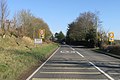
 Manworthy Cross road junction - geograph.org.uk - 6684324.jpg 1,600 × 1,200; 829 KB
-
 Market Cross, Milverton - geograph.org.uk - 1818379.jpg 1,600 × 1,200; 436 KB
-
 Mature tree, on the road to Houndsmoor - geograph.org.uk - 3744641.jpg 758 × 1,024; 272 KB
-
 Meadows Way (B3227) north of Milverton - geograph.org.uk - 6678861.jpg 1,600 × 963; 661 KB
-
 Milverton , Butts Way - geograph.org.uk - 6008960.jpg 6,000 × 4,000; 6.88 MB
-
 Milverton , Countryside Scenery - geograph.org.uk - 6009134.jpg 6,000 × 4,000; 5.79 MB
-
 Milverton , Grassy Field - geograph.org.uk - 6008975.jpg 6,000 × 4,000; 6.54 MB
-
 Milverton , Grassy Field - geograph.org.uk - 6008982.jpg 6,000 × 4,000; 5.97 MB
-
 Milverton , Mast - geograph.org.uk - 6009133.jpg 4,000 × 6,000; 5.9 MB
-
 Milverton , Sand Street - geograph.org.uk - 6008959.jpg 6,000 × 4,000; 6.84 MB
-
 Milverton , St Michael's Church - geograph.org.uk - 6008928.jpg 6,000 × 4,000; 5.27 MB
-
 Milverton , St Michael's Hill - geograph.org.uk - 6008929.jpg 6,000 × 4,000; 7.77 MB
-
 Milverton , Wood Street B3187 - geograph.org.uk - 6009135.jpg 6,000 × 4,000; 6.54 MB
-
 Milverton , Wood Street B3187 - geograph.org.uk - 6009137.jpg 6,000 × 4,000; 6.06 MB
-
 Milverton , Wood Street B3187 - geograph.org.uk - 6009138.jpg 6,000 × 4,000; 7.32 MB
-
 Milverton - geograph.org.uk - 4003890.jpg 2,816 × 1,880; 3.57 MB
-
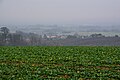
 Milverton from the west - geograph.org.uk - 4487177.jpg 3,456 × 2,304; 1.89 MB
-
 Milverton geograph-3788106-by-Ben-Brooksbank.jpg 2,341 × 1,312; 2.47 MB
-
 Milverton old fire station - geograph.org.uk - 491259.jpg 640 × 427; 246 KB
-
 Milverton Stores - geograph.org.uk - 2141897.jpg 1,024 × 768; 157 KB
-
 Milverton Stores - geograph.org.uk - 6678852.jpg 1,600 × 1,200; 802 KB
-
 Milverton, Chipley Park - geograph.org.uk - 118055.jpg 640 × 427; 91 KB
-
 Milverton, Limekiln at Aslant Covert - geograph.org.uk - 159856.jpg 427 × 640; 227 KB
-
 Milverton, North Street - geograph.org.uk - 1807836.jpg 535 × 800; 483 KB
-
 Minor road to Milverton - geograph.org.uk - 3441563.jpg 1,024 × 768; 258 KB
-
 Near Lovelynch - geograph.org.uk - 1701997.jpg 640 × 480; 110 KB
-
 North Street, Milverton - geograph.org.uk - 6678857.jpg 1,600 × 1,203; 796 KB
-
 Oake , Oake Manor Golf Club - geograph.org.uk - 5790142.jpg 6,000 × 4,000; 5.61 MB
-
 Orchard near Milverton Court - geograph.org.uk - 4487183.jpg 3,456 × 2,304; 1.64 MB
-
 Pavement parking on North Street - geograph.org.uk - 5214005.jpg 1,024 × 868; 238 KB
-
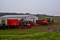
 Piggery near Preston Farm - geograph.org.uk - 2698637.jpg 3,888 × 2,592; 1.3 MB
-
 Poultry Farm near Preston Bowyer - geograph.org.uk - 3460942.jpg 1,024 × 774; 304 KB
-
 Preston Farm - geograph.org.uk - 2698644.jpg 3,888 × 2,592; 1.43 MB
-
 Preston Farm - geograph.org.uk - 3460968.jpg 1,024 × 768; 198 KB
-
 Pylon south of Leigh Furzes - geograph.org.uk - 6685279.jpg 1,600 × 1,200; 586 KB
-
 Quaking House Cave - geograph.org.uk - 4487189.jpg 3,456 × 2,304; 4.64 MB
-
 Quaking House Cave - geograph.org.uk - 4487191.jpg 2,304 × 3,456; 1.54 MB
-
 Road cutting between Houndsmoor and Milverton - geograph.org.uk - 6678846.jpg 1,600 × 1,200; 1.06 MB
-
 Road from Exton's Barn to Holywell Bridge - geograph.org.uk - 6678882.jpg 1,600 × 1,199; 550 KB
-
 Road in valley north of Exton's Barn - geograph.org.uk - 6678877.jpg 1,600 × 1,275; 699 KB
-
 Road junction on road between Milverton and Halse - geograph.org.uk - 6678870.jpg 1,600 × 1,001; 467 KB
-
 Road past old quarries, north of Milverton - geograph.org.uk - 6678863.jpg 1,600 × 1,144; 864 KB
-
 Road to Bickley Cottages - geograph.org.uk - 3744649.jpg 768 × 1,024; 216 KB
-
 Road to Milverton - geograph.org.uk - 1713981.jpg 640 × 480; 120 KB
-
 Road to Milverton - geograph.org.uk - 1714043.jpg 640 × 411; 99 KB
-
 Road to Milverton from Milverton Heath - geograph.org.uk - 6685277.jpg 1,600 × 1,282; 1.13 MB
-
 Road to the Coach House Stables - geograph.org.uk - 3551187.jpg 1,024 × 768; 204 KB
-
 Roundabout on the B3227, near Milverton - geograph.org.uk - 2141827.jpg 1,024 × 766; 198 KB
-
 Small cave at West Park Covert - geograph.org.uk - 4003880.jpg 2,816 × 1,880; 5.13 MB
-
 Spring Grove Cross - geograph.org.uk - 1713903.jpg 640 × 480; 104 KB
-
 St Michael and All Angels Church, Milverton - geograph.org.uk - 5213960.jpg 1,024 × 768; 192 KB
-
 St Michael's Hill, Milverton - geograph.org.uk - 6678853.jpg 1,600 × 1,207; 843 KB
-
 Stone wall of Houndsmoor Farm - geograph.org.uk - 6678838.jpg 1,600 × 1,063; 677 KB
-
 Taunton Dean , Country Lane - geograph.org.uk - 6009055.jpg 6,000 × 4,000; 7.64 MB
-
 Taunton Deane , Burn Hill B3187 - geograph.org.uk - 6008981.jpg 6,000 × 4,000; 6.61 MB
-
 Taunton Deane , Burn Hill B3187 - geograph.org.uk - 6008985.jpg 6,000 × 4,000; 7.23 MB
-
 Taunton Deane , Country Lane - geograph.org.uk - 6009030.jpg 6,000 × 4,000; 7.22 MB
-
 Taunton Deane , Country Lane - geograph.org.uk - 6009032.jpg 6,000 × 4,000; 6.38 MB
-
 Taunton Deane , Country Lane - geograph.org.uk - 6009034.jpg 6,000 × 4,000; 6.82 MB
-
 Taunton Deane , Country Lane - geograph.org.uk - 6009063.jpg 4,000 × 6,000; 7.59 MB
-
 Taunton Deane , Country Road - geograph.org.uk - 6009039.jpg 6,000 × 4,000; 7.73 MB
-
 Taunton Deane , Countryside Scenery - geograph.org.uk - 6009015.jpg 6,000 × 4,000; 7.19 MB
-
 Taunton Deane , Countryside Scenery - geograph.org.uk - 6009111.jpg 6,000 × 4,000; 7.85 MB
-
 Taunton Deane , Countryside Scenery - geograph.org.uk - 6009117.jpg 6,000 × 4,000; 7.64 MB
-
 Taunton Deane , Countryside Scenery - geograph.org.uk - 6009127.jpg 6,000 × 4,000; 5.45 MB
-
 Taunton Deane , Crop Field - geograph.org.uk - 5790149.jpg 6,000 × 4,000; 7.5 MB
-
 Taunton Deane , Crop Field - geograph.org.uk - 5790150.jpg 6,000 × 4,000; 7.39 MB
-
 Taunton Deane , Crop Field - geograph.org.uk - 6008978.jpg 6,000 × 4,000; 6.52 MB
-
 Taunton Deane , Crop Field - geograph.org.uk - 6009071.jpg 6,000 × 4,000; 5.9 MB
-
 Taunton Deane , Farthings Farm - geograph.org.uk - 6009104.jpg 6,000 × 4,000; 7.19 MB
-
 Taunton Deane , Field - geograph.org.uk - 5790147.jpg 6,000 × 4,000; 4.77 MB
-
 Taunton Deane , Footpath - geograph.org.uk - 6008999.jpg 4,000 × 6,000; 7.68 MB
-
 Taunton Deane , Footpath - geograph.org.uk - 6009020.jpg 6,000 × 4,000; 7.05 MB
-
 Taunton Deane , Grassy Field - geograph.org.uk - 5790148.jpg 6,000 × 4,000; 7 MB
-
 Taunton Deane , Grassy Field - geograph.org.uk - 5790153.jpg 6,000 × 4,000; 7.86 MB
-
 Taunton Deane , Grassy Field - geograph.org.uk - 6008990.jpg 6,000 × 4,000; 6.82 MB
-
 Taunton Deane , Grassy Field - geograph.org.uk - 6008992.jpg 6,000 × 4,000; 5.55 MB
-
 Taunton Deane , Grassy Field - geograph.org.uk - 6008994.jpg 6,000 × 4,000; 5.68 MB
-
 Taunton Deane , Grassy Field - geograph.org.uk - 6008998.jpg 6,000 × 4,000; 7.62 MB
-
 Taunton Deane , Grassy Field - geograph.org.uk - 6009001.jpg 6,000 × 4,000; 6.66 MB
-
 Taunton Deane , Grassy Field - geograph.org.uk - 6009004.jpg 6,000 × 4,000; 5.64 MB
-
 Taunton Deane , Grassy Field - geograph.org.uk - 6009018.jpg 6,000 × 4,000; 7.58 MB
-
 Taunton Deane , Grassy Field - geograph.org.uk - 6009021.jpg 6,000 × 4,000; 6.45 MB
-
 Taunton Deane , Grassy Field - geograph.org.uk - 6009066.jpg 6,000 × 4,000; 5.67 MB
-
 Taunton Deane , Grassy Field - geograph.org.uk - 6009068.jpg 6,000 × 4,000; 7.23 MB
-
 Taunton Deane , Grassy Field - geograph.org.uk - 6009070.jpg 6,000 × 4,000; 6.04 MB
-
 Taunton Deane , Grassy Field - geograph.org.uk - 6009077.jpg 6,000 × 4,000; 5.61 MB
-
 Taunton Deane , Grassy Field - geograph.org.uk - 6009081.jpg 6,000 × 4,000; 6.3 MB
-
 Taunton Deane , Grassy Field - geograph.org.uk - 6009126.jpg 6,000 × 4,000; 5.45 MB
-
 Taunton Deane , Grassy Field - geograph.org.uk - 6009129.jpg 6,000 × 4,000; 6.75 MB
-
 Taunton Deane , Grassy Field - geograph.org.uk - 6009132.jpg 6,000 × 4,000; 5.77 MB
-
 Taunton Deane , Grassy Field ^ Pylon - geograph.org.uk - 6009011.jpg 6,000 × 4,000; 6 MB
-
 Taunton Deane , Grassy Field ^ Pylon - geograph.org.uk - 6009016.jpg 6,000 × 4,000; 7.18 MB
-
 Taunton Deane , Grassy Field ^ Pylons - geograph.org.uk - 5790154.jpg 6,000 × 4,000; 5.09 MB
-
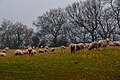
 Taunton Deane , Grassy Field ^ Sheep - geograph.org.uk - 6008988.jpg 6,000 × 4,000; 6.19 MB
-
 Taunton Deane , Grassy Field ^ Sheep - geograph.org.uk - 6008989.jpg 6,000 × 4,000; 7.8 MB
-
 Taunton Deane , Grassy Field ^ Sheep - geograph.org.uk - 6009112.jpg 6,000 × 4,000; 6.41 MB
-
 Taunton Deane , Lovelynch Farm - geograph.org.uk - 6008987.jpg 6,000 × 4,000; 7.65 MB
-
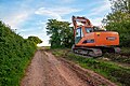
 Taunton Deane , Muddy Track - geograph.org.uk - 6009108.jpg 6,000 × 4,000; 7.28 MB
-
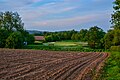 Taunton Deane , Ploughed Field - geograph.org.uk - 5790144.jpg 6,000 × 4,000; 6.61 MB
-
 Taunton Deane , Ploughed Field - geograph.org.uk - 5790145.jpg 6,000 × 4,000; 7.2 MB
-
 Taunton Deane , Quakinghouse Lane - geograph.org.uk - 6009116.jpg 6,000 × 4,000; 6.69 MB
-
 Taunton Deane , Quakinghouse Lane - geograph.org.uk - 6009119.jpg 6,000 × 4,000; 5.92 MB
-
 Taunton Deane , Screedy Cottage - geograph.org.uk - 6009059.jpg 6,000 × 4,000; 7.19 MB
-
 Taunton Deane , Solar Farm - geograph.org.uk - 5790151.jpg 6,000 × 4,000; 7.8 MB
-
 Taunton Deane , Solar Farm - geograph.org.uk - 5790152.jpg 6,000 × 4,000; 7.58 MB
-
 Taunton Deane , Spring Grove Cross - geograph.org.uk - 6009036.jpg 6,000 × 4,000; 7.75 MB
-
 Taunton Deane , Spring Grove Cross - geograph.org.uk - 6009038.jpg 6,000 × 4,000; 6.74 MB
-
 Taunton Deane , Track - geograph.org.uk - 5790146.jpg 6,000 × 4,000; 5.92 MB
-
 Taunton Deane , Track - geograph.org.uk - 6009000.jpg 6,000 × 4,000; 6.88 MB
-
 Taunton Deane , Track - geograph.org.uk - 6009109.jpg 6,000 × 4,000; 6.95 MB
-
 Taunton Deane , Track - geograph.org.uk - 6009110.jpg 6,000 × 4,000; 7.77 MB
-
 The B3187 passes through Higher Park Kiln Covert - geograph.org.uk - 2142271.jpg 1,024 × 768; 306 KB
-
 The Globe, Fore Street, Milverton - geograph.org.uk - 1818323.jpg 1,600 × 1,200; 427 KB
-
 The Herbfield at Organic Herb Trading.png 900 × 319; 700 KB
-
 The lane to Milverton Court - geograph.org.uk - 4003863.jpg 2,816 × 1,880; 5.59 MB
-
 The Mount, Milverton - geograph.org.uk - 1714742.jpg 640 × 480; 101 KB
-
 The Victoria Rooms, Milverton - geograph.org.uk - 6678848.jpg 1,600 × 1,200; 916 KB
-
 Town houses on North Street, Milverton - geograph.org.uk - 2141845.jpg 1,024 × 768; 180 KB
-
 Track (right of way) to River's Wood - geograph.org.uk - 6678864.jpg 1,600 × 1,200; 1 MB
-
 Tree by road junction south of Houndsmoor - geograph.org.uk - 6678837.jpg 1,600 × 1,200; 840 KB
-
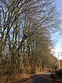
 Trees from Wiveliscombe Covert bordering the road - geograph.org.uk - 6684327.jpg 1,600 × 1,334; 1.22 MB
-
 Turning for Fitzhead - geograph.org.uk - 3460953.jpg 1,024 × 768; 221 KB
-
 Turning for Milverton - geograph.org.uk - 3441743.jpg 1,024 × 769; 166 KB
-
 Turning for Screedy - geograph.org.uk - 4244908.jpg 1,024 × 777; 143 KB
-
 Valley near Higher Lovelynch - geograph.org.uk - 1702034.jpg 640 × 392; 80 KB
-
 Vulcan Kennels - geograph.org.uk - 3744643.jpg 1,024 × 775; 239 KB
-
 Wall, Milverton - geograph.org.uk - 1714712.jpg 480 × 640; 92 KB
-
 West Park Covert - geograph.org.uk - 1714519.jpg 640 × 459; 72 KB
-

-
 Wiveliscombe, Quakinghouse Lane - geograph.org.uk - 63375.jpg 640 × 427; 185 KB


.jpg)


_north_of_Milverton_-_geograph.org.uk_-_6678861.jpg)


_to_River%27s_Wood_-_geograph.org.uk_-_6678864.jpg)


