Category:Molsteeg 9, Amsterdam
Jump to navigation
Jump to search
| Object location | | View all coordinates using: OpenStreetMap |
|---|
 | |||||
| Upload media | |||||
| Instance of |
| ||||
|---|---|---|---|---|---|
| Location | Amsterdam, North Holland, Netherlands | ||||
| Street address |
| ||||
| Located on street | |||||
| Heritage designation |
| ||||
 | |||||
|
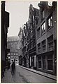
This is a category about rijksmonument number 3701
|
| Address |
|
Media in category "Molsteeg 9, Amsterdam"
The following 4 files are in this category, out of 4 total.
-
 RM3701 RM3702 Amsterdam - Molsteeg 9-11.jpg 1,944 × 2,592; 1.32 MB
-
 Stadsarchief Amsterdam, Afb 010194000335.jpg 902 × 1,644; 343 KB
-
 Stadsarchief Amsterdam, Afb 012000005131.jpg 1,458 × 2,099; 460 KB
-
 Zicht langs gevelwand richting schip kerk - Amsterdam - 20320428 - RCE.jpg 825 × 1,200; 191 KB


