Category:Monte Faraut
Jump to navigation
Jump to search
|
Monte Faraut has an entry on OpenStreetMap (show). |
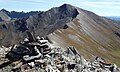
mountain of the Cottian Alps  | |||||
| Upload media | |||||
| Instance of | |||||
|---|---|---|---|---|---|
| Location | Piedmont, Italy | ||||
| Mountain range |
| ||||
| Topographic prominence |
| ||||
| Topographic isolation |
| ||||
| Elevation above sea level |
| ||||
 | |||||
Media in category "Monte Faraut"
The following 3 files are in this category, out of 3 total.
-
 Monte faraut croce di vetta.jpg 2,740 × 4,049; 648 KB
-
 Monte faraut da buc faraut.jpg 4,186 × 2,511; 594 KB
-
 Monte faraut da colletto pence.jpg 2,932 × 2,079; 374 KB

