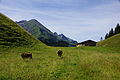
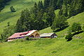
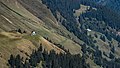
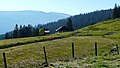
Category:Mountain pastures of Allgäu Alps
Jump to navigation
Jump to search
Deutsch: Bergweiden mit Wirtschaftsgebäude (Alphütten) in den Allgäuer Alpen.
Subcategories
This category has the following 21 subcategories, out of 21 total.
A
B
- Breitengehrenalpe (10 F)
- Buchrainer Alpe (12 F)
D
- Dietersbachalpe (8 F)
G
- Gerstruber Alpe (8 F)
- Gutenalpe (3 F)
H
- Heigle-Alpe (3 F)
K
- Käseralpe (13 F)
- Kemptener Naturfreundehaus (8 F)
- Kesselalpe (5 F)
- Kühgundalpe (8 F)
O
- Obere Schwandalpe (3 F)
- Obergelchenwang Alpe (1 F)
P
- Petersalpe (5 F)
R
- Mittlere Rappenalpe (5 F)
S
- Schwarze Hütte (6 F)
- Sennalpe Hochried (5 F)
- Speicherhütte (5 F)
T
- Trifthütte (Haldenwanger Eck) (13 F)
W
- Willersalpe (5 F)
Z
- Zipfelsalpe (10 F)
Media in category "Mountain pastures of Allgäu Alps"
The following 106 files are in this category, out of 106 total.
-
 20150807 xl P1010960 Untere Richteralpe.JPG 4,896 × 3,672; 5.83 MB
-
 2019 Oberstdorf Vordere Traufbergalpe.jpg 4,608 × 2,592; 5.33 MB
-
 360° Alpe Spicherhalde 1478m Balderschwang.jpg 7,805 × 2,216; 11.92 MB
-
 AIMG 3271 Gunzesrieder Tal Sennalpe Derb.jpg 3,110 × 2,333; 2.37 MB
-
 Alpe am Jägersberg.jpg 4,512 × 3,008; 5.95 MB
-
 Alpe im Gunzesrieder Tal.jpg 2,937 × 2,035; 863 KB
-
 Alpe Mitterhaus, Retterschwanger Tal.jpg 3,910 × 2,815; 3.26 MB
-
 Alpe Ornach.JPG 2,560 × 1,920; 2.3 MB
-
 Alpe Schlappold - panoramio.jpg 2,621 × 1,814; 1.59 MB
-
 Alpe-gschwenderberg.jpg 1,824 × 1,368; 1.02 MB
-
 Alpe-wiesach.jpg 4,436 × 2,768; 4.1 MB
-
 Aprilwetter - panoramio (1).jpg 3,264 × 1,632; 1.38 MB
-
 Bad Hindelang - Retterschwanger Tal - Mitterhaus Denkmaltafel.jpg 2,048 × 1,536; 543 KB
-
 Bad Hindelang - Untere Alpe Schwand v O, Winter.JPG 3,264 × 1,840; 2.91 MB
-
 Beim Grüntenlift - panoramio.jpg 2,048 × 1,536; 759 KB
-
 Berggasthof Seealpe Nebelhorn - panoramio.jpg 2,816 × 2,120; 1.43 MB
-
 Blaichach - Begrüntes Dach des Stadels der Alpe Blässe.JPG 3,932 × 2,837; 3.04 MB
-
 Blaichach - Buhl´s Alpe über dem Ostertal, Brunnen.JPG 3,421 × 3,000; 2.35 MB
-
 Blaichach - Gunzesrieder Tal - Ornachalpe v O 02.JPG 3,264 × 2,448; 3.9 MB
-
 Blaichach - Gunzesrieder Tal - Unterkirchealpe - Giebel v SO.JPG 3,264 × 2,448; 3.67 MB
-
 Blaichach - Gunzesrieder Tal - Vordere Au-Alpe, Nagelfluhfels.JPG 2,272 × 1,704; 1.6 MB
-
 Blaichach - Ostertal - Mitteralpe v N 01.JPG 4,000 × 2,248; 2.65 MB
-
 Blaichach - Ostertal - Oberalpe v O.JPG 4,000 × 3,000; 4.02 MB
-
 Blaichach - Ostertal - Ostertalalpe v NW.JPG 4,000 × 3,000; 4.54 MB
-
 Blaichach - Ostertal - Schwand-Alpe v NO.JPG 4,000 × 3,000; 2.15 MB
-
 Blaichach - Ostertal - Unteralpe - Giebel v O.JPG 4,000 × 2,248; 2.93 MB
-
 Blaichach - Rappengschwendalpe 1240m.ü.NN. 02.jpg 3,369 × 1,951; 953 KB
-
 Blaichach - Steineberg südl - Grathöflealpe v W 03.JPG 3,264 × 2,448; 3.64 MB
-
 Blechdach - panoramio (1).jpg 2,816 × 2,120; 1.46 MB
-
 Blechdach - panoramio (2).jpg 2,816 × 2,120; 1.41 MB
-
 Bolsterlang - Zunkleitenalpe - Giebel v NO.JPG 2,272 × 1,704; 1.26 MB
-
 Die Piesenalpe-hier gibt es guten Bergkäse - panoramio.jpg 1,958 × 1,469; 1.42 MB
-
 Die Südseite vom Grünten mit Blick auf den Allgäuer Hochalpen.jpg 6,000 × 3,375; 12.73 MB
-
 Ehrenschwanger Tal - panoramio (4).jpg 3,072 × 2,304; 2.93 MB
-
 Eineguntkopf021.jpg 942 × 747; 194 KB
-
 Gimpelalm.jpg 1,776 × 1,148; 1.18 MB
-
 Gottesackeralpe - panoramio.jpg 4,444 × 3,056; 5.44 MB
-
 Gund-alpe-besler.jpg 3,036 × 2,196; 2.2 MB
-
 Hintere-einoedsbergalpe-kuehe.jpg 6,000 × 4,000; 10.22 MB
-
 Hintere-einoedsbergalpe.jpg 6,000 × 4,000; 8.09 MB
-
 Hirschalp, östlich vom Hirschberg - panoramio.jpg 3,872 × 2,592; 847 KB
-
 Hirschgundalpe.jpg 3,672 × 2,278; 2.35 MB
-
 Hochgrat im Winter (Hochgrat in winter) - geo.hlipp.de - 4498.jpg 640 × 480; 60 KB
-
 Hoeferspitze.JPG 3,264 × 2,448; 3.64 MB
-
 Hoermoosalpe.jpg 1,318 × 852; 268 KB
-
 Hofhütte Seealpe.jpg 2,048 × 1,536; 928 KB
-
 Hütte am Kammeregg - panoramio.jpg 2,816 × 2,120; 1.51 MB
-
 Hütte Seealpe 2.jpg 2,048 × 1,536; 1.48 MB
-
 Hütte Seealpe.jpg 2,048 × 1,536; 1.39 MB
-
 Kienberg Morning Fog.JPG 3,264 × 2,448; 3.94 MB
-
 Laufbichlalpe.jpg 3,000 × 2,000; 2.74 MB
-
 Lechleitner Alpe - 2. Tag (9800466485).jpg 1,920 × 1,440; 1.14 MB
-
 Lechleitner Alpe - 2. Tag (9800490264).jpg 2,976 × 3,968; 1.75 MB
-
 MK58280 Obere Alpe Wengen.jpg 2,981 × 1,677; 4.72 MB
-
 Obere Rappengschwend II Alpe.jpg 3,243 × 2,210; 2.39 MB
-
 Obere-reuterwanne.jpg 1,200 × 785; 654 KB
-
 Obermaiselstein - Kindsbangetalpe v N, Hoher Ifen.JPG 3,264 × 1,840; 3 MB
-
 Obermaiselstein - Lochbachalpe Ri NW, Obere Lochbachalpe.JPG 3,264 × 2,448; 3.58 MB
-
 Obermaiselstein - Lochbachtal - Kelleralpe v SO 101216.jpg 4,608 × 3,456; 3.17 MB
-
 Obermaiselstein - Lochbachtal - Schwabenalpe 02.jpg 2,272 × 1,704; 764 KB
-
 Obermaiselstein - Toniskopfalpe v S, Besler.jpg 3,264 × 1,840; 2.99 MB
-
 Oberstaufen - Hochgrat südl - Obergelchenwangalpe v O 02.JPG 3,264 × 1,840; 2.85 MB
-
 Oberstaufen - Hochgrat östl - Gütlealpe v SO.jpg 3,264 × 2,448; 2.09 MB
-
 Oberstaufen - Kalzhofner Höhe - Hompessenalpe.JPG 2,272 × 1,704; 1.01 MB
-
 Oberstaufen - Mittlere Simatsgund-Alpe v W, St Rochus.JPG 2,048 × 1,536; 1.55 MB
-
 Oberstaufen - Scheidwang-Alpe v O.JPG 2,272 × 1,704; 962 KB
-
 Oberstaufen - Vorderbürschgschwend-Alpe v S, Denneberg.JPG 1,481 × 1,990; 902 KB
-
 Oberstaufen, Germany - panoramio (4).jpg 5,060 × 3,120; 2.02 MB
-
 Oberstaufen, Germany - panoramio (7).jpg 4,368 × 3,380; 2.92 MB
-
 Oberstaufen, Germany - panoramio.jpg 1,591 × 2,122; 1.48 MB
-
 Oberstdorf - Alpe Breitengern.JPG 1,984 × 1,488; 637 KB
-
 Oberstdorf - Rohrmoos - Schattwald-Alpe v NW.JPG 2,272 × 1,704; 662 KB
-
 Oberstdorf - Traufberg - Hintere Traufbergalpe 02.jpg 3,264 × 1,840; 2.41 MB
-
 Oberstdorf Ferlewang Obere Fluh Alpe.jpg 4,608 × 2,592; 2.78 MB
-
 Oberstdorf Höfle Alpe.jpg 4,608 × 2,592; 3.01 MB
-
 Oberstdorf Peters Alpe.jpg 2,048 × 1,152; 902 KB
-
 Oberstdorf Raut Alpe.jpg 4,608 × 2,592; 2.75 MB
-
 Oberstdorf Untere Mädele Alpe.jpg 4,608 × 2,592; 2.76 MB
-
 Oberstdorf Vordere Falkenberg Alpe.jpg 4,608 × 2,592; 2.92 MB
-
 Ofterschwang - Obereggalpe v NO.jpg 4,608 × 3,456; 3.21 MB
-
 Osterbergalpe.jpg 3,648 × 2,736; 5.2 MB
-
 Piesenalpe.jpg 1,200 × 694; 465 KB
-
 Rindalpe.jpg 689 × 469; 339 KB
-
 Roßberg-Alpe - panoramio.jpg 2,756 × 1,649; 1.75 MB
-
 Salmaser Höhe - panoramio (cropped).jpg 3,082 × 2,254; 1.11 MB
-
 Schrattenwang2.jpg 5,708 × 800; 1.14 MB
-
 Schwarzenbergalpe.jpg 3,442 × 2,294; 2.36 MB
-
 Schönbergalpe 16.09.2012.jpg 4,608 × 3,456; 3.93 MB
-
 Schönbergalpe 2 16.09.2012.jpg 500 × 375; 42 KB
-
 Schöne Landschaft - panoramio.jpg 7,601 × 2,254; 2.16 MB
-
 Seealpe.jpg 640 × 439; 211 KB
-
 Seebenalpe Lumberger Grat.JPG 3,264 × 2,448; 3.21 MB
-
 Spielmannsau bei Oberstdorf.jpg 1,200 × 800; 160 KB
-
 Strausberg Moor.jpg 4,000 × 3,000; 4.54 MB
-
 Strausberg-Alpe.jpg 4,000 × 3,000; 4.26 MB
-
 Strausbergalpe; Strausberg Moos.jpg 4,000 × 3,000; 4.43 MB
-
 Stubenbach I Alpe.jpg 2,581 × 1,876; 755 KB
-
 Tennenmooskopf über dem Gunzesrieder Tal.jpg 3,264 × 2,448; 1.85 MB
-
 Untere Lüchle Alp.jpg 2,048 × 1,536; 1.11 MB
-
 Untere Ochsenalpe.jpg 2,400 × 1,800; 657 KB
-
 Untere Rappengschwend II Alpe.jpg 3,156 × 2,348; 2.4 MB
-
 Untere-reuterwanne.jpg 1,200 × 741; 552 KB
-
 Vilsalptal.JPG 3,264 × 2,448; 4.18 MB
-
 Weg zur Hirschalpe.jpg 3,830 × 3,145; 4 MB
-
 Wertach, OA - Vordere Alpe Sorg v N (sw).JPG 4,000 × 3,000; 3.07 MB
-
 Zipfelsalpe (1).jpg 2,521 × 1,440; 1.82 MB


.jpg)


.jpg)
.jpg)


.jpg)


_-_geo.hlipp.de_-_4498.jpg)


.jpg)
.jpg)


.jpg)
.jpg)


.jpg)


.JPG)
.jpg)