Category:National Cycle Network route 656
Jump to navigation
Jump to search

National Cycle Network (NCN) Route 656 is a Sustrans regional route in North Yorkshire. A 18.5 miles (29.8 km) cycle way between Coxwold and a junction with NCN Route 65 near Osmotherley via Sutton Bank National Park Centre and Hawnby.  | |||||
| Upload media | |||||
| Instance of | |||||
|---|---|---|---|---|---|
| Part of | |||||
| Location |
| ||||
| Connects with | |||||
| Length |
| ||||
| |||||
Media in category "National Cycle Network route 656"
The following 20 files are in this category, out of 20 total.
-
 Approaching Hawnby - geograph.org.uk - 1583996.jpg 640 × 480; 112 KB
-
 Approaching Moor Gate - geograph.org.uk - 1762884.jpg 2,048 × 1,536; 1.32 MB
-
 Beeches at Blow Gill - geograph.org.uk - 1063247.jpg 480 × 640; 122 KB
-
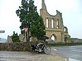 Byland Abbey - geograph.org.uk - 1747046.jpg 640 × 480; 82 KB
-
 Byland Abbey Arch - panoramio.jpg 1,632 × 1,224; 308 KB
-
 Cleveland Road - geograph.org.uk - 583042.jpg 640 × 480; 82 KB
-
 Gatehouse Arch - geograph.org.uk - 834001.jpg 640 × 428; 85 KB
-
 Hawnby Bridge and the River Rye - geograph.org.uk - 1583976.jpg 640 × 480; 126 KB
-
 High or low^ - geograph.org.uk - 1746999.jpg 640 × 480; 88 KB
-
 NCN Route Sign 656.svg 512 × 212; 8 KB
-
 NCN-65 NCN-656 signs.jpg 2,846 × 1,897; 1.63 MB
-
 NCN-route65-route-656-signs.jpg 2,738 × 2,738; 1.72 MB
-
 Oldstead village street - geograph.org.uk - 734953.jpg 557 × 640; 99 KB
-
 Road Over Hawnby Moor - geograph.org.uk - 967103.jpg 640 × 480; 55 KB
-
 Silver Hill Farm - geograph.org.uk - 94002.jpg 640 × 413; 68 KB
-
 Sunset at Square Corner - geograph.org.uk - 909853.jpg 640 × 427; 215 KB
-
 The Hambleton Drove Road - geograph.org.uk - 1628339.jpg 640 × 480; 65 KB
-
 The Hambleton Drove Road - geograph.org.uk - 1628361.jpg 640 × 480; 75 KB
-

-
 The rebuilt road bridge at Blow Gill - geograph.org.uk - 190973.jpg 640 × 480; 151 KB


