Category:National parks of England
Saltar para a navegação
Saltar para a pesquisa
Cymraeg: Delweddau o Barciau Cenedlaethol Lloegr.
English: Pictures of National Parks in England.
Deutsch: Bilder von englischen Nationalparks.
categoria de um projeto da Wikimedia | |||||
| Carregar ficheiro | |||||
| Instância de | |||||
|---|---|---|---|---|---|
| |||||
Subcategorias
Esta categoria contém as seguintes 11 subcategorias (de um total de 11).
D
E
L
N
P
S
Y
Multimédia na categoria "National parks of England"
Esta categoria contém os seguintes 42 ficheiros (de um total de 42).
-

-
 Head of Miterdale - geograph.org.uk - 74751.jpg 640 × 480; 94 kB
-
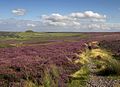 Heather moorland on the North York Moors.jpg 640 × 465; 81 kB
-
 Lake viaduct cycleway.jpg 4 928 × 3 264; 11,18 MB
-

-
 New Forest National Park map.svg 1 244 × 1 227; 925 kB
-
 North York Moors National Park map.svg 1 425 × 1 200; 1,11 MB
-
 Peak District National Park map.svg 1 022 × 1 305; 1,2 MB
-
 South Downs National Park map.svg 1 425 × 884; 1,98 MB
-
 Yorkshire Dales National Park map 2016.svg 1 153 × 1 448; 1,08 MB
-
 Yorkshire Dales National Park map.svg 1 157 × 1 345; 1,01 MB
-
 Anson's Bank, Cannock Chase - geograph.org.uk - 838070.jpg 640 × 480; 113 kB
-
 Anson's Bank, Cannock Chase - geograph.org.uk - 838082.jpg 640 × 480; 99 kB
-
 Anson's Bank, Cannock Chase - geograph.org.uk - 838088.jpg 640 × 480; 138 kB
-
 Bleaberry Fell Cairn and View NW - geograph.org.uk - 470824.jpg 640 × 480; 113 kB
-
 Carling Knott - geograph.org.uk - 79446.jpg 640 × 480; 93 kB
-
 Cattle grid below Sannat Hall Farm - geograph.org.uk - 236859.jpg 640 × 480; 97 kB
-
-
 Danby Lodge - The Moors Centre - geograph.org.uk - 136089.jpg 640 × 427; 80 kB
-
 Dew Bottoms - geograph.org.uk - 242334.jpg 640 × 480; 98 kB
-
 Foal grazes - geograph.org.uk - 242125.jpg 640 × 480; 104 kB
-
 From the top of the hill. - geograph.org.uk - 168074.jpg 640 × 427; 113 kB
-
 Gorge River Bain - geograph.org.uk - 75870.jpg 640 × 369; 39 kB
-
 Grazing ponies, Cadnam Green - geograph.org.uk - 1431348.jpg 640 × 481; 105 kB
-
 Heathland on Morridge Top - geograph.org.uk - 167930.jpg 640 × 427; 156 kB
-
 Langdale Pikes from Elterwater Common - geograph.org.uk - 18338.jpg 640 × 478; 78 kB
-
 Little Mam Tor - geograph.org.uk - 23656.jpg 640 × 480; 255 kB
-
 Looking down to Darnbrook - geograph.org.uk - 243374.jpg 640 × 480; 104 kB
-
 Looking up valley of Cowside Beck - geograph.org.uk - 236793.jpg 640 × 480; 91 kB
-
 Moorhead springs and field walls - geograph.org.uk - 236881.jpg 640 × 480; 94 kB
-
 National Park Centre - geograph.org.uk - 584442.jpg 640 × 427; 70 kB
-
 Old National Park Conservation sign - geograph.org.uk - 242131.jpg 640 × 480; 164 kB
-
 Park Fell Head - geograph.org.uk - 631235.jpg 640 × 480; 74 kB
-
 Peak District National Park - geograph.org.uk - 167497.jpg 640 × 427; 97 kB
-
 Rough Lands and Neals Ing - geograph.org.uk - 236854.jpg 640 × 480; 115 kB
-
 Ryedale - geograph.org.uk - 172770.jpg 640 × 480; 119 kB
-
 Scree - geograph.org.uk - 242146.jpg 640 × 480; 135 kB
-
 Stony Cove Ice Formations - geograph.org.uk - 631435.jpg 640 × 480; 88 kB
-
 The only tent in the valley - geograph.org.uk - 73965.jpg 640 × 480; 119 kB
-
 Warrendale Knotts and Attermire Scar - geograph.org.uk - 238568.jpg 640 × 200; 61 kB
-
-
 Yew Cogar Scar and Falcon Cave - geograph.org.uk - 242138.jpg 640 × 480; 142 kB


