Category:Nesselwängle
Jump to navigation
Jump to search
municipality in Reutte District, Tyrol, Austria    | |||||
| Upload media | |||||
| Instance of |
| ||||
|---|---|---|---|---|---|
| Location | Reutte district, Tyrol, Austria | ||||
| Population |
| ||||
| Area |
| ||||
| Elevation above sea level |
| ||||
| official website | |||||
 | |||||
Subcategories
This category has the following 6 subcategories, out of 6 total.
Media in category "Nesselwängle"
The following 46 files are in this category, out of 46 total.
-
 Blick auf Nesselwängle.jpg 2,560 × 1,920; 437 KB
-
 Der Ort Nesselwängle im Tannheimertal.jpg 5,270 × 3,946; 17.36 MB
-
 Friedberger Steig - panoramio.jpg 2,382 × 1,523; 1.51 MB
-
 Haller 9.jpg 2,560 × 1,920; 942 KB
-
 Haller-Adlerhorst-1.jpg 1,538 × 1,025; 1.08 MB
-
 Haller-Adlerhorst-2.jpg 1,920 × 2,560; 1.25 MB
-
 HerzJesufeuer Nesselwängle.jpg 5,247 × 4,081; 10.54 MB
-
 Leilachspitze Rauth Lechtal.JPG 3,264 × 2,448; 3.28 MB
-
 Map at nesselwaengle.png 400 × 240; 3 KB
-
 Morgendliche Krinnenspitze.jpg 6,296 × 2,262; 9.95 MB
-
 Nesselwaengle.jpg 2,592 × 1,944; 2.08 MB
-
 AUT Nesselwängle COA.svg 402 × 482; 4 KB
-
 Nesselwängle - panoramio (1).jpg 2,048 × 1,536; 738 KB
-
 Nesselwängle - panoramio (3).jpg 2,048 × 1,536; 717 KB
-
 Nesselwängle - panoramio.jpg 2,048 × 1,536; 777 KB
-
 Nesselwängle - Tannheimer Berggruppe Gimpel li, Kellespitz 2238 Hm mit Nesselwängle.jpg 3,206 × 2,081; 829 KB
-
 Nesselwängle Almboden.jpg 640 × 480; 113 KB
-
 Nesselwängle Berg.jpg 2,048 × 1,536; 574 KB
-
 Nesselwängle Dorf.jpg 2,048 × 1,536; 603 KB
-
 Nesselwängle im Bezirk RE.png 645 × 645; 24 KB
-
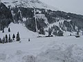 Nesselwängle Lift.jpg 2,048 × 1,536; 905 KB
-
 Nesselwängle mit Gaichtspitze.JPG 2,355 × 1,773; 802 KB
-
 Nesselwängle Morning-2 new.jpg 1,689 × 1,223; 1.1 MB
-
 Nesselwängle Morning-2.JPG 2,048 × 1,536; 297 KB
-
 Nesselwängle Morning.jpg 2,048 × 1,536; 741 KB
-
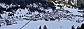 Nesselwängle Ortspanorama CN-I.jpg 2,537 × 892; 1.53 MB
-
 Nesselwängle Ortspanorama CN-II.jpg 3,657 × 1,030; 2.95 MB
-
 Nesselwängle von Rote Flüh.JPG 2,560 × 1,920; 1.16 MB
-
 Nesselwängle von Westen, CN-1 2010-12.jpg 3,000 × 1,520; 3.44 MB
-
 Nesselwängle-1.jpg 3,094 × 2,028; 1.68 MB
-
 Nesselwängle-Blick-1.jpg 2,385 × 1,590; 1.24 MB
-
 Nesselwängle-Blick-2.jpg 2,288 × 1,716; 1.55 MB
-
 Nesselwängle-Blick-3.jpg 2,560 × 1,707; 1.55 MB
-
 Nesselwängle-Blick-4.jpg 2,558 × 1,705; 1.28 MB
-
 Nesselwängle.jpg 640 × 480; 100 KB
-
 Nesselwängle1.jpg 2,220 × 1,665; 1.01 MB
-
 Pistenraupe vor der Roten Flüh, Nesselwängle, CN-01.jpg 3,000 × 2,008; 3.11 MB
-
 Rote Flüh Panorama.jpg 2,300 × 2,400; 4.47 MB
-
 Tannheimer Berge bei Nesselwängle 2010.jpg 7,029 × 2,684; 18.54 MB
-
 Tannheimertal Berg - panoramio.jpg 2,048 × 1,536; 805 KB
-
 Tennenberg Nesselwängle ArM.jpg 5,000 × 1,200; 1.93 MB
-
 Tennenberg Nesselwängle new.jpg 9,697 × 2,343; 6.43 MB
-
 Tennenberg Nesselwängle timm.jpg 9,697 × 2,343; 17.97 MB
-
 Tennenberg Nesselwängle-2.jpg 9,697 × 2,343; 2.76 MB
-
 Tennenberg Nesselwängle.jpg 9,697 × 2,343; 6.92 MB
-
 Winterbaum Nesselwängle.jpg 2,063 × 3,160; 5.2 MB


.jpg)
.jpg)


