Category:Newnham, Northamptonshire
Jump to navigation
Jump to search
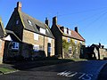
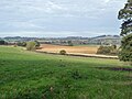
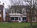
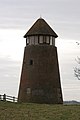
English: Newnham is a village in the West Northamptonshire district of the county of Northamptonshire in England.
village and civil parish in Northamptonshire, UK .JPG) | |||||
| Upload media | |||||
| Instance of | |||||
|---|---|---|---|---|---|
| Location | West Northamptonshire, Northamptonshire, East Midlands, England | ||||
| Population |
| ||||
| Area |
| ||||
 | |||||
Subcategories
This category has the following 2 subcategories, out of 2 total.
Media in category "Newnham, Northamptonshire"
The following 93 files are in this category, out of 93 total.
-
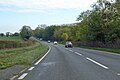 A45 east from Daventry - geograph.org.uk - 5949132.jpg 1,024 × 684; 219 KB
-
 A45 heading for Weedon - geograph.org.uk - 6690192.jpg 1,600 × 1,066; 476 KB
-
 A45 Junction - geograph.org.uk - 5233745.jpg 640 × 480; 58 KB
-
 Alpacas near Badby Wood, Northants - geograph.org.uk - 2583533.jpg 1,195 × 1,600; 488 KB
-
 Alpacas near Newnham Lodge - geograph.org.uk - 4640245.jpg 4,320 × 3,240; 4.55 MB
-
 B4037 through Newnham - geograph.org.uk - 5949091.jpg 1,024 × 684; 259 KB
-
 Bench by Nene Way, Newnham - geograph.org.uk - 6682774.jpg 1,600 × 1,066; 468 KB
-
 Bracken covered hill - geograph.org.uk - 5949058.jpg 1,024 × 768; 498 KB
-
 Burnt Walls - geograph.org.uk - 6690204.jpg 1,600 × 1,066; 466 KB
-
 Byway to Dodford - geograph.org.uk - 6690167.jpg 1,600 × 1,066; 395 KB
-
 Cattle on the hill - geograph.org.uk - 6690191.jpg 1,600 × 1,066; 323 KB
-
 Concrete Stile - geograph.org.uk - 3321156.jpg 2,560 × 1,920; 981 KB
-
 Cottages by The Green, Newnham - geograph.org.uk - 6611939.jpg 1,024 × 768; 259 KB
-
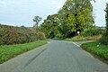 Country crossroads - geograph.org.uk - 5949073.jpg 1,024 × 684; 264 KB
-
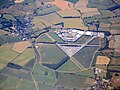
 Daventry from the air - geograph.org.uk - 2407609.jpg 640 × 403; 91 KB
-
 Eastern Daventry - geograph.org.uk - 3321181.jpg 2,560 × 1,920; 1.08 MB
-
 Entrance to Burnt Walls Farm - geograph.org.uk - 6690211.jpg 1,600 × 1,066; 682 KB
-
 Entrance to Newnham Grounds - geograph.org.uk - 6682605.jpg 1,600 × 1,066; 412 KB
-
 Fallow fields near Burnt Walls - geograph.org.uk - 4141928.jpg 4,320 × 3,240; 3.62 MB
-
 Farmland near Newnham - geograph.org.uk - 6682746.jpg 1,600 × 1,066; 359 KB
-
 Farmland with hay rolls - geograph.org.uk - 6682786.jpg 1,600 × 1,066; 359 KB
-
 Fields by the A45, Newnham - geograph.org.uk - 6161133.jpg 1,920 × 1,280; 2.16 MB
-
 Fishing lake by Borough Hill - geograph.org.uk - 6690183.jpg 1,600 × 1,066; 410 KB
-
 Footpath towards Newnham Hill - geograph.org.uk - 6682688.jpg 1,600 × 1,066; 437 KB
-
 Footpath towards Newnham Hill - geograph.org.uk - 6682719.jpg 1,600 × 1,066; 479 KB
-
 Former airfield at Chipping Warden - geograph.org.uk - 5833350.jpg 3,264 × 2,448; 3.95 MB
-
 Grass field and avenue of trees - geograph.org.uk - 6611946.jpg 1,024 × 768; 198 KB
-
 Heading towards Newnham Hill - geograph.org.uk - 3321173.jpg 2,560 × 1,920; 1.11 MB
-
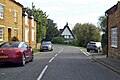
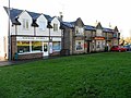
 Houses in Newnham - geograph.org.uk - 5531072.jpg 1,600 × 1,068; 664 KB
-
 Houses on Daventry Road Newnham - geograph.org.uk - 6682771.jpg 1,600 × 1,066; 466 KB
-
 Houses on Daventry Road, Newnham - geograph.org.uk - 6583391.jpg 1,920 × 1,280; 1.5 MB
-
 Lane at the foot of Borough Hill - geograph.org.uk - 6690169.jpg 1,600 × 1,066; 658 KB
-
 Lane from Newnham descending to the A45 - geograph.org.uk - 5949104.jpg 1,024 × 684; 344 KB
-
 Lane to Burnt Walls Farm - geograph.org.uk - 6690197.jpg 1,600 × 1,066; 522 KB
-
 Lane up to the A43 - geograph.org.uk - 6682695.jpg 1,600 × 1,066; 473 KB
-
 Layby on the A45 - geograph.org.uk - 6690208.jpg 1,600 × 1,066; 613 KB
-
 Listed building no.1354737 - geograph.org.uk - 3321148.jpg 2,560 × 1,920; 1.06 MB
-
 Manor Lane, Newnham - geograph.org.uk - 6611944.jpg 1,024 × 768; 174 KB
-
 Nene Way going through the churchyard - geograph.org.uk - 6682702.jpg 1,600 × 1,066; 482 KB
-
 Nene Way leaving Newnham - geograph.org.uk - 6682768.jpg 1,600 × 1,066; 592 KB
-
 Newnham - geograph.org.uk - 119565.jpg 640 × 480; 105 KB
-
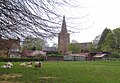
 Newnham Church - geograph.org.uk - 6302193.jpg 833 × 1,024; 257 KB
-
 Newnham Grounds - geograph.org.uk - 1438055.jpg 640 × 426; 71 KB
-
 Newnham Hall - geograph.org.uk - 3251719.jpg 640 × 480; 120 KB
-
 Newnham Manor Lane - geograph.org.uk - 3256920.jpg 640 × 480; 88 KB
-
 Newnham Manor Lane - geograph.org.uk - 3256928.jpg 3,000 × 4,000; 5.4 MB
-
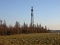 Newnham Mast.jpg 640 × 480; 104 KB
-
 Newnham Primary School building.JPG 567 × 391; 52 KB
-
 Newnham Signpost - geograph.org.uk - 3256912.jpg 480 × 640; 94 KB
-
 Newnham Underground Reservoir - geograph.org.uk - 3740542.jpg 1,024 × 768; 237 KB
-
 Newnham Village Green - geograph.org.uk - 3251739.jpg 640 × 480; 73 KB
-
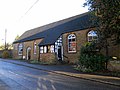 Newnham Village Hall - geograph.org.uk - 3253786.jpg 640 × 480; 82 KB
-
 Newnham Village.jpg 640 × 480; 129 KB
-
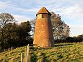 Newnham Windmill - geograph.org.uk - 3740514.jpg 1,024 × 768; 291 KB
-
 Newnham, B4037 Weedon Road - geograph.org.uk - 4554313.jpg 640 × 480; 74 KB
-
 Newnham, B4037 Weedon Road - geograph.org.uk - 4554370.jpg 640 × 480; 85 KB
-
 Newnham, Farmland near Newnham Lodge - geograph.org.uk - 4554354.jpg 640 × 480; 94 KB
-
 Newnham, Northamptonshire and the Church.jpg 2,525 × 1,741; 721 KB
-
 Newnham-Air Traffic Control Mast - geograph.org.uk - 3740587.jpg 1,024 × 768; 215 KB
-
 Newnham-Badby Road - geograph.org.uk - 3253518.jpg 640 × 440; 101 KB
-
 Newnham-Church Street - geograph.org.uk - 3256958.jpg 640 × 480; 77 KB
-
 Newnham-Hillview - geograph.org.uk - 3256951.jpg 640 × 452; 91 KB
-
 Newnham-Poet's Way - geograph.org.uk - 3251729.jpg 640 × 480; 130 KB
-
 Newnham-School Hill - geograph.org.uk - 3253530.jpg 640 × 480; 66 KB
-
 Newnham-School Hill - geograph.org.uk - 3256963.jpg 640 × 480; 74 KB
-
 Newnham-School Hill - geograph.org.uk - 3256969.jpg 640 × 480; 70 KB
-
 Newnham-The Old Chapel - geograph.org.uk - 3256971.jpg 640 × 480; 70 KB
-

-
 Pasture by the A45 - geograph.org.uk - 6690188.jpg 1,600 × 1,066; 258 KB
-
 Pasture by the Weedon Road - geograph.org.uk - 6682621.jpg 1,600 × 1,066; 308 KB
-
 Poets' Way and a small patch of woodland - geograph.org.uk - 5531082.jpg 1,200 × 1,600; 750 KB
-
 Road into Newnham crossing River Nene - geograph.org.uk - 5531066.jpg 1,600 × 1,200; 825 KB
-
 Sheep and sheds by the stream - geograph.org.uk - 6682751.jpg 1,600 × 1,066; 653 KB
-
 Sheep by Weedon Road - geograph.org.uk - 6682726.jpg 1,600 × 1,066; 453 KB
-
 St Michael and All Angels - geograph.org.uk - 6682712.jpg 1,600 × 1,200; 559 KB
-
 Stile on the path to Newnham - geograph.org.uk - 6682692.jpg 1,600 × 1,066; 695 KB
-
 Stubble field near Newnham - geograph.org.uk - 6611947.jpg 1,024 × 768; 206 KB
-
 Stubble field south of Newnham - geograph.org.uk - 5216663.jpg 640 × 480; 153 KB
-
 Thatched cottage and war memorial, Newnham - geograph.org.uk - 4141919.jpg 4,320 × 3,240; 4.61 MB
-
 The Green, Newnham - geograph.org.uk - 5949078.jpg 1,024 × 684; 366 KB
-
 The Green, Newnham - geograph.org.uk - 6583392.jpg 1,912 × 1,268; 2.08 MB
-
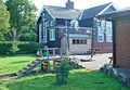
 The Romer Arms - geograph.org.uk - 1172992.jpg 640 × 480; 86 KB
-
 The Romer Arms, Newnham - geograph.org.uk - 4141902.jpg 4,320 × 3,240; 5.09 MB
-
 The spire of Newnham church (St Michael and All Angels) - geograph.org.uk - 5531076.jpg 1,200 × 1,600; 912 KB
-
 Towards Daventry - geograph.org.uk - 2720445.jpg 2,448 × 1,632; 1.27 MB
-
 Tree lined country lane - geograph.org.uk - 6682780.jpg 1,600 × 1,066; 603 KB
-
 Tree lined lane heading for the A361 - geograph.org.uk - 6682742.jpg 1,600 × 1,066; 735 KB
-
 View north over Nene Valley - geograph.org.uk - 5949758.jpg 1,024 × 768; 270 KB
-
 Village of Newnham 15,04,2007 (4).JPG 2,560 × 1,920; 963 KB
-
 Village of Newnham, The Romer Arms 15,04,2007 (5).JPG 2,560 × 1,920; 1.17 MB
-
 Weedon Bec from the air - geograph.org.uk - 3377945.jpg 480 × 640; 98 KB
-
 Wind Mill - geograph.org.uk - 1181557.jpg 427 × 640; 41 KB
-
 Woods by Newnham Grounds - geograph.org.uk - 6682619.jpg 1,600 × 1,066; 439 KB


_-_geograph.org.uk_-_5531076.jpg)


.JPG)


