Category:Newry, Mourne and Down
Jump to navigation
Jump to search
Districts of Northern Ireland (2015-): Antrim and Newtownabbey · Ards and North Down · Armagh, Banbridge and Craigavon · Belfast · Causeway Coast and Glens · Derry and Strabane · Fermanagh and Omagh · Lisburn and Castlereagh · Mid and East Antrim · Mid Ulster · Newry, Mourne and Down
one of the 11 local government districts of Northern Ireland established 2015  | |||||
| Upload media | |||||
| Instance of | |||||
|---|---|---|---|---|---|
| Location | Northern Ireland | ||||
| Capital | |||||
| Population |
| ||||
| Area |
| ||||
| official website | |||||
 | |||||
Subcategories
This category has the following 5 subcategories, out of 5 total.
D
H
N
Media in category "Newry, Mourne and Down"
The following 200 files are in this category, out of 2,415 total.
(previous page) (next page)-
 'Clean' granite at Thomas's Mountain Quarry - geograph.org.uk - 5591145.jpg 3,429 × 1,730; 4.04 MB
-

-
 'The Biodegradablity Waste at Sea' Chart - geograph.org.uk - 6107855.jpg 2,608 × 2,787; 3.71 MB
-
 11kV power lines approaching Cabra Road from the West - geograph.org.uk - 5990821.jpg 3,106 × 2,274; 3.35 MB
-

-
 11kV power lines east of Aghlisnafin - geograph.org.uk - 5604145.jpg 1,682 × 773; 660 KB
-
 11kV power lines running parallel with the Kinghill Road - geograph.org.uk - 5940854.jpg 3,315 × 1,759; 3.08 MB
-
 A "Not In Service" Ulster Bus on the Newcastle Road - geograph.org.uk - 5701348.jpg 2,306 × 1,304; 1.15 MB
-
 A 11kV line feeding a local line above the Cavan Road - geograph.org.uk - 5939826.jpg 2,726 × 3,808; 4.85 MB
-

-
 A bend in the Woodgrange Road leading to Lake House - geograph.org.uk - 5980757.jpg 4,000 × 3,000; 2.87 MB
-
 A bleak day on the Central Promenade at Newcastle - geograph.org.uk - 5656315.jpg 3,054 × 1,842; 2.55 MB
-
 A boarded up cottage in the grounds of Dromantine House - geograph.org.uk - 6120286.jpg 4,000 × 3,000; 2.87 MB
-
-
 A casualty of Ex-Hurricane Ophelia - geograph.org.uk - 5572689.jpg 3,991 × 2,311; 3.45 MB
-
-
 A complex of hospitality venues facing the Central Promenade - geograph.org.uk - 5657188.jpg 2,636 × 1,960; 1.79 MB
-
 A cormorant on a gravel bank in Castle Lake, Newcastle - geograph.org.uk - 5607556.jpg 1,659 × 2,000; 2.74 MB
-

-

-
 A depleted Clanrye River emerges below Newry's City Hall - geograph.org.uk - 5816695.jpg 4,000 × 3,000; 2.83 MB
-
 A depleted waterfall at Lindsay's Leap - geograph.org.uk - 6144031.jpg 3,602 × 2,327; 4.69 MB
-
 A disused homestead on the Cavan Road - geograph.org.uk - 5939338.jpg 4,000 × 3,000; 2.93 MB
-
 A dredger on the Newry Canal viewed from the Merchant's Quay - geograph.org.uk - 5848807.jpg 4,000 × 3,000; 2.57 MB
-

-

-
 A flock of crows above ploughed drumlin land near Tullymurry - geograph.org.uk - 5605435.jpg 3,725 × 1,942; 2.92 MB
-
-
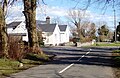
 A hamlet on the A 25 (Castlewellan Road) in Moneygore TD - geograph.org.uk - 5763714.jpg 2,669 × 2,000; 2.79 MB
-
 A hazy evening on the South Promenade, Newcastle - geograph.org.uk - 5793577.jpg 3,416 × 2,516; 5.59 MB
-
 A heavy wintery shower over the Clanrye River - geograph.org.uk - 5680653.jpg 3,584 × 2,386; 4.08 MB
-
 A hole in the B8 in the centre of Hilltown - geograph.org.uk - 5676373.jpg 4,000 × 3,000; 2.3 MB
-
 A Honda Goldwing Trike outside the Newcastle Centre - geograph.org.uk - 5850652.jpg 3,540 × 2,517; 5.39 MB
-
 A meander in the Upper Bann - geograph.org.uk - 5934733.jpg 4,000 × 3,000; 2.89 MB
-
 A Mute Swan on the banks of the Duckweed covered Newry Canal - geograph.org.uk - 5848821.jpg 3,932 × 2,906; 5.96 MB
-

-

-

-
-
 A staggered crossroads on the A25 east of McComb's Bridge - geograph.org.uk - 5988262.jpg 2,668 × 2,000; 3.33 MB
-
 A staggered terrace of houses in Dunwellan Park - geograph.org.uk - 5679498.jpg 3,029 × 2,180; 2.95 MB
-
 A stream flowing parallel with School Road - geograph.org.uk - 5749836.jpg 4,000 × 3,000; 2.88 MB
-

-
 A victim of Ex-Hurricane Ophelia straddles the Glen River - geograph.org.uk - 5574278.jpg 4,000 × 3,000; 2.88 MB
-
 A wee bit crowded on Castle Bridge, Newcastle - geograph.org.uk - 5842774.jpg 2,233 × 1,130; 1.67 MB
-
 A wild start to 2018 on Newcastle's Promenade - geograph.org.uk - 5641377.jpg 4,000 × 3,000; 2.49 MB
-
 A winding section of the Bucks Road - geograph.org.uk - 5979132.jpg 3,902 × 2,864; 6.04 MB
-

-
 Abandoned forestry road east of Amy's River - geograph.org.uk - 6031014.jpg 4,000 × 3,000; 2.86 MB
-
 Abandoned homesteads west of the Convent Road - geograph.org.uk - 6219777.jpg 2,030 × 1,166; 1.29 MB
-
 About to cross West of the Bann - geograph.org.uk - 5735354.jpg 3,998 × 2,998; 5.81 MB
-
 Above The Silent Valley - geograph.org.uk - 5775265.jpg 1,280 × 720; 832 KB
-
 Access walkway from the Central Promenade to the beach - geograph.org.uk - 6026568.jpg 3,972 × 2,960; 5.18 MB
-
 Adams Hill drumlin from the Bannfield Road - geograph.org.uk - 5990838.jpg 3,765 × 2,296; 5.81 MB
-

-

-
 Aggregate quarry at Narrow Water, Co Down - geograph.org.uk - 5717618.jpg 1,596 × 1,038; 1.02 MB
-
 Aghlisnafin Community Centre - geograph.org.uk - 5745136.jpg 4,000 × 3,000; 2.89 MB
-
 Aghlisnafin Road at its junction with Castlewellan Road - geograph.org.uk - 5602894.jpg 3,300 × 1,978; 2.71 MB
-
 Aghlisnafin Water Treatment Works - geograph.org.uk - 5746342.jpg 4,000 × 3,000; 2.87 MB
-
 Agricultural land between the B8 and Crobane Road - geograph.org.uk - 5804767.jpg 2,566 × 1,334; 1.98 MB
-
 Agricultural traffic on the Bannfield Road - geograph.org.uk - 5937864.jpg 2,871 × 2,088; 4.01 MB
-
 Agricultural traffic on the Rathfriland Road - geograph.org.uk - 5732955.jpg 1,780 × 1,231; 1.54 MB
-
 Agricultural traffic on the Rathfriland Road - geograph.org.uk - 5737491.jpg 2,668 × 2,000; 2.52 MB
-
 Altnadua Lake viewed from the Dublin Road - geograph.org.uk - 6119511.jpg 3,207 × 1,412; 2.26 MB
-
 Altnadua Lough viewed from the A25 (Dublin Road) - geograph.org.uk - 5689987.jpg 3,100 × 1,747; 2.79 MB
-
 Altnadua Road at its junction with the Dublin Road - geograph.org.uk - 6119476.jpg 2,601 × 1,328; 2.24 MB
-
 Amy's River descending through Donard Wood - geograph.org.uk - 6031023.jpg 3,000 × 4,000; 7.67 MB
-
 Amy's River in Donard Wood - geograph.org.uk - 6246658.jpg 2,556 × 3,559; 7.06 MB
-

-
 Amy's River stilled by the Wee Beast from the East - geograph.org.uk - 5711456.jpg 4,000 × 3,000; 2.9 MB
-
 An abandoned section of the old A50 - geograph.org.uk - 6114336.jpg 4,000 × 3,000; 2.86 MB
-
 An April evening at Newcastle Harbour - geograph.org.uk - 6138550.jpg 2,669 × 2,658; 4.13 MB
-
 An early April crop of silage on Barr Hill - geograph.org.uk - 6136818.jpg 3,087 × 2,000; 4.21 MB
-
 An empty Central Promenade on Easter Sunday, 2018 - geograph.org.uk - 5723601.jpg 3,628 × 2,000; 3.62 MB
-

-
 Angling platforms above the Clanrye River - geograph.org.uk - 5736947.jpg 3,918 × 2,886; 5.36 MB
-
 Annalong from the air - geograph.org.uk - 5987674.jpg 1,024 × 768; 378 KB
-
 Annalong Road, Ballymartin - geograph.org.uk - 5927100.jpg 3,928 × 2,902; 3.81 MB
-
 Annesley Hall and the Seaweed Bath House - geograph.org.uk - 5794292.jpg 4,000 × 3,000; 2.28 MB
-
 Annesley Hall on Newcastles' South Promenade - geograph.org.uk - 5794308.jpg 2,689 × 2,476; 3.32 MB
-
 Apartments at the Bryansford Road entrance to Donard Park - geograph.org.uk - 5618428.jpg 3,582 × 2,187; 2.76 MB
-

-
 Apartments in Sandys Street with offices at street level - geograph.org.uk - 5818101.jpg 3,729 × 2,309; 5.66 MB
-

-

-
 Apartments overlooking Castle Lake, Newcastle - geograph.org.uk - 5573186.jpg 4,000 × 3,000; 2.24 MB
-
 Apartments overlooking the Albert Basin, Newry - geograph.org.uk - 5775963.jpg 2,921 × 2,141; 4.72 MB
-
 Apartments overlooking the Shimna River - geograph.org.uk - 5680027.jpg 3,950 × 2,932; 6.02 MB
-

-

-
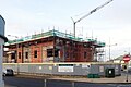 Apartments under construction on the former SERC campus - geograph.org.uk - 5615396.jpg 3,000 × 1,990; 2.34 MB
-

-
 Approaching Bonecastle Cross Roads along Bonecastle Road - geograph.org.uk - 5980062.jpg 2,668 × 2,000; 3.07 MB
-
 Approaching Bonney's Caravan Park on Tullybrannigan Road - geograph.org.uk - 5607525.jpg 3,909 × 2,933; 2.69 MB
-

-
 Approaching Dromantine House along the visitors' drive - geograph.org.uk - 6120297.jpg 3,331 × 2,004; 5.02 MB
-

-
 Approaching George's Quay from the South along the A2 - geograph.org.uk - 5729594.jpg 2,753 × 2,024; 3.06 MB
-
 Approaching Hilltown on the Rathfriland Road - geograph.org.uk - 5737486.jpg 2,584 × 1,884; 1.76 MB
-
 Approaching Kilcoo from the West along the A25 (Dublin Road) - geograph.org.uk - 5734707.jpg 2,668 × 2,000; 3.29 MB
-
 Approaching Low Water at Newcastle, Co Down - geograph.org.uk - 6041477.jpg 4,000 × 3,000; 2.5 MB
-
 Approaching McCombs Bridge from the Rathfriland direction - geograph.org.uk - 5889661.jpg 3,062 × 2,000; 3.86 MB
-
 Approaching Meelmore Lodge - geograph.org.uk - 5717153.jpg 1,280 × 720; 1.14 MB
-
 Approaching road works on the Hilltown Road above Mayobridge - geograph.org.uk - 5737723.jpg 3,204 × 2,602; 2.91 MB
-

-
 Approaching the big bend in the Manse Road, Seaforde - geograph.org.uk - 5752831.jpg 2,668 × 2,000; 3.72 MB
-

-

-

-

-
 Approaching the Hollymount Forest exit gate - geograph.org.uk - 5985181.jpg 4,000 × 3,000; 2.87 MB
-

-

-

-
 Approaching the NW end of Ballymoney Road, Kilcoo - geograph.org.uk - 5937762.jpg 3,890 × 2,850; 6.45 MB
-

-

-

-
-
 Approaching Trassey Bridge from the West - geograph.org.uk - 5530615.jpg 4,000 × 3,000; 5.08 MB
-

-
 Arable land between Kilkeel and Ballymartin - geograph.org.uk - 5729713.jpg 3,000 × 2,058; 2.63 MB
-

-
 Araucaria araucana at Glasdrumman - geograph.org.uk - 5702537.jpg 2,668 × 2,000; 2.9 MB
-
 Arched footbridge over the Newry Canal - geograph.org.uk - 5736832.jpg 3,908 × 2,872; 5.67 MB
-
 Arched pedestrian bridge over the Newry Canal - geograph.org.uk - 5736806.jpg 4,000 × 3,000; 2.85 MB
-
 Ardiente Grill Bar on Newcastle's Central Promenade - geograph.org.uk - 5538748.jpg 3,861 × 2,169; 1.74 MB
-

-
 Around A Pound Store on Newcastle's Main Street - geograph.org.uk - 5683694.jpg 2,818 × 2,383; 3.07 MB
-
 Ascending forestry track in Tollymore Forest - geograph.org.uk - 5528677.jpg 4,000 × 3,000; 4.41 MB
-
 Ascending Trassey Road in a WSW direction - geograph.org.uk - 5531810.jpg 4,000 × 3,000; 3.35 MB
-
 At the end of the rainbow - geograph.org.uk - 5572795.jpg 3,353 × 2,835; 1.53 MB
-

-
 Aughnahoory Heroes Pipe Band - geograph.org.uk - 5842812.jpg 3,994 × 2,994; 6.6 MB
-
 Aughrim or Little Kilkeel River below the A2 Bridge - geograph.org.uk - 5682882.jpg 3,712 × 2,562; 5.78 MB
-

-
 Autumn colours in the undergrowth in Donard Wood - geograph.org.uk - 5590659.jpg 3,920 × 2,890; 7.97 MB
-
 Autumn in Donard Park - geograph.org.uk - 5589900.jpg 4,000 × 3,000; 2.92 MB
-
 Autumn leaves carpet the floor of Donard Wood - geograph.org.uk - 5574294.jpg 3,000 × 4,000; 2.58 MB
-
 Autumn leaves on the Kinghill Road - geograph.org.uk - 5936026.jpg 4,000 × 3,000; 2.92 MB
-

-

-
 Bailey's Bridge on the Ballyhafry Road - geograph.org.uk - 6114145.jpg 4,000 × 3,000; 2.89 MB
-
-
 Baillies Mills Accordion Band outside the Newcastle Centre - geograph.org.uk - 5850733.jpg 3,994 × 1,968; 3.55 MB
-

-
 Ballycoshone Flax Mill on the River Bann - geograph.org.uk - 5937793.jpg 3,699 × 2,323; 4.98 MB
-
 Ballycoshone Road approaching its junction with the A25 - geograph.org.uk - 5988252.jpg 3,102 × 1,946; 3.85 MB
-

-
 Ballycoshone Road north of the junction with Cavan Road - geograph.org.uk - 5987889.jpg 2,669 × 2,000; 3.68 MB
-

-
 Ballydonety Road weaving its way through drumlins - geograph.org.uk - 5985831.jpg 4,000 × 3,000; 2.92 MB
-
 Ballydugan Lake - geograph.org.uk - 5980820.jpg 4,000 × 3,000; 2.53 MB
-
 Ballydugan Lake from the car park of the Lakeside Inn - geograph.org.uk - 5978793.jpg 3,752 × 2,669; 5.68 MB
-
 Ballydugan Mill from the Lake House - geograph.org.uk - 5981323.jpg 4,000 × 3,000; 2.88 MB
-
 Ballydugan Mill from the northern end of Bonecastle Road - geograph.org.uk - 5980879.jpg 2,635 × 1,748; 2.3 MB
-
 Ballygowan Flute Band - geograph.org.uk - 5842865.jpg 2,668 × 2,000; 2.73 MB
-
 Ballyhafry Road (B180) from its junction with the A50 - geograph.org.uk - 6111780.jpg 3,655 × 2,096; 4.82 MB
-
 Ballykeel Road at its junction with the B8 (Hilltown Road) - geograph.org.uk - 5939852.jpg 4,000 × 3,000; 2.92 MB
-

-
 Ballylough Road approaching the junction with School Road - geograph.org.uk - 5747027.jpg 2,833 × 1,373; 2.15 MB
-
 Ballymacdermott - panoramio.jpg 7,374 × 4,147; 6.62 MB
-

-
 Ballymoney Road junction on Letalian Road, near Kilcoo - geograph.org.uk - 5990552.jpg 4,000 × 3,000; 2.92 MB
-
 Ballynagappoge Flax Mill - geograph.org.uk - 5937807.jpg 3,761 × 2,257; 5.62 MB
-
 Ballynagappoge Road ascending towards Corbett's Hill Head - geograph.org.uk - 5988555.jpg 4,000 × 3,000; 2.88 MB
-

-
 Ballywillwill GAA club house - geograph.org.uk - 5755684.jpg 2,614 × 1,926; 2.71 MB
-
 Ballywillwill Gospel Hall - geograph.org.uk - 5743817.jpg 4,000 × 3,000; 2.4 MB
-
 Ballywillwill Gospel Hall - geograph.org.uk - 5746354.jpg 4,000 × 3,000; 2.91 MB
-
 Ballywillwill Lake on the Ballylough Road - geograph.org.uk - 5743798.jpg 4,000 × 3,000; 2.48 MB
-
 Ballywillwill Lough - geograph.org.uk - 5755751.jpg 4,000 × 3,000; 2.84 MB
-

-

-
 Bann side farm house and outbuildings - geograph.org.uk - 5576009.jpg 2,669 × 2,000; 3.76 MB
-

-
 Barbican Bus Stop in Kilkeel Road, Annalong - geograph.org.uk - 5702120.jpg 3,838 × 2,774; 5.39 MB
-
 Barbican Farmhouse viewed across Bryansford Road - geograph.org.uk - 5715430.jpg 3,535 × 2,285; 7.14 MB
-
 Bardan Cottage Elderly Day Care Centre, Bryansford Avenue - geograph.org.uk - 5573547.jpg 3,123 × 2,339; 2.46 MB
-
 Barn on the Ballycoshone Road - geograph.org.uk - 5679131.jpg 1,336 × 794; 563 KB
-

-
 Barr Hill Road at its junction with Glen Road - geograph.org.uk - 6122140.jpg 4,000 × 3,000; 2.87 MB
-
 Basket of eggs topography between the A25 and the B8 - geograph.org.uk - 5679183.jpg 2,893 × 1,389; 1.75 MB
-

-
 Beechmount Park off Rathfriland Road - geograph.org.uk - 5804672.jpg 2,528 × 1,799; 2.24 MB
-
 Beers Bridge on Bryansford Road - geograph.org.uk - 5680063.jpg 4,000 × 3,000; 2.34 MB
-
 Belfast Water Company Gates on Tullybrannigan Road - geograph.org.uk - 5599279.jpg 2,476 × 1,676; 3.18 MB
-

-
 Belinis Bars and Restaurants facing Needham Bridge - geograph.org.uk - 6102035.jpg 3,896 × 2,856; 5.94 MB
-
 Belinis Bars and Restaurants, Needham Bridge, Newry - geograph.org.uk - 6176806.jpg 3,878 × 2,832; 7.39 MB
-
 Below the Promenade Bridge at the mouth of the Shimna - geograph.org.uk - 5627821.jpg 4,000 × 3,000; 5.64 MB
-
 Bench Mark near Clough - geograph.org.uk - 5866215.jpg 1,280 × 1,280; 1.22 MB
-
 Bench Mark, Newry - geograph.org.uk - 5767403.jpg 1,280 × 1,280; 2.4 MB
-
 Bench Mark, Newry - geograph.org.uk - 5767406.jpg 1,280 × 1,280; 2.44 MB
-
 Bench Mark, Newry - geograph.org.uk - 5767407.jpg 1,280 × 1,280; 2.25 MB
-

-

-
 Bend in the Ballydonety Road - geograph.org.uk - 5985188.jpg 4,000 × 3,000; 2.39 MB
-
 Bend in the Ballydonety Road - geograph.org.uk - 5985821.jpg 4,000 × 3,000; 2.86 MB


_in_Moneygore_TD_-_geograph.org.uk_-_5763714.jpg)


_-_geograph.org.uk_-_5689987.jpg)


_-_geograph.org.uk_-_5734707.jpg)


_-_geograph.org.uk_-_5763710.jpg)


_-_geograph.org.uk_-_5935234.jpg)


_from_its_junction_with_the_A50_-_geograph.org.uk_-_6111780.jpg)
_-_geograph.org.uk_-_5939852.jpg)
_approaching_the_junction_with_the_western_end_of_School_Road_-_geograph.org.uk_-_5755704.jpg)


_-_geograph.org.uk_-_5885598.jpg)


_east_of_the_Ballynagappoge_Road_junction_-_geograph.org.uk_-_5737534.jpg)


