Category:Nidderdale
Zur Navigation springen
Zur Suche springen
valley in Yorkshire, UK  | |||||
| Medium hochladen | |||||
| Ist ein(e) | |||||
|---|---|---|---|---|---|
| Ort |
| ||||
| Schutzkategorie | |||||
 | |||||
Unterkategorien
Es werden 41 von insgesamt 41 Unterkategorien in dieser Kategorie angezeigt:
In Klammern die Anzahl der enthaltenen Kategorien (K), Seiten (S), Dateien (D)
A
- Angram Reservoir (25 D)
- Ashfold Side Beck (24 D)
B
C
D
F
G
- Glasshouses, North Yorkshire (47 D)
- Gouthwaite Reservoir (55 D)
- Great Haw (7 D)
H
- Heathfield, North Yorkshire (16 D)
K
L
- Lindley Wood (5 D)
- Little Whernside (23 D)
M
- Meugher (16 D)
N
- Nidderdale Way (35 D)
P
R
S
- Scar House Reservoir (77 D)
- Smelthouses (11 D)
- Spinkburn Beck (2 D)
T
W
Medien in der Kategorie „Nidderdale“
Folgende 61 Dateien sind in dieser Kategorie, von 61 insgesamt.
-
 8 of 'Nidderdale and the Garden of the Nid- a Yorkshire Rhineland, etc' (11225571393).jpg 3.370 × 2.489; 2,45 MB
-
 A chilly day above Nidderdale - geograph.org.uk - 1107964.jpg 640 × 347; 55 KB
-
 Across Nidderdale - geograph.org.uk - 440179.jpg 640 × 427; 257 KB
-

-
 Crag Hall - geograph.org.uk - 1351371.jpg 640 × 480; 78 KB
-
 Crocodile Rock - geograph.org.uk - 37215.jpg 640 × 480; 107 KB
-
 Dales Barn - geograph.org.uk - 1351434.jpg 640 × 442; 109 KB
-
 East from Scar House Dam - geograph.org.uk - 735996.jpg 640 × 480; 59 KB
-
 Farm near Wilsill - geograph.org.uk - 1466193.jpg 640 × 480; 65 KB
-
 Farmland near Wilsill - geograph.org.uk - 1467231.jpg 640 × 480; 73 KB
-
 Field - geograph.org.uk - 153995.jpg 640 × 480; 83 KB
-
 Field above Laver Valley - geograph.org.uk - 88261.jpg 640 × 480; 104 KB
-
 Field above Spa Gill Woods - geograph.org.uk - 118585.jpg 640 × 480; 108 KB
-
 Field barn and Herdwicks - geograph.org.uk - 1202014.jpg 640 × 480; 88 KB
-
 Footbridge over the Nidd - geograph.org.uk - 1350395.jpg 480 × 640; 150 KB
-
 From Edenvale to the plains of York- or, A thousand miles in the valleys of the Nidd and Yore (IA fromedenvaletopl00boggiala).pdf 1.006 × 1.485, 362 Seiten; 36,37 MB
-
 Grass Track approaching Lodge (geograph 3755116).jpg 4.320 × 3.240; 3,91 MB
-
 Grass Track on West House Pasture (geograph 3755027).jpg 4.320 × 3.240; 4,41 MB
-
 Guise Cliff rocks - geograph.org.uk - 885970.jpg 640 × 480; 97 KB
-
 Hungate Bridge - geograph.org.uk - 1717013.jpg 2.048 × 1.536; 1,45 MB
-
 Looking down to Limley Farm - geograph.org.uk - 573871.jpg 640 × 480; 92 KB
-
 Looking towards Blayshaw Gill - geograph.org.uk - 50140.jpg 640 × 480; 75 KB
-
 Looking towards Upper Nidderdale - geograph.org.uk - 151420.jpg 640 × 480; 103 KB
-
 Lord of All he Surveys ^ - geograph.org.uk - 1351414.jpg 640 × 480; 77 KB
-
 Middle Woodale - geograph.org.uk - 736171.jpg 480 × 640; 66 KB
-
 Nidderdale at Limley - geograph.org.uk - 1129606.jpg 545 × 640; 100 KB
-
 Nidderdale Bridleway - geograph.org.uk - 1155895.jpg 640 × 375; 67 KB
-
 Nidderdale Flock - geograph.org.uk - 1155883.jpg 640 × 480; 89 KB
-
 Nidderdale near Pateley Bridge - geograph.org.uk - 484583.jpg 640 × 429; 72 KB
-
 Nidderdale Valley - geograph.org.uk - 225516.jpg 640 × 479; 116 KB
-
 Nidderdale Way above Ashfold Side Beck - geograph.org.uk - 1024927.jpg 640 × 480; 108 KB
-
 Nidderdale, Yorkshire Dales - panoramio (1).jpg 1.100 × 733; 489 KB
-
 Nidderdale, Yorkshire Dales - panoramio.jpg 868 × 1.100; 547 KB
-
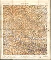 Ordnance Survey One-Inch Tourist Map of Ilkley District, Published 1935.jpg 13.058 × 15.538; 24,8 MB
-

-
 Picture Postcard cottage - geograph.org.uk - 1351427.jpg 640 × 480; 115 KB
-

-

-

-
 Replanting at Nutwith Common - geograph.org.uk - 1222091.jpg 640 × 480; 107 KB
-
 Riggs Moor - geograph.org.uk - 25961.jpg 640 × 480; 102 KB
-
 River Nidd - geograph.org.uk - 1467249.jpg 640 × 480; 127 KB
-
 Road from Scar House - geograph.org.uk - 225504.jpg 640 × 479; 107 KB
-
 Ruined sheepfold above Fox Crag - geograph.org.uk - 583434.jpg 640 × 480; 114 KB
-
 Scar House Dam, Nidderdale - geograph.org.uk - 121004.jpg 596 × 394; 97 KB
-
 Shelterless Barn - geograph.org.uk - 225524.jpg 640 × 457; 92 KB
-

-
-
 Stone on Combs Fell - geograph.org.uk - 243992.jpg 640 × 480; 90 KB
-
 Taking the Llamas for a walk - geograph.org.uk - 1466235.jpg 640 × 480; 80 KB
-
 The Raikes - geograph.org.uk - 1351459.jpg 640 × 480; 89 KB
-
 Thrope Edge - geograph.org.uk - 225529.jpg 640 × 479; 120 KB
-
 Upper Nidderdale near Bouthwaite.jpg 640 × 480; 93 KB
-
 Upper Nidderdale.JPG 1.280 × 960; 612 KB
-
 Waterfall below Colt House Gill Intake - geograph.org.uk - 583430.jpg 640 × 480; 138 KB
-
 Winter in Nidderdale.jpg 2.580 × 1.932; 1,96 MB
-
 Across Nidderdale - geograph.org.uk - 225540.jpg 640 × 479; 119 KB
-
 Boundary fence on Riggs Moor - geograph.org.uk - 239475.jpg 480 × 640; 87 KB
-
 Boundary fence on Riggs Moor - geograph.org.uk - 239482.jpg 640 × 480; 65 KB
-
 Ramsgill-Dallowgill Highway (1) - geograph.org.uk - 243449.jpg 640 × 480; 93 KB
-
 View from In Moor Lane - geograph.org.uk - 227336.jpg 640 × 480; 83 KB
.jpg)


.jpg)
.jpg)


.jpg)


_-_geograph.org.uk_-_243449.jpg)
