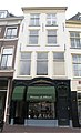
Category:Nieuwe Rijn 29, Leiden
Jump to navigation
Jump to search
| Object location | | View all coordinates using: OpenStreetMap |
|---|
 | |||||
| Upload media | |||||
| Instance of |
| ||||
|---|---|---|---|---|---|
| Location | Leiden, South Holland, Netherlands | ||||
| Street address |
| ||||
| Heritage designation |
| ||||
 | |||||
|
This is a category about rijksmonument number 25157
|
| Address |
|
Media in category "Nieuwe Rijn 29, Leiden"
The following 6 files are in this category, out of 6 total.
-
 Exterieur OVERZICHT - Leiden - 20304638 - RCE.jpg 1,189 × 1,200; 266 KB
-
 Exterieur OVERZICHT - Leiden - 20304639 - RCE.jpg 1,189 × 1,200; 324 KB
-
 Exterieur OVERZICHT - Leiden - 20304640 - RCE.jpg 1,189 × 1,200; 273 KB
-
 Exterieur OVERZICHT VOORGEVEL - Leiden - 20304641 - RCE.jpg 1,190 × 1,200; 315 KB
-
 Leiden - Nieuwe Rijn 29.JPG 3,056 × 4,592; 3.42 MB
-
 Leiden Nieuwe Rijn 29.jpg 2,227 × 3,670; 1.11 MB


