Category:Nieuwstad 49 (Hindeloopen)
Jump to navigation
Jump to search
| Object location | | View all coordinates using: OpenStreetMap |
|---|
house in Súdwest-Fryslân, Netherlands  | |||||
| Upload media | |||||
| Instance of | |||||
|---|---|---|---|---|---|
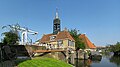
| Location | Hindeloopen, Hindeloopen | ||||
| Located on street | |||||
| Heritage designation |
| ||||
 | |||||
Nederlands: De Foeke
|
This is a category about rijksmonument number 22183
|
| Address |
|
Media in category "Nieuwstad 49 (Hindeloopen)"
The following 19 files are in this category, out of 19 total.
-
 20080504 Zijlroede Hindeloopen NL.jpg 3,000 × 785; 382 KB
-
 20140430 Sluis en sluiswachterswoning (Sylhús) Hindeloopen Fr NL.jpg 5,400 × 3,000; 4.57 MB
-
 8713 Hindeloopen, Netherlands - panoramio (20).jpg 2,048 × 1,375; 474 KB
-
 Achterbouw - Hindeloopen - 20113570 - RCE.jpg 1,200 × 1,200; 308 KB
-
 Achtergevel achterbouw - Hindeloopen - 20113571 - RCE.jpg 1,193 × 1,200; 410 KB
-
 Boerderij C 99, brug over de Oostervaart - Hindeloopen - 20446991 - RCE.jpg 1,200 × 900; 133 KB
-
 Linker zijgevel- achterbouw - Hindeloopen - 20113572 - RCE.jpg 1,190 × 1,200; 406 KB
-
 Nieuwstad49 Hindeloopen.jpg 2,736 × 3,648; 801 KB
-
 Oelebord - Hindeloopen - 20514735 - RCE.jpg 663 × 888; 82 KB
-
 Overzicht - Hindeloopen - 20113478 - RCE.jpg 1,200 × 867; 177 KB
-
 Overzicht - Hindeloopen - 20113566 - RCE.jpg 1,188 × 1,200; 325 KB
-
 Overzicht Kalverstraat naar het oosten - Hindeloopen - 20113409 - RCE.jpg 1,200 × 822; 156 KB
-
 Overzicht met brug Nieuwstad - Hindeloopen - 20113464 - RCE.jpg 1,200 × 815; 223 KB
-

-
 Overzicht Nieuwstad - Hindeloopen - 20113445 - RCE.jpg 1,200 × 813; 228 KB
-
 Overzicht Nieuwstad naar het oosten - Hindeloopen - 20113452 - RCE.jpg 1,200 × 817; 221 KB
-
 Rechter zijgevel- achterbouw - Hindeloopen - 20113573 - RCE.jpg 1,190 × 1,200; 371 KB
-
 Voor- en linker zijgevel - Hindeloopen - 20113568 - RCE.jpg 1,195 × 1,200; 343 KB
-
 Voor- en rechter zijgevel - Hindeloopen - 20113569 - RCE.jpg 1,197 × 1,200; 366 KB
_Hindeloopen_Fr_NL.jpg)
.jpg)


