Category:North Walsham
Saltar para a navegação
Saltar para a pesquisa
town and civil parish in Norfolk, United Kingdom  | |||||
| Carregar ficheiro | |||||
| Instância de | |||||
|---|---|---|---|---|---|
| Localização | North Norfolk, Norfolk, Leste da Inglaterra, Inglaterra | ||||
| População |
| ||||
| Área |
| ||||
| sítio web oficial | |||||
 | |||||
Deutsch: North Walsham ist eine Marktstadt in North Norfolk, Ostengland, liegt am Fluss Ant und am Rande des Seengebietes der Norfolk Broads. Die Stadt hat eine Fläche von 17.27 km² und 11.998 Einwohner (2001).
English: North Walsham is a market town and civil parish in the English county of Norfolk. It is within the North Norfolk district, and is situated some to the south.
Français : North Walsham au sud de Cromer.
Română: North Walsham este un oraş în comitatul Norfolk, regiunea East, Anglia. Oraşul se află în districtul North Norfolk.
Subcategorias
Esta categoria contém as seguintes 15 subcategorias (de um total de 15).
Multimédia na categoria "North Walsham"
Esta categoria contém os seguintes 60 ficheiros (de um total de 60).
-
 "Beached" boat in Norwich Road - geograph.org.uk - 5372369.jpg 480 × 640; 69 kB
-
 A149 bridge, North Walsham - geograph.org.uk - 5061897.jpg 1 600 × 1 200; 663 kB
-
 Acorn Road, North Walsham - geograph.org.uk - 5030419.jpg 1 600 × 1 200; 783 kB
-
 Antingham Drive, North Walsham - geograph.org.uk - 5310272.jpg 1 600 × 1 200; 546 kB
-
 Arnold Pitcher Close, North Walsham - geograph.org.uk - 5310306.jpg 1 600 × 1 200; 527 kB
-
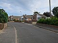 Ashfield Road, North Walsham - geograph.org.uk - 5126562.jpg 1 600 × 1 200; 539 kB
-
 B1150 towards North Walsham - geograph.org.uk - 5877299.jpg 1 024 × 684; 289 kB
-
 Bare field by North Walsham - geograph.org.uk - 5374213.jpg 1 600 × 1 200; 329 kB
-
 Blakeys Bar bus - geograph.org.uk - 5878563.jpg 1 024 × 768; 358 kB
-
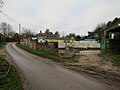 Brick Kiln Farm, Lyngate Road - geograph.org.uk - 6027352.jpg 1 600 × 1 200; 258 kB
-
 Crickmore Farm - geograph.org.uk - 6293226.jpg 1 600 × 1 067; 352 kB
-
 Crop boundary - geograph.org.uk - 5029335.jpg 1 600 × 1 200; 550 kB
-
 Crop field near Lyngate Farm - geograph.org.uk - 4966896.jpg 640 × 456; 47 kB
-
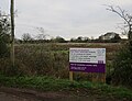
 Development plot, North Walsham - geograph.org.uk - 5153116.jpg 1 600 × 1 153; 452 kB
-
 Ditch off Lyngate Road - geograph.org.uk - 6027348.jpg 1 600 × 1 200; 320 kB
-
 Dream Lodge, North Walsham - geograph.org.uk - 5126560.jpg 1 600 × 1 200; 640 kB
-
 Drury's, North Walsham Industrial Estate - geograph.org.uk - 5153123.jpg 1 600 × 1 200; 382 kB
-
 Farmland towards Wild's Farm - geograph.org.uk - 4966900.jpg 640 × 471; 85 kB
-
 Fenced off site, Lyngate Road - geograph.org.uk - 6027344.jpg 1 600 × 1 200; 248 kB
-
 Field Lane - geograph.org.uk - 5374218.jpg 1 600 × 1 200; 324 kB
-
 Field near Bradfield Bridge - geograph.org.uk - 6027362.jpg 1 600 × 1 231; 360 kB
-
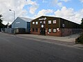
 Folgate Road Industrial Estate, North Walsham - geograph.org.uk - 5153131.jpg 1 600 × 1 200; 398 kB
-
 Football pitch, North Walsham - geograph.org.uk - 5310208.jpg 1 600 × 1 200; 606 kB
-
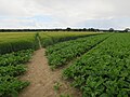
 Footpath from North Walsham - geograph.org.uk - 5029332.jpg 1 600 × 1 200; 674 kB
-
 Footpath to North Walsham - geograph.org.uk - 5029338.jpg 1 600 × 1 200; 711 kB
-
 Foxglove Close, North Walsham - geograph.org.uk - 5556049.jpg 1 600 × 1 200; 285 kB
-
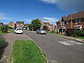
 Hannant Road, North Walsham - geograph.org.uk - 5310275.jpg 1 600 × 1 200; 456 kB
-
 Happisburgh Road through White Horse Common - geograph.org.uk - 6027739.jpg 1 600 × 1 149; 263 kB
-
 Holly Farm - geograph.org.uk - 5556043.jpg 1 600 × 1 200; 299 kB
-

-
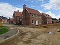
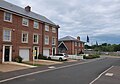
 Houses on Norwich Road, North Walsham - geograph.org.uk - 5877303.jpg 1 024 × 684; 242 kB
-
 Junction on Lyngate Road - geograph.org.uk - 6027354.jpg 1 600 × 1 200; 437 kB
-
 Lay-by on the A149, Cromer Road north of Aylsham - geograph.org.uk - 6196674.jpg 3 456 × 2 592; 3,77 MB
-
 Lyngate Road - geograph.org.uk - 6027753.jpg 1 600 × 1 200; 337 kB
-
 Marine Weld Fabrications - geograph.org.uk - 5153142.jpg 1 600 × 1 200; 585 kB
-
 Mulberry Grove - geograph.org.uk - 5029368.jpg 1 600 × 1 151; 589 kB
-
 Mulberry Grove - geograph.org.uk - 5029386.jpg 1 600 × 1 200; 633 kB
-
 Mulberry Grove - geograph.org.uk - 5029391.jpg 1 600 × 1 200; 707 kB
-
 Mulberry Grove growing - geograph.org.uk - 5029389.jpg 1 600 × 1 200; 547 kB
-
 Mulberry Grove marketing suite - geograph.org.uk - 5029378.jpg 1 600 × 1 231; 548 kB
-
 Mulberry Grove marketing suite - geograph.org.uk - 6190447.jpg 1 600 × 1 120; 296 kB
-
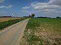
 North Walsham and Dilham Canal - geograph.org.uk - 5877824.jpg 1 024 × 768; 274 kB
-
 North Walsham Building Solutions - geograph.org.uk - 5127250.jpg 1 600 × 1 200; 740 kB
-
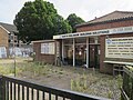
 North Walsham Job Centre - geograph.org.uk - 5370045.jpg 640 × 480; 81 kB
-
 North Walsham Police Headquarters - geograph.org.uk - 5662414.jpg 3 456 × 2 592; 3,71 MB
-
 North Walsham Register Office - geograph.org.uk - 5370044.jpg 640 × 480; 115 kB
-
 North Walsham Rifle and Pistol Club - geograph.org.uk - 6027750.jpg 1 600 × 1 200; 276 kB
-
 Open area, North Walsham - geograph.org.uk - 5030410.jpg 1 600 × 1 200; 816 kB
-
 P G Products Ltd - geograph.org.uk - 5153137.jpg 1 600 × 1 145; 397 kB
-
 Parked cars in Market Place - geograph.org.uk - 5370101.jpg 640 × 480; 72 kB
-
 Paston Sixth Form College - geograph.org.uk - 5370036.jpg 640 × 480; 86 kB
-
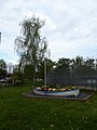
 Play area, North Walsham - geograph.org.uk - 5310197.jpg 1 600 × 1 200; 609 kB
-
 Pumptronics, North Walsham Industrial Estate - geograph.org.uk - 5153126.jpg 1 600 × 1 200; 434 kB
-
 Recycling point and petrol station - geograph.org.uk - 5310435.jpg 1 600 × 1 200; 411 kB
-
 Retirement apartments under construction - geograph.org.uk - 6027757.jpg 1 600 × 1 200; 238 kB
-
 Robin Farrow, North Walsham - geograph.org.uk - 5310403.jpg 1 600 × 1 200; 465 kB
-
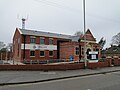
 Salvation Army, Hall Lane - geograph.org.uk - 5127246.jpg 1 600 × 1 200; 603 kB
-
 Sheds made to order - geograph.org.uk - 5310199.jpg 1 600 × 1 200; 474 kB
-
 Showcase Gallery, North Walsham - geograph.org.uk - 5310370.jpg 1 600 × 1 230; 536 kB
-
 Waterfield Meadows, North Walsham - geograph.org.uk - 5556050.jpg 1 600 × 1 200; 291 kB


