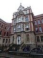
Category:Nottingham
Jump to navigation
Jump to search


English: Nottingham is a city and unitary authority in the East Midlands of England. It is located in the ceremonial county of Nottinghamshire.
city in Nottinghamshire, England    | |||||
| Upload media | |||||
| Instance of |
| ||||
|---|---|---|---|---|---|
| Location | City of Nottingham, Nottinghamshire, East Midlands, Inglaterra | ||||
| Legislative body | |||||
| Official language | |||||
| Inception |
| ||||
| Population |
| ||||
| Area |
| ||||
| Elevation above sea level |
| ||||
| Different from | |||||
| official website | |||||
 | |||||
Mga ubos-nga-kaarangay
Ini nga kaarangay mayda han mga nasunod nga 34 nga mga ubos-nga-kaarangay, tikang hin 34 nga kabug-osan.
A
B
C
- Castle Rock (Nottingham) (19 F)
E
G
H
- Hart, Fellows & Company (1 F)
- Hockley, Nottingham (4 F)
I
- I. & R. Morley (1 F)
M
- Murals in Nottingham (10 F)
N
- Coats of arms of Nottingham (3 F)
- Nottingham in art (3 F)
P
- Postcards of Nottingham (26 F)
S
T
U
V
W
Mga pakli ha kaarangay nga "Nottingham"
Ini nga kaarangay mayda han amo la nga nasunod nga pakli.
Media ha kaarangay nga "Nottingham"
An mga nasunod nga 200 ka mga fayl aada han hini nga kaarangay, tikang hin 3,463 nga kabug-osan.
(nahiuna nga pakli) (masunod nga pakli)-
 "Intending passengers . . . - geograph.org.uk - 4161745.jpg 960 × 1,280; 351 nga KB
-
 "Point girl", Old Market Square - geograph.org.uk - 6149946.jpg 1,280 × 960; 384 nga KB
-
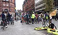 "Space for Cycling" - geograph.org.uk - 5360800.jpg 1,280 × 784; 394 nga KB
-
 "The D Store" Victoria Shopping Centre, Nottingham - geograph.org.uk - 2239929.jpg 1,991 × 1,489; 518 nga KB
-
 'Nottingham Prince' near Meadow Lane Lock - geograph.org.uk - 6271323.jpg 1,024 × 768; 759 nga KB
-
 'The man who knows the ropes' - geograph.org.uk - 3006221.jpg 1,280 × 1,920; 170 nga KB
-
 1 and 2 Long Row - geograph.org.uk - 6176589.jpg 5,472 × 3,648; 5.03 nga MB
-
 1 and 3 St Peter's Gate, Nottingham - geograph.org.uk - 6176621.jpg 5,472 × 3,648; 4.53 nga MB
-
 1 Broadway, Nottingham - geograph.org.uk - 6110324.jpg 886 × 1,280; 339 nga KB
-
 1 ^ 2 Standard Hill, Nottingham - geograph.org.uk - 6115458.jpg 953 × 1,280; 299 nga KB
-
 1 – 3 South Parade, Nottingham - geograph.org.uk - 6109218.jpg 1,280 × 1,280; 406 nga KB
-
 10 and 11, Angel Row, Nottingham - geograph.org.uk - 6154990.jpg 1,936 × 2,592; 2.07 nga MB
-
 10 King Street, Nottingham - geograph.org.uk - 6176790.jpg 3,648 × 5,472; 4.5 nga MB
-
 10-11 Poultry, Nottingham - geograph.org.uk - 4067603.jpg 485 × 640; 175 nga KB
-
 10-12 Angel Row, Nottingham - geograph.org.uk - 4064906.jpg 577 × 640; 193 nga KB
-
 102 Friar Lane, refurbishment underway - geograph.org.uk - 3845819.jpg 1,024 × 798; 518 nga KB
-
 11 Bridlesmith Gate, Nottingham - geograph.org.uk - 6111233.jpg 960 × 1,280; 317 nga KB
-
 11-13 Beastmarket Hill, Nottingham - geograph.org.uk - 4058450.jpg 640 × 535; 175 nga KB
-
 13 and 14 Exchange Walk - geograph.org.uk - 6176618.jpg 5,472 × 3,648; 4.64 nga MB
-
 13-15 Bridlesmith Gate, Nottingham - geograph.org.uk - 6111234.jpg 945 × 1,280; 300 nga KB
-
 13-15 St James's Street, Nottingham - geograph.org.uk - 4053139.jpg 455 × 640; 170 nga KB
-
 13-16 South Parade, Nottingham - geograph.org.uk - 4058427.jpg 473 × 640; 145 nga KB
-
 14-30 King Street, Nottingham - geograph.org.uk - 6176793.jpg 3,648 × 5,472; 4.75 nga MB
-
 15 George Street, Nottingham - geograph.org.uk - 6145006.jpg 1,936 × 2,592; 1.84 nga MB
-
 15-17 King Street, Nottingham - geograph.org.uk - 6176778.jpg 3,648 × 5,472; 5.3 nga MB
-
 16-17, Angel Row, Nottingham - geograph.org.uk - 6118208.jpg 1,152 × 1,280; 384 nga KB
-
 17-21 Upper Parliament Street, Nottingham - geograph.org.uk - 4060629.jpg 535 × 640; 187 nga KB
-
 1877 Borough of Nottingham boundary marker, Woodthorpe Drive (geograph 6108646).jpg 683 × 1,024; 245 nga KB
-
 193428994 cgbXk-O.jpg 480 × 320; 46 nga KB
-
 1GL Bolt Bench Mark, St Peter's Church - geograph.org.uk - 3012447.jpg 1,024 × 682; 329 nga KB
-
 2 Castle Place and 76 Hounds Gate, Nottingham - geograph.org.uk - 4053232.jpg 640 × 627; 224 nga KB
-
 2 St James's Terrace, Nottingham - geograph.org.uk - 6115462.jpg 1,280 × 1,280; 478 nga KB
-
 2 St Peter's Gate, Nottingham - geograph.org.uk - 6176596.jpg 5,472 × 3,648; 5.34 nga MB
-
 2-4 St James's Terrace, Nottingham - geograph.org.uk - 4053192.jpg 640 × 448; 173 nga KB
-
 20-24 Friar Lane, Nottingham - geograph.org.uk - 4067626.jpg 562 × 640; 184 nga KB
-
 23 Milton Street, Nottingham - geograph.org.uk - 4063315.jpg 574 × 640; 233 nga KB
-
 24 and 26, Low Pavement, Nottingham - geograph.org.uk - 6100469.jpg 1,280 × 1,280; 305 nga KB
-
 25 Warser Gate, Nottingham - geograph.org.uk - 6115182.jpg 1,280 × 1,280; 512 nga KB
-
 25-29 Wheeler Gate, Nottingham - geograph.org.uk - 4069022.jpg 486 × 640; 222 nga KB
-
 27 Pelham Street, Nottingham - geograph.org.uk - 6109981.jpg 1,280 × 1,135; 345 nga KB
-
 28 High Pavement, Nottingham - geograph.org.uk - 6145183.jpg 2,592 × 1,936; 2.3 nga MB
-
 28 Jun 2012 Olympic torch relay Nottingham (171).jpg 3,648 × 2,736; 2.32 nga MB
-
 28 to 32 Wheeler Gate, Nottingham - geograph.org.uk - 6176630.jpg 5,472 × 3,648; 5.63 nga MB
-
 29 George Street, Nottingham - geograph.org.uk - 4108885.jpg 573 × 640; 218 nga KB
-
 29 High Pavement, Nottingham - geograph.org.uk - 6110291.jpg 878 × 1,280; 327 nga KB
-
 29 Upper Parliament Street, Nottingham - geograph.org.uk - 4060605.jpg 640 × 494; 203 nga KB
-
 3 St James's Terrace, Nottingham - geograph.org.uk - 6115467.jpg 960 × 1,280; 330 nga KB
-
 3 ^ 4 Kaye's Walk, Nottingham - geograph.org.uk - 6110319.jpg 1,280 × 932; 476 nga KB
-
 3-5 Market Street, Nottingham - geograph.org.uk - 4063481.jpg 403 × 640; 129 nga KB
-
 30 Market Street, Nottingham - geograph.org.uk - 6176808.jpg 3,648 × 5,472; 7.44 nga MB
-
 30-32 Park Row, Nottingham - geograph.org.uk - 4117001.jpg 640 × 462; 176 nga KB
-
 31 High Pavement, Nottingham - geograph.org.uk - 6110296.jpg 1,208 × 1,280; 478 nga KB
-
 31 ^ 33 Warser Gate, Nottingham - geograph.org.uk - 6115238.jpg 1,280 × 1,280; 438 nga KB
-
 32 and 34 Market Street, Nottingham - geograph.org.uk - 6176810.jpg 3,648 × 5,472; 6.19 nga MB
-
 34 and 36 Wheeler Gate, Nottingham - geograph.org.uk - 6176627.jpg 3,648 × 5,472; 5.14 nga MB
-
 35 ^ 37 St Mary's Gate, Nottingham - geograph.org.uk - 6110323.jpg 831 × 1,280; 295 nga KB
-
 38 Goose Gate - geograph.org.uk - 5669727.jpg 1,280 × 719; 307 nga KB
-

-
 4 and 6 St Peter's Gate, Nottingham - geograph.org.uk - 6176595.jpg 3,648 × 5,472; 4.36 nga MB
-
 4 Bridlesmith Gate, Nottingham - geograph.org.uk - 6109972.jpg 969 × 1,280; 363 nga KB
-
 4 miles from the Trent - geograph.org.uk - 6234956.jpg 4,032 × 3,024; 4.87 nga MB
-
 4 St James's Terrace, Nottingham - geograph.org.uk - 6115470.jpg 1,280 × 1,280; 544 nga KB
-
 4 St Peter's Church Walk, Nottingham - geograph.org.uk - 6176605.jpg 5,472 × 3,648; 6.42 nga MB
-
 40 Friar Lane, Nottingham - geograph.org.uk - 4069066.jpg 490 × 640; 174 nga KB
-
 41 Maid Marian Way, Nottingham - geograph.org.uk - 4110923.jpg 472 × 640; 180 nga KB
-
 41 Pilcher Gate (geograph 6577332).jpg 1,280 × 960; 308 nga KB
-
 41 Pilcher Gate, Nottingham - geograph.org.uk - 5432298.jpg 1,280 × 946; 399 nga KB
-
 42-44 Clumber Street, Nottingham - geograph.org.uk - 4062259.jpg 640 × 513; 181 nga KB
-
 43 ^ 45 Castle Gate, Nottingham - geograph.org.uk - 6115430.jpg 938 × 1,280; 318 nga KB
-
 43-55 Lower Parliament Street, Nottingham - geograph.org.uk - 4108873.jpg 640 × 498; 159 nga KB
-
 45 ^ 47 Castle Gate, Nottingham - geograph.org.uk - 6115425.jpg 929 × 1,280; 243 nga KB
-
 47 Stoney Street, Nottingham - geograph.org.uk - 6110312.jpg 932 × 1,280; 485 nga KB
-
 49 Castle Gate, Nottingham - geograph.org.uk - 6115419.jpg 876 × 1,280; 219 nga KB
-
 5 Kaye's Walk, Nottingham - geograph.org.uk - 6110318.jpg 1,280 × 1,280; 622 nga KB
-
 5, 7, 8 Bridlesmith Gate, Nottingham - geograph.org.uk - 6111237.jpg 1,280 × 1,280; 445 nga KB
-
 5-a-side - geograph.org.uk - 4134167.jpg 1,280 × 853; 356 nga KB
-
 50 Shakespeare Street, Nottingham – entrance - geograph.org.uk - 6226528.jpg 989 × 1,280; 394 nga KB
-
 51 Castle Gate, Nottingham - geograph.org.uk - 6115408.jpg 690 × 1,280; 245 nga KB
-
 53 Castle Gate, Nottingham - geograph.org.uk - 6115413.jpg 871 × 1,280; 330 nga KB
-
 55 Castle Gate, Nottingham - geograph.org.uk - 6115401.jpg 756 × 1,280; 230 nga KB
-
 58 Bridlesmith Gate, Nottingham - geograph.org.uk - 6109961.jpg 1,280 × 1,280; 355 nga KB
-
 60 Talbot Street, Nottingham - geograph.org.uk - 6176581.jpg 5,472 × 3,648; 6.02 nga MB
-
 64 St James's Street, Nottingham - geograph.org.uk - 4053409.jpg 511 × 640; 205 nga KB
-
 66-70 St James's Street, Nottingham - geograph.org.uk - 4053436.jpg 483 × 640; 201 nga KB
-
 67 Upper Parliament Street, Nottingham - geograph.org.uk - 4064893.jpg 503 × 640; 184 nga KB
-
 68 St James's Street, Nottingham - geograph.org.uk - 6115483.jpg 850 × 1,280; 303 nga KB
-
 7 St James's Terrace, Nottingham - geograph.org.uk - 6115473.jpg 1,280 × 1,280; 538 nga KB
-
 7-12 South Parade, Nottingham - geograph.org.uk - 4058500.jpg 640 × 477; 168 nga KB
-
 70 Long Row and 2-6 Chapel Bar, Nottingham - geograph.org.uk - 4064852.jpg 640 × 449; 158 nga KB
-
 72 St James's Street, Nottingham - geograph.org.uk - 4053173.jpg 268 × 640; 126 nga KB
-
 72 St James's Street, Nottingham - geograph.org.uk - 6115475.jpg 758 × 1,280; 303 nga KB
-
 72 St James's Street, Nottingham – detail - geograph.org.uk - 6115476.jpg 1,280 × 914; 372 nga KB
-
 74-76 St James's Street, Nottingham - geograph.org.uk - 4053183.jpg 481 × 640; 194 nga KB
-
 76 Hounds Gate, Nottingham - geograph.org.uk - 6115431.jpg 1,280 × 1,280; 397 nga KB
-
 8 ^ 9 St James's Terrace, Nottingham - geograph.org.uk - 6117455.jpg 1,280 × 960; 399 nga KB
-
 84 Friar Lane, Nottingham - geograph.org.uk - 4053224.jpg 640 × 496; 196 nga KB
-
 84 Friar Lane, Nottingham - geograph.org.uk - 6115444.jpg 1,280 × 871; 324 nga KB
-
 9 - 11 St James' Street, Nottingham – The Roebuck - geograph.org.uk - 6118195.jpg 1,280 × 960; 366 nga KB
-
 9 and 11 St Peter's Gate, Nottingham - geograph.org.uk - 6176609.jpg 3,648 × 5,472; 5.28 nga MB
-
 9 Weekday Cross, Nottingham - geograph.org.uk - 6109997.jpg 1,040 × 1,280; 380 nga KB
-
 9 Weekday Cross, Nottingham – detail - geograph.org.uk - 6110000.jpg 1,280 × 960; 294 nga KB
-
 A bend in route 6 - geograph.org.uk - 5368706.jpg 1,280 × 1,280; 940 nga KB
-
 A big hand on the Council House - geograph.org.uk - 6189725.jpg 960 × 1,280; 337 nga KB
-
 A breach of Nottingham's low-emission zone. - geograph.org.uk - 1911641.jpg 640 × 480; 89 nga KB
-
 A building site on Short Hill - geograph.org.uk - 6201651.jpg 1,024 × 1,024; 1.07 nga MB
-
 A crane over Nottingham College - geograph.org.uk - 6208820.jpg 819 × 1,024; 937 nga KB
-
 A dense patch of Himalayan Balsam by the Trent - geograph.org.uk - 1979865.jpg 1,024 × 683; 374 nga KB
-
 A digger at work on Science Road - geograph.org.uk - 3541930.jpg 640 × 427; 326 nga KB
-
 A digger on the tracks - geograph.org.uk - 4371061.jpg 1,280 × 853; 398 nga KB
-
 A disappearing landmark - geograph.org.uk - 3767540.jpg 1,280 × 792; 248 nga KB
-
 A dragon on the Tower - geograph.org.uk - 1838665.jpg 1,024 × 683; 124 nga KB
-
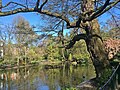
 A family of swans on a lake in Colwick Country Park - geograph.org.uk - 5048564.jpg 800 × 600; 93 nga KB
-
 A Fothergill doorway - geograph.org.uk - 3956456.jpg 1,024 × 1,024; 1.27 nga MB
-
 A gap in the Fence - geograph.org.uk - 1621036.jpg 480 × 640; 109 nga KB
-
 A grey morning in Fletcher Gate - geograph.org.uk - 5678869.jpg 1,024 × 768; 980 nga KB
-
 A heron beside the River Lean - geograph.org.uk - 3024462.jpg 640 × 431; 148 nga KB
-
 A long view from Greenwood Road - geograph.org.uk - 5027425.jpg 1,024 × 731; 903 nga KB
-
 A mash-up mouse - geograph.org.uk - 5530310.jpg 1,151 × 1,280; 279 nga KB
-
 A May evening in the Market Square - geograph.org.uk - 3465771.jpg 900 × 1,200; 1.23 nga MB
-
 A May morning by the Trent - geograph.org.uk - 4960056.jpg 1,024 × 732; 1.15 nga MB
-
 A May morning in Nottingham General Cemetery - geograph.org.uk - 4937158.jpg 1,024 × 765; 1.08 nga MB
-
 A May morning in The Arboretum - geograph.org.uk - 4937152.jpg 1,024 × 768; 1.27 nga MB
-
 A May morning in Wollaton Park - geograph.org.uk - 4936631.jpg 1,024 × 731; 1.07 nga MB
-
 A NET auger and QMC Medical School - geograph.org.uk - 3394138.jpg 640 × 640; 147 nga KB
-
 A northbound tram approaching Middle Hill - geograph.org.uk - 6208817.jpg 1,024 × 768; 866 nga KB
-
 A northbound tram approaching the Market Square - geograph.org.uk - 4948778.jpg 800 × 800; 191 nga KB
-
 A Nottingham Winter Wonderland - Christmas lights - Beastmarket Hill (15718462300).jpg 4,288 × 3,216; 3.55 nga MB
-
 A peek at the rotunda - geograph.org.uk - 4184366.jpg 853 × 1,280; 429 nga KB
-
 A protest outside St. Peter's Church, Nottingham - geograph.org.uk - 1826286.jpg 480 × 640; 100 nga KB
-
 A real tram at the University Boulevard stop - geograph.org.uk - 5265551.jpg 1,280 × 853; 295 nga KB
-
 A seat with a view in Wollaton Park - geograph.org.uk - 3881896.jpg 800 × 533; 132 nga KB
-
 A southbound tram leaving Wilkinson Street - geograph.org.uk - 5756565.jpg 800 × 800; 830 nga KB
-
 A southbound tram on Goldsmith Street - geograph.org.uk - 5773858.jpg 1,024 × 1,024; 1.03 nga MB
-
 A Spring lunchtime by The School of Chemistry - geograph.org.uk - 2347861.jpg 640 × 427; 123 nga KB
-
 A spring morning in Dryden Street - geograph.org.uk - 4937429.jpg 819 × 1,024; 1.23 nga MB
-
 A spring morning in Maid Marian Way - geograph.org.uk - 4442153.jpg 1,024 × 731; 915 nga KB
-
 A spring morning in The Arboretum - geograph.org.uk - 4937146.jpg 819 × 1,024; 1.22 nga MB
-
 A stroll round Nottingham City Centre (22) - geograph.org.uk - 5993425.jpg 640 × 480; 62 nga KB
-
 A stroll round Nottingham City Centre (23) - geograph.org.uk - 5993426.jpg 480 × 640; 61 nga KB
-
 A stroll round Nottingham City Centre (24) - geograph.org.uk - 5993427.jpg 480 × 640; 67 nga KB
-
 A stroll round Nottingham City Centre (25) - geograph.org.uk - 5993429.jpg 480 × 640; 62 nga KB
-
 A stroll round Nottingham City Centre (26) - geograph.org.uk - 5993430.jpg 480 × 640; 61 nga KB
-
 A stroll round Nottingham City Centre (27) - geograph.org.uk - 5994923.jpg 480 × 640; 71 nga KB
-
 A stroll round Nottingham City Centre (28) - geograph.org.uk - 5993432.jpg 640 × 480; 78 nga KB
-
 A stroll round Nottingham City Centre (29) - geograph.org.uk - 5993435.jpg 480 × 640; 65 nga KB
-
 A stroll round Nottingham City Centre (35) - geograph.org.uk - 5993495.jpg 480 × 640; 68 nga KB
-
 A stroll round Nottingham City Centre (36) - geograph.org.uk - 5993508.jpg 640 × 480; 89 nga KB
-
 A stroll round Nottingham City Centre (38) - geograph.org.uk - 5993909.jpg 640 × 480; 73 nga KB
-
 A stroll round Nottingham City Centre (39) - geograph.org.uk - 5993915.jpg 480 × 640; 71 nga KB
-
 A stroll round Nottingham City Centre (40) - geograph.org.uk - 5993924.jpg 480 × 640; 64 nga KB
-
 A stroll round Nottingham City Centre (41) - geograph.org.uk - 5993961.jpg 480 × 640; 66 nga KB
-
 A stroll round Nottingham City Centre (42) - geograph.org.uk - 5993967.jpg 480 × 640; 74 nga KB
-
 A stroll round Nottingham City Centre (43) - geograph.org.uk - 5993971.jpg 480 × 640; 57 nga KB
-
 A stroll round Nottingham City Centre (44) - geograph.org.uk - 5993972.jpg 640 × 480; 93 nga KB
-
 A stroll round Nottingham City Centre (45) - geograph.org.uk - 5993975.jpg 640 × 480; 82 nga KB
-
 A stroll round Nottingham City Centre (46) - geograph.org.uk - 5993977.jpg 640 × 480; 89 nga KB
-
 A stroll round Nottingham City Centre (47) - geograph.org.uk - 5994015.jpg 640 × 480; 79 nga KB
-
 A stroll round Nottingham City Centre (48) - geograph.org.uk - 5994017.jpg 640 × 480; 79 nga KB
-
 A stroll round Nottingham City Centre (49) - geograph.org.uk - 5994025.jpg 640 × 480; 74 nga KB
-
 A stroll round Nottingham City Centre (50) - geograph.org.uk - 5994030.jpg 480 × 640; 63 nga KB
-
 A stroll round Nottingham City Centre (51) - geograph.org.uk - 5994041.jpg 640 × 480; 83 nga KB
-
 A stroll round Nottingham City Centre (59) - geograph.org.uk - 5994055.jpg 640 × 480; 100 nga KB
-
 A stroll round Nottingham City Centre (60) - geograph.org.uk - 5994060.jpg 640 × 480; 72 nga KB
-
 A stroll round Nottingham City Centre (61) - geograph.org.uk - 5994067.jpg 640 × 480; 77 nga KB
-
 A stroll round Nottingham City Centre (62) - geograph.org.uk - 5994069.jpg 640 × 480; 77 nga KB
-
 A stroll round Nottingham City Centre (63) - geograph.org.uk - 5994078.jpg 640 × 480; 73 nga KB
-
 A stroll round Nottingham City Centre (64) - geograph.org.uk - 5994085.jpg 480 × 640; 65 nga KB
-
 A stroll round Nottingham City Centre (64) - geograph.org.uk - 5994093.jpg 480 × 640; 71 nga KB
-
 A stroll round Nottingham City Centre (65) - geograph.org.uk - 5994099.jpg 480 × 640; 70 nga KB
-
 A stroll round Nottingham City Centre (66) - geograph.org.uk - 5994100.jpg 480 × 640; 72 nga KB
-
 A summer evening in St James's Terrace - geograph.org.uk - 4550613.jpg 800 × 800; 591 nga KB
-
 A summer evening in St Mary's Place - geograph.org.uk - 5520825.jpg 1,024 × 1,024; 1 nga MB
-
 A tram approaching Clifton - geograph.org.uk - 5501812.jpg 1,024 × 682; 943 nga KB
-
 A tram approaching the Market Square - geograph.org.uk - 5044447.jpg 1,024 × 1,024; 1.1 nga MB
-
 A tram in Goldsmith Street - geograph.org.uk - 5519554.jpg 819 × 1,024; 960 nga KB
-
 A tram in Poultry - geograph.org.uk - 3955991.jpg 1,024 × 915; 977 nga KB
-
 A tram in Waverley Street - geograph.org.uk - 4937153.jpg 819 × 1,024; 1.15 nga MB
-
 A tram leaving Clifton - geograph.org.uk - 5035553.jpg 1,024 × 768; 1,010 nga KB
-
 A tram leaving Wilkinson Street Depot - geograph.org.uk - 5058821.jpg 1,024 × 1,024; 1.18 nga MB
-
 A tram passing The Arboretum - geograph.org.uk - 3619121.jpg 1,200 × 884; 1.78 nga MB
-
 A tram passing The Arboretum - geograph.org.uk - 5519877.jpg 1,024 × 768; 1.27 nga MB
-
 A tram passing the Nottingham College site - geograph.org.uk - 6265553.jpg 1,024 × 732; 835 nga KB
-
 A view down Pelham Street - geograph.org.uk - 3957218.jpg 1,024 × 1,024; 1.08 nga MB
-
 A view from Nottingham Castle - geograph.org.uk - 5445739.jpg 1,024 × 768; 777 nga KB
-
 A wet day in Wollaton Park - geograph.org.uk - 2034755.jpg 1,024 × 682; 133 nga KB
-
 A wet day on Wollaton Street, Nottingham - geograph.org.uk - 1899696.jpg 640 × 480; 50 nga KB
-
 A wet Lime Tree Avenue - geograph.org.uk - 2034758.jpg 640 × 426; 88 nga KB
-
 A wet morning in Castle Gate - geograph.org.uk - 6148151.jpg 819 × 1,024; 988 nga KB
-
 A wet morning in King Street - geograph.org.uk - 5626231.jpg 731 × 1,024; 902 nga KB
-
 A wet morning in Sutton Passeys Crescent - geograph.org.uk - 3191311.jpg 1,024 × 770; 1,001 nga KB
-
 A word in your ear - geograph.org.uk - 5123443.jpg 1,280 × 1,280; 348 nga KB
-
 A453 Road Widening, Mill Hill - geograph.org.uk - 4229312.jpg 640 × 480; 250 nga KB
-
 A453 towards Birmingham - geograph.org.uk - 5029803.jpg 640 × 480; 68 nga KB
-
 A453, Clifton - geograph.org.uk - 4228680.jpg 640 × 480; 241 nga KB
-
 A453, Mill Hill - geograph.org.uk - 4229306.jpg 640 × 480; 271 nga KB
-
 A52 eastbound, sliproad from A6005 joins - geograph.org.uk - 3468613.jpg 2,256 × 1,504; 1.09 nga MB
-
 A52 near the Queen's Medical Centre - geograph.org.uk - 1910777.jpg 640 × 480; 79 nga KB
-
 A6002 at Bilborough - geograph.org.uk - 1810832.jpg 640 × 480; 56 nga KB
-
 A6002 at Strelley - geograph.org.uk - 1810835.jpg 640 × 480; 78 nga KB
-
 Abbey Street, Dunkirk, Nottingham - geograph.org.uk - 1819102.jpg 640 × 480; 63 nga KB


.jpg)


.jpg)


.jpg)


.jpg)


_-_geograph.org.uk_-_5993425.jpg)
_-_geograph.org.uk_-_5993426.jpg)
_-_geograph.org.uk_-_5993427.jpg)
_-_geograph.org.uk_-_5993429.jpg)
_-_geograph.org.uk_-_5993430.jpg)
_-_geograph.org.uk_-_5994923.jpg)
_-_geograph.org.uk_-_5993432.jpg)
_-_geograph.org.uk_-_5993435.jpg)
_-_geograph.org.uk_-_5993495.jpg)
_-_geograph.org.uk_-_5993508.jpg)
_-_geograph.org.uk_-_5993909.jpg)
_-_geograph.org.uk_-_5993915.jpg)
_-_geograph.org.uk_-_5993924.jpg)
_-_geograph.org.uk_-_5993961.jpg)
_-_geograph.org.uk_-_5993967.jpg)
_-_geograph.org.uk_-_5993971.jpg)
_-_geograph.org.uk_-_5993972.jpg)
_-_geograph.org.uk_-_5993975.jpg)
_-_geograph.org.uk_-_5993977.jpg)
_-_geograph.org.uk_-_5994015.jpg)
_-_geograph.org.uk_-_5994017.jpg)
_-_geograph.org.uk_-_5994025.jpg)
_-_geograph.org.uk_-_5994030.jpg)
_-_geograph.org.uk_-_5994041.jpg)
_-_geograph.org.uk_-_5994055.jpg)
_-_geograph.org.uk_-_5994060.jpg)
_-_geograph.org.uk_-_5994067.jpg)
_-_geograph.org.uk_-_5994069.jpg)
_-_geograph.org.uk_-_5994078.jpg)
_-_geograph.org.uk_-_5994085.jpg)
_-_geograph.org.uk_-_5994093.jpg)
_-_geograph.org.uk_-_5994099.jpg)
_-_geograph.org.uk_-_5994100.jpg)


