Category:Nucli central de Valls
Jump to navigation
Jump to search
| Object location | | View all coordinates using: OpenStreetMap |
|---|
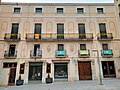
human settlement in Valls, Alt Camp, Camp de Tarragona, Spain  La plaça del Blat | |||||
| Upload media | |||||
| Instance of | |||||
|---|---|---|---|---|---|
| Location | Valls, Alt Camp, Camp de Tarragona, Tarragona Province, Catalonia | ||||
| Architectural style | |||||
| Heritage designation |
| ||||
| Inception |
| ||||
 | |||||
Català: Nucli central de Valls
This is a category about a building indexed in the Catalan heritage register as Bé Cultural d'Interès Local (BCIL) under the reference IPA-36572. |
Subcategories
This category has the following 8 subcategories, out of 8 total.
Media in category "Nucli central de Valls"
The following 4 files are in this category, out of 4 total.
-
 29 Carrer d'en Bosc (Valls), des de la plaça de la Zeta.jpg 3,120 × 4,160; 3.65 MB
-
 30 Ca Serra de la Plana, c. Nou 6-8 (Valls).jpg 4,160 × 3,120; 3.41 MB
-

-
 87 Mural d'Alba Fabre i Antonio Valadés, c. Sant Pere - c. Forn Nou (Valls).jpg 3,120 × 4,160; 3.88 MB
,_des_de_la_pla%C3%A7a_de_la_Zeta.jpg)
.jpg)
.jpg)
.jpg)