Category:Obere Ranftkapelle
Jump to navigation
Jump to search
| Object location | | View all coordinates using: OpenStreetMap |
|---|
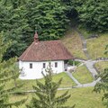
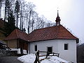
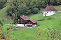
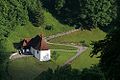
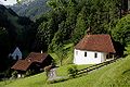
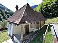
chapel building in Flüeli-Ranft in the canton of Obwalden, Switzerland   | |||||
| Upload media | |||||
| Instance of | |||||
|---|---|---|---|---|---|
| Part of | |||||
| Patron saint | |||||
| Location | Flüeli-Ranft, Sachseln, Obwalden, Switzerland | ||||
| Street address |
| ||||
| Diocese | |||||
| Occupant | |||||
| Heritage designation | |||||
| Inception |
| ||||
 | |||||
Media in category "Obere Ranftkapelle"
The following 27 files are in this category, out of 27 total.
-
 20230725 Ranft-1.tif 926 × 926; 4.55 MB
-
 20230725 Ranft-2.tif 5,184 × 3,888; 105.81 MB
-
 CH-NB - Ranft, Einsiedlerkapelle - Collection Gugelmann - GS-GUGE-LORY-B-15.tif 6,496 × 4,545, 2 pages; 84.48 MB
-
 Einsiedlerzelle Flüeli Ranft Web.jpg 598 × 600; 43 KB
-
 ETH-BIB-Flüeli-Ranft, beide Kapelle-Dia 247-13750.tif 3,625 × 2,852; 29.7 MB
-
 ETH-BIB-Flüeli-Ranft, Beide Klaus-Kapellen, Melchtal aufwärts-Dia 247-13748.tif 3,611 × 2,835; 29.42 MB
-
 ETH-BIB-Flüeli-Ranft, obere Kapelle-Dia 247-13749.tif 3,034 × 3,439; 29.97 MB
-
 Flueli Ranft BW 1.JPG 3,246 × 2,460; 3.64 MB
-
 Flueli Ranft BW 2.JPG 3,676 × 2,552; 3.8 MB
-
 Flueli Ranft BW 3.JPG 2,592 × 3,872; 2.09 MB
-
 Flueli Ranft BW 4.JPG 1,980 × 2,970; 2.24 MB
-
 Hier wohnte Bruder Klaus - Flickr - Michael Beat.jpg 1,600 × 1,200; 682 KB
-
 Obere Ranftkapelle und Sigristenhaus.jpg 5,184 × 3,456; 4.88 MB
-
 Picswiss OW-26-19.jpg 500 × 333; 50 KB
-
 Picswiss OW-26-21.jpg 300 × 450; 44 KB
-
 Picswiss OW-26-22.jpg 501 × 333; 56 KB
-
 Ranft, Chapelle supérieure de Nicolas de Flüe, face amont.jpg 2,048 × 1,536; 1.56 MB
-
 Ranft, Chapelle supérieure de Nicolas de Flüe, face aval.jpg 2,048 × 1,536; 1.42 MB
-
 Ranft, Chapelle supérieure, ermitage de Nicolas de Flüe, ex votos.jpg 2,048 × 1,536; 1.26 MB
-
 Ranft, Chapelle supérieure, ex votos.jpg 2,048 × 1,536; 925 KB
-
 Ranft, Chapelle supérieure, plafond.jpg 2,048 × 1,536; 1.14 MB
-
 Ranft, Chapelle supérieure, scènes de la vie de Nicolas de Flüe , détail.jpg 1,536 × 2,048; 924 KB
-
 Ranft, Chapelle supérieure, scènes de la vie de Nicolas de Flüe.jpg 2,048 × 1,536; 785 KB
-
 Ranft, Chapelle supérieure, vue vers le chœur.jpg 2,048 × 1,536; 821 KB
-
 Ranft, Chapelles supérieure et inférieure de Nicolas de Flüe.jpg 2,048 × 1,536; 1.96 MB
-
 Sachseln-Ranftkapelle-oben-2.jpg 1,800 × 1,200; 2.04 MB
-
 Sachseln-Ranftkapelle-oben.jpg 1,800 × 1,200; 2.37 MB


