Category:Old maps of Haiti
Jump to navigation
Jump to search
Countries of North America: Antigua and Barbuda · The Bahamas · Barbados · Belize · Canada · Costa Rica · Cuba · Dominica · Dominican Republic · El Salvador · Grenada · Guatemala · Haiti · Honduras · Jamaica · Mexico · Nicaragua · Panama · Saint Kitts and Nevis · Saint Lucia · Saint Vincent and the Grenadines · Trinidad and Tobago‡ · United States of America‡
Other territories: Bermuda · Florida Keys · Greenland · Guadeloupe · Martinique · Montserrat · Puerto Rico · Saint Barthélemy · Saint-Martin · Saint Pierre and Miquelon
‡: partly located in North America
Other territories: Bermuda · Florida Keys · Greenland · Guadeloupe · Martinique · Montserrat · Puerto Rico · Saint Barthélemy · Saint-Martin · Saint Pierre and Miquelon
‡: partly located in North America
For maps of Haiti prior to 1804, see Old maps of Hispaniola
Subcategories
This category has the following 9 subcategories, out of 9 total.
Media in category "Old maps of Haiti"
The following 91 files are in this category, out of 91 total.
-
 "PL. XXXV." (21082813580).jpg 3,936 × 2,939; 2.18 MB
-

-
 IleGonave1818 Carey.jpg 1,192 × 700; 148 KB
-
 IleGonave1825.jpg 752 × 491; 116 KB
-
 Map of Hayti Island (1839).jpg 1,020 × 689; 211 KB
-
 (1899) Map of the Island Haiti.jpg 1,062 × 620; 226 KB
-
 A Sketch of the harbour of Port Francoise on the Island of Hispaniola. LOC 73691516.jpg 9,060 × 6,447; 8.21 MB
-
 A Sketch of the harbour of Port Francoise on the Island of Hispaniola. LOC 73691516.tif 9,060 × 6,447; 167.11 MB
-

-
 Admiralty Chart No 467 The Môle of St. Nicolas, in the Island of Haiti, Published 1831.jpg 4,488 × 3,536; 1.85 MB
-

-
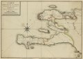
 AMH-8040-KB Map of Haiti and surrounding islands.jpg 2,400 × 1,676; 735 KB
-

-

-
 Baye et ville de Bayaha ou Port-Dauphin dans l'isle de St. Domingue. LOC 73696470.jpg 5,592 × 4,006; 3.05 MB
-
 Baye et ville de Bayaha ou Port-Dauphin dans l'isle de St. Domingue. LOC 73696470.tif 5,592 × 4,006; 64.09 MB
-
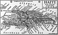 Britannica Haiti.jpg 1,029 × 625; 200 KB
-

-

-
 Carte des environs du Cap François et des paroisses qui en dependent. LOC 74691147.jpg 6,828 × 4,720; 3.82 MB
-
 Carte des environs du Cap François et des paroisses qui en dependent. LOC 74691147.tif 6,828 × 4,720; 92.21 MB
-
 Carte générale de la partie française de l'isle de St. Domingue. LOC 74692178.jpg 14,917 × 10,558; 16.36 MB
-
 Carte générale de la partie française de l'isle de St. Domingue. LOC 74692178.tif 14,917 × 10,558; 450.59 MB
-

-

-

-

-
 Environs de Leogane et du Port Au Prince dans lIsle de St. Domingue (2674967942).jpg 2,000 × 1,431; 2.34 MB
-
 Environs de Léogâne et du Port au Prince dans l'isle de St. Domingue. LOC 73696439.jpg 9,214 × 5,051; 5.18 MB
-
 Environs de Léogâne et du Port au Prince dans l'isle de St. Domingue. LOC 73696439.tif 9,214 × 5,051; 133.15 MB
-
 Esquisse du plan de la ville du Mole à St. Domingue. LOC 74692185.jpg 5,926 × 4,694; 2.49 MB
-
 Esquisse du plan de la ville du Mole à St. Domingue. LOC 74692185.tif 5,926 × 4,694; 79.58 MB
-
 Haiti 1800.jpg 2,000 × 1,533; 2.57 MB
-
 Haiti and Santo Domingo inset map (1921).jpg 1,164 × 543; 272 KB
-
 Haiti. 10-62. LOC 75694037.jpg 14,891 × 11,130; 21.14 MB
-
 Haiti. 10-62. LOC 75694037.tif 14,891 × 11,130; 474.18 MB
-
 Haiti. LOC 95680500.jpg 4,179 × 4,271; 1.79 MB
-
 Haiti. LOC 95680500.tif 4,179 × 4,271; 51.07 MB
-
 Haiti. LOC 99463776.jpg 3,269 × 2,544; 753 KB
-
 Haiti. LOC 99463776.tif 3,269 × 2,544; 23.79 MB
-
 Jacmel Haiti map 1799.jpg 400 × 400; 49 KB
-
 La partie Francoise de lisle de Saint Domingue (2674966926).jpg 2,000 × 1,420; 2.19 MB
-
 La partie françoise de l'isle de Saint Domingue. LOC 73696443.tif 6,536 × 4,484; 83.85 MB
-
 Le Port au Prince dans l'isle de St. Domingue. LOC 73696440.jpg 5,431 × 5,023; 2.83 MB
-
 Le Port au Prince dans l'isle de St. Domingue. LOC 73696440.tif 5,431 × 5,023; 78.05 MB
-
 Le Port au Prince. LOC 74692171.jpg 5,916 × 4,285; 3.51 MB
-
 Le Port au Prince. LOC 74692171.tif 5,916 × 4,285; 72.53 MB
-

-

-
 Plan de l'isle à Vache à la coste de sud de S. Domingue. LOC 73696442.jpg 5,394 × 4,787; 2.79 MB
-
 Plan de l'isle à Vache à la coste de sud de S. Domingue. LOC 73696442.tif 5,394 × 4,787; 73.87 MB
-

-

-
 Plan de la baye et du cap de Tiburon. LOC 74692184.jpg 4,586 × 4,147; 2.42 MB
-
 Plan de la baye et du cap de Tiburon. LOC 74692184.tif 4,586 × 4,147; 54.41 MB
-
 Plan de la Baye Saint Louis dans l'isle de St. Domingue. LOC 73696469.jpg 6,993 × 5,064; 4.06 MB
-
 Plan de la Baye Saint Louis dans l'isle de St. Domingue. LOC 73696469.tif 6,993 × 5,064; 101.32 MB
-
 Plan de la Baye Saint Louis dans lisle de St. Domingue (2674647843).jpg 2,000 × 1,334; 2.1 MB
-

-

-
 Plan de la plaine du Cap François en l'Isle St. Domingue, LOC 73695940.jpg 14,124 × 11,480; 23.29 MB
-
 Plan de la Rade et Ville du Petit Goave dans iIsle de St. Domingue (2674149203).jpg 2,000 × 1,419; 2.08 MB
-
 Plan de la rade et ville du Petit Goâve dans l'isle de St. Domingue. LOC 73695997.jpg 9,226 × 4,992; 4.43 MB
-
 Plan de la rade et ville du Petit Goâve dans l'isle de St. Domingue. LOC 73695997.tif 9,226 × 4,992; 131.77 MB
-
 Plan de la ville des Cayes, dans l'Isle Saint Domingue. LOC 74691151.jpg 7,579 × 10,606; 13.88 MB
-
 Plan de la ville des Cayes, dans l'Isle Saint Domingue. LOC 74691151.tif 7,579 × 10,606; 229.98 MB
-

-

-
 Plan du canton de Plimouth et partie des Baradéres. LOC gm71002302.jpg 10,525 × 7,754; 11.83 MB
-
 Plan du cap et Mole S. Nicolas. LOC 2007627870.jpg 11,711 × 6,923; 8.21 MB
-
 Plan du cap et Mole S. Nicolas. LOC 2007627870.tif 11,711 × 6,923; 231.96 MB
-

-
 Plan du port du Cap dans l'isle de St. Domingue. LOC 74691148.jpg 9,243 × 4,928; 5.2 MB
-
 Plan du port du Cap dans l'isle de St. Domingue. LOC 74691148.tif 9,243 × 4,928; 130.32 MB
-
 Plano de la Bahía de Manzanillo LOC 91680798.jpg 6,197 × 8,168; 7.65 MB
-
 Plano de la Bahía de Manzanillo LOC 91680798.tif 6,197 × 8,168; 144.82 MB
-

-

-

-
 Plano del puerto del Guárico, cuyo conocimto. y entrada es del modo siguiente. LOC 74692141.tif 8,597 × 6,150; 151.27 MB
-
 Port Louis, Knowles.jpg 1,585 × 2,701; 668 KB
-
 Puerto de Guárico situado en la latd. de 19°48ʹ y en longitud de 304°16ʹ. LOC 90683831.jpg 5,665 × 4,085; 2.22 MB
-
 Puerto de Guárico situado en la latd. de 19°48ʹ y en longitud de 304°16ʹ. LOC 90683831.tif 5,665 × 4,085; 66.21 MB
-

-
 Puerto de Guárico situado en la lattd. de 19°48ʹ y en la longd. de 304°16 ms. LOC 90683832.tif 5,053 × 3,625; 52.41 MB
-
 Santo Domingo - Museo de las Casas Reales 0102.JPG 6,000 × 4,000; 14.31 MB
-
 The Birds of Haiti and San Domingo (1885) (20196585748).jpg 4,048 × 2,784; 1,007 KB
-
 Tortuga17thcentury.jpg 800 × 517; 111 KB
-
 Ville du Cap dans l'isle de St. Domingue. LOC 73695994.jpg 6,749 × 3,741; 3.71 MB
-
 Ville du Cap dans l'isle de St. Domingue. LOC 73695994.tif 6,749 × 3,741; 72.24 MB
-
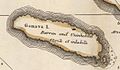
 Île-à-Vache Haiti around 1700.jpg 789 × 458; 53 KB
.jpg)


.jpg)
_Map_of_the_Island_Haiti.jpg)


.jpg)


.jpg)


.jpg)


.jpg)

.jpg)


_(20196585748).jpg)


