Category:Old maps of Leeuwarden
Jump to navigation
Jump to search
Subcategories
This category has the following 2 subcategories, out of 2 total.
Media in category "Old maps of Leeuwarden"
The following 17 files are in this category, out of 17 total.
-
 Plattegrond Leeuwarden Johan Sems 1603.jpg 6,188 × 4,995; 10.12 MB
-
 Oud Leeuwarden jpg.jpg 1,630 × 1,311; 852 KB
-

-
 Blaeu 1652 - Leeuwarden.jpg 1,630 × 1,311; 736 KB
-

-

-
 Oude kaart van Leeuwarden.jpg 3,413 × 2,636; 5.79 MB
-
 Atlas de Wit 1698-pl049-Leeuwarden-KB PPN 145205088.jpg 2,000 × 1,664; 1.88 MB
-
 Netherlands, Leeuwarden, map of 1866.jpg 1,400 × 1,197; 513 KB
-
 Leeuwarden 1905.jpg 3,503 × 2,316; 2.42 MB
-

-

-

-
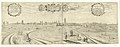 Gezicht op Leeuwarden vanuit het Zuiden, 1602, RP-P-1897-A-19536.jpg 6,468 × 2,528; 3.47 MB
-
 Leeuwarden stad, Gemeenteatlas van Nederland.jpg 1,265 × 943; 191 KB
-
 Plan of Leeuwarden PK-P-111.582, PK-1961-P-1631.tiff 5,996 × 4,839; 83.05 MB
-


.jpg)


.jpg)
.jpg)
.jpg)

