Category:Old maps of Milan
Jump to navigation
Jump to search
Subcategories
This category has the following 5 subcategories, out of 5 total.
Pages in category "Old maps of Milan"
This category contains only the following page.
Media in category "Old maps of Milan"
The following 89 files are in this category, out of 89 total.
-
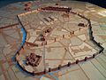 A model in wood of imperial era Mediolanum, Civico museo archeologico di Milano (8441760743).jpg 4,288 × 3,216; 10.89 MB
-
 Pietro Grazioli - De praeclaris Mediolani aedificiis... (2).JPG 968 × 718; 196 KB
-

-

-
 TopografiaMilano1158.png 1,363 × 1,191; 1.12 MB
-
 Galvano Fiamma, Mappa di Milano.jpg 3,826 × 5,308; 4.57 MB
-
-
 Ticino e Naviglio Grande.JPG 1,474 × 1,104; 1.38 MB
-
 The castle of Milano 1600.jpg 800 × 1,067; 241 KB
-
 Atlas Ortelius KB PPN369376781-061av-061br.jpg 3,000 × 2,194; 4.83 MB
-

-
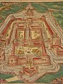
 Brunetti Lazzaretto di Milano 1631.jpg 2,000 × 2,511; 2.47 MB
-
 Atlas Van der Hagen-KW1049B12 063-STATO DI MILANO.jpeg 5,500 × 4,324; 4.27 MB
-

-
 "Stato di Milano" (22254704215).jpg 3,906 × 3,066; 2.57 MB
-
 Aveline, Antoine (1691-1743) - Milan.jpg 895 × 608; 492 KB
-
 Plattegrond van Milaan, ca. 1701-1713, RP-P-OB-83.037-20.jpg 2,558 × 1,915; 1.72 MB
-
 Plattegrond van Milaan, RP-P-2015-62-20.jpg 2,487 × 1,892; 860 KB
-
 Viage del Rey Catholico N.S. Phelipe V. de Milan a Cremona (BM Mm,3.103).jpg 2,500 × 1,896; 1.09 MB
-
-

-
 Ca. 1730 map of Milano by Matthaus Seutter.jpg 4,849 × 4,202; 5.43 MB
-
 Novo et accurato disegno della gran città di Milano - Anonimo, 1730 ca..jpg 1,946 × 1,625; 890 KB
-
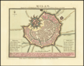
 Dal Re, Marc'Antonio (1697-1766) - Pianta di Milano - 1734.jpg 600 × 569; 181 KB
-
 Ager Mediolanensis Medii Aevi (detail).jpg 600 × 798; 127 KB
-
 1798 of 'Italien ... mit 12 Städteplanen und 40 Ansichten in Stahlstich' (11025354983).jpg 1,565 × 2,516; 1.14 MB
-
 Milan2.png 4,769 × 3,741; 29.74 MB
-
 1799 of 'Italien ... mit 12 Städteplanen und 40 Ansichten in Stahlstich' (11024430826).jpg 1,563 × 2,498; 1.15 MB
-
-
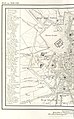
 1832 map of Milan.jpg 9,611 × 7,929; 14.85 MB
-
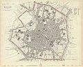 Milan 1832.jpg 6,420 × 5,219; 3.81 MB
-
 Mi860.jpg 6,193 × 4,447; 9.29 MB
-
 Milano - Giovanni Brenna (1860), ritaglio.JPG 1,658 × 1,662; 697 KB
-
 Milano - Giovanni Brenna (1860).jpg 2,399 × 1,729; 1.17 MB
-
 Carta di Milano di Giovanni Brenna (1865) - Musocco.jpg 2,378 × 1,922; 2.5 MB
-
 Pianta della citta di Milano, 1865 - btv1b84435492 (1 of 2).jpg 6,660 × 5,266; 6.82 MB
-
 Giardini pubblici mappa.jpg 2,409 × 2,404; 2.3 MB
-
 Corpi Santi.jpg 800 × 885; 566 KB
-
 Corpi Santi3.jpg 1,241 × 1,600; 635 KB
-

-
-

-
-
 Baedekers switzerland 1881 milan 1200x1569-600.jpg 1,200 × 1,569; 537 KB
-

-

-
-
 Milano - Piano Beruto (bozza).jpg 1,200 × 1,458; 501 KB
-
 Meyers b11 s0109a.jpg 4,457 × 5,562; 7.96 MB
-
 Mailand - 27-45.jpg 3,555 × 5,005; 3.85 MB
-
 Map Milan 1910.jpg 551 × 381; 211 KB
-
 MIlano - Piano regolatore del circondario interno della città (1888) 01.jpg 1,500 × 887; 147 KB
-
 MIlano - Piano regolatore del circondario interno della città (1888) 02.jpg 1,500 × 1,125; 185 KB
-
 Milano - Piano Beruto (definitivo).jpg 1,276 × 1,400; 693 KB
-
 Italy- a handbook for travellers. First Part (Nothern Italy) (1893) (14778176401).jpg 2,702 × 1,680; 1.65 MB
-

-

-
-
 Luca Beltrami - Lazzaretto 1899.jpg 1,643 × 1,200; 295 KB
-
-
 Carta contado.jpg 1,202 × 1,856; 214 KB
-
 Milano - Piano regolatore di diverse zone di Milano (1906) 01.jpg 1,500 × 1,289; 409 KB
-
 Milano - Piano regolatore di diverse zone di Milano (1906) 02.jpg 1,500 × 924; 241 KB
-
 Milano - Piano regolatore di diverse zone di Milano (1906) 03.jpg 1,500 × 776; 232 KB
-
 Guide to Italy and Sicily (1911) (14785900133).jpg 2,856 × 2,840; 1.86 MB
-
 Milano 1913.jpg 1,323 × 1,273; 750 KB
-
 Storia di Milano (Roma).jpg 2,717 × 2,614; 3.76 MB
-
 Milano TouringClubItaliano 1914.jpg 2,206 × 2,551; 2.46 MB
-

-
 Milano 1943.jpg 7,206 × 5,424; 10.04 MB
-
-

-
 3 TERRITORIO PD-964x675.jpg 964 × 675; 257 KB
-
-

-
 Atlante Veneto Volume 2 041.jpg 7,258 × 10,256; 8.88 MB
-
 Cascina Torchiera.jpg 979 × 804; 863 KB
-
 Catasto Carolo VI - Boscajola 1.jpg 1,301 × 1,059; 498 KB
-
 Catasto Carolo VI - Boscajola 2.jpg 2,846 × 2,402; 2.45 MB
-
-

-

-
 Leonardo Milano04.jpg 761 × 1,094; 624 KB
-
 Mappa delle linee di omnibus a Milano nell'anno 1871.jpg 2,289 × 2,562; 4.33 MB
-
 Meyer‘s Zeitungsatlas 008 – Österreich- Lombardisch-Venetisches Königreich.jpg 7,344 × 6,224; 16.82 MB
-
 Milano, piazza San Babila map01.jpg 968 × 1,070; 119 KB
-
 Pianta storica di Milano- Federico Agnelli (1731 ca).jpg 2,000 × 1,560; 789 KB
-
 Tombongabelle01.jpg 961 × 1,101; 1.15 MB
-
 Tombongabelle02.jpg 2,171 × 2,191; 2.73 MB
.jpg)
.JPG)
.jpg)
.jpg)


.jpg)


.jpg)


.jpg)
.jpg)
_-_Milan.jpg)


.jpg)
.jpg)


_-_Pianta_di_Milano_-_1734.jpg)
.jpg)
.jpg)

.jpg)


,_ritaglio.JPG)
.jpg)
_-_Musocco.jpg)
.jpg)


%27_(11251224093).jpg)
.jpg)
.jpg)
.jpg)

.jpg)
.jpg)
.jpg)
.jpg)


_01.jpg)
_02.jpg)
.jpg)
_(1893)_(14778176401).jpg)
.jpg)
.jpg)
.jpg)

_(14593805468).jpg)

_01.jpg)
_02.jpg)
_03.jpg)
_(14785900133).jpg)

.jpg)

.jpg)

.jpg)
.jpg)

.jpg)
.jpg)


.jpg)


.jpg)