Category:Old maps of Saint Lucia
Jump to navigation
Jump to search
Countries of North America: Antigua and Barbuda · The Bahamas · Barbados · Belize · Canada · Costa Rica · Cuba · Dominica · Dominican Republic · El Salvador · Grenada · Guatemala · Haiti · Honduras · Jamaica · Mexico · Nicaragua · Panama · Saint Kitts and Nevis · Saint Lucia · Saint Vincent and the Grenadines · Trinidad and Tobago‡ · United States of America‡
Other territories: Bermuda · Florida Keys · Greenland · Guadeloupe · Martinique · Montserrat · Puerto Rico · Saint Barthélemy · Saint-Martin · Saint Pierre and Miquelon
‡: partly located in North America
Other territories: Bermuda · Florida Keys · Greenland · Guadeloupe · Martinique · Montserrat · Puerto Rico · Saint Barthélemy · Saint-Martin · Saint Pierre and Miquelon
‡: partly located in North America
Subcategories
This category has only the following subcategory.
Media in category "Old maps of Saint Lucia"
The following 37 files are in this category, out of 37 total.
-
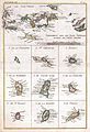
 1632 Cardona Descripcion Indias (28).jpg 3,184 × 2,165; 1.28 MB
-
 1632 Cardona Descripcion Indias (29).jpg 3,184 × 2,165; 661 KB
-

-

-

-
-
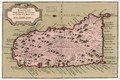
 Map of St.Lucia (1888).jpg 1,259 × 1,923; 1.35 MB
-

-

-
 70 of 'Les guerres des Antilles de 1793 à 1815 ... Avec 7 cartes' (11236469726).jpg 1,324 × 1,786; 335 KB
-

-
 Admiralty Chart No 1273 St Lucia, Published 1889.jpg 11,237 × 16,369; 25.9 MB
-
 Admiralty Chart No 197 Marigot Harbour to Pointe du Cap, Published 1875.jpg 11,338 × 16,428; 30.18 MB
-

-

-
 Carte de l'isle de Sainte Lucie, LOC 73697107.jpg 3,991 × 2,825; 1.68 MB
-
 Carte de l'isle de Sainte Lucie, LOC 73697107.tif 3,991 × 2,825; 32.26 MB
-
 Carte de l'isle de Sainte Lucie. LOC 73692429.jpg 4,076 × 2,944; 1.51 MB
-
 Carte de l'isle de Sainte Lucie. LOC 73692429.tif 4,076 × 2,944; 34.33 MB
-

-

-

-
 Karte von der Insel St. Lucia. LOC 74691608.jpg 3,522 × 2,349; 1.3 MB
-
 Karte von der Insel St. Lucia. LOC 74691608.tif 3,522 × 2,349; 23.67 MB
-

-
 Plan du port du Carenage ou petit cul de sac de l'Isle Se. Lucie. LOC 74691677.jpg 2,452 × 3,195; 955 KB
-
 Plan du port du Carenage ou petit cul de sac de l'Isle Se. Lucie. LOC 74691677.tif 2,452 × 3,195; 22.41 MB
-
-
 Rigobert-Bonne-Atlas-de-toutes-les-parties-connues-du-globe-terrestre MG 0018.tif 3,536 × 5,263; 53.28 MB
-
 Rigobert-Bonne-Atlas-de-toutes-les-parties-connues-du-globe-terrestre MG 0031.tif 3,597 × 1,833; 25.16 MB
-
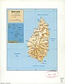
 Saint Lucia (1-50,000) (1968).jpg 8,173 × 13,317; 18.64 MB
-
 Saint Lucia. LOC 2005631605.jpg 2,521 × 3,259; 659 KB
-
 Saint Lucia. LOC 2005631605.tif 2,521 × 3,259; 23.51 MB
-
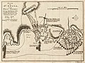
 St Lucia Plan 1778.jpg 540 × 421; 75 KB
-

-
-
 Atlas national portatif de la France 1792 (105094065).jpg 10,970 × 5,733; 10.72 MB
.jpg)
.jpg)
,_West_Indies_-_Geographicus_-_SaintLucia-bellin-1758.jpg)
,_in_the_West_Indies_-_Geographicus_-_StLucie-bellin-1758.jpg)


.jpg)
.jpg)
.jpg)
.jpg)
.jpg)


.jpg)
%27_(11192964455).jpg)
%27_(16564195936).jpg)

_RMG_K1016.jpg)


_(1968).jpg)


.jpg)