Category:Old maps of Sri Lanka
Jump to navigation
Jump to search
Subcategories
This category has the following 12 subcategories, out of 12 total.
- 15th-century maps of Sri Lanka (11 F)
- 16th-century maps of Sri Lanka (15 F)
- 20th-century maps of Sri Lanka (36 F)
A
- Archipelagus Orientalis (8 F)
O
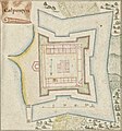
- Old maps of Galle Fort (11 F)
S
Media in category "Old maps of Sri Lanka"
The following 24 files are in this category, out of 24 total.
-
 00004000164CeylonkaartNationaalArchiefKalpitiya.jpg 1,074 × 1,151; 548 KB
-

-

-

-
 Admiralty Chart No 2031 Ceylon East Coast, Published 1888, Large Corrections 1947.jpg 11,124 × 16,323; 56.06 MB
-
 Admiralty Chart No 2898 Maldive Islands to Ceylon, Published 1944.jpg 16,304 × 11,072; 32.56 MB
-
 Admiralty Chart No 68b Palk Strait and Gulf of Mannar, Published 1862, New Edition 1935.jpg 18,351 × 11,208; 46.07 MB
-
 Admiralty Chart No 813 Ceylon South Coast, Published 1853, Large Corrections 1896.jpg 16,033 × 10,847; 59.39 MB
-
 Admiralty Chart No 813 Ceylon South Part, Published 1911.jpg 16,259 × 10,952; 60.14 MB
-
 Agricultural Map of Ceylon - DPLA - 8344a0b3321eab305acc2ab8de83346f.jpg 2,819 × 4,355; 1.74 MB
-
 Asia w sri lanka.jpg 281 × 370; 55 KB
-
 Carte française de l'île de Ceylan - btv1b59057315 (1 of 2).jpg 10,208 × 6,216; 7.59 MB
-
 Carte française de l'île de Ceylan - btv1b5905732k (1 of 2).jpg 8,400 × 6,232; 8.21 MB
-
 Carte française de l'île de Ceylan - btv1b59057330 (1 of 2).jpg 9,472 × 7,512; 8.24 MB
-
 Indian Empire in 1912.jpg 1,850 × 1,416; 613 KB
-
 Kart med inntegnet reiserute for reisen i India (5268461582).jpg 500 × 778; 124 KB
-
 Korales.png 700 × 990; 176 KB
-
 Manuscript map of Ceylon (Sri Lanka) Wellcome L0049846.jpg 3,918 × 5,855; 3.51 MB
-
 Map of the island of Ceylon Wellcome L0047915.jpg 3,090 × 4,912; 4.32 MB
-
 Mathakal Thombu Map resized.jpg 1,024 × 651; 219 KB
-
 Mathakal Thombu map.jpg 1,810 × 1,150; 1.17 MB
-
 Pauly-Wissowa IV A,2, 2267 b.jpg 1,603 × 1,328; 509 KB
-
 Peutinger India.png 463 × 247; 42 KB
-
 The Ganges and The Ghaghra, 1784.jpg 4,000 × 3,299; 3.1 MB

.jpg)
.jpg)
.jpg)


.jpg)
.jpg)
.jpg)

.jpg)

_Wellcome_L0049846.jpg)


