Category:Old maps of the Sea of Japan
Jump to navigation
Jump to search
Subcategories
This category has only the following subcategory.
V
Media in category "Old maps of the Sea of Japan"
The following 72 files are in this category, out of 72 total.
-
 'The Sea Serpent' by George Roux 13.jpg 1,128 × 1,653; 891 KB
-
 082 china-und-japan (1905).png 2,175 × 1,797; 2.64 MB
-
 084 japan-und-korea (1905).png 1,824 × 2,215; 2.55 MB
-
 CaronMap.jpg 514 × 350; 140 KB
-
 CEM-36-NE-corner.jpg 2,560 × 1,920; 2.02 MB
-
 Delisle - Carte d'Asie (Compagnieland).jpg 783 × 799; 576 KB
-
 L'Asie divisée en tous ses Etats 2.jpg 1,089 × 1,515; 376 KB
-
 1780 Raynal and Bonne Map of China, Korea, and Japan - Geographicus - Chine-bonne-1780.jpg 1,686 × 2,500; 1.24 MB
-
 Chikyu zenzu.JPG 326 × 326; 70 KB
-
 SeaEst in Koeea18c.jpg 730 × 564; 283 KB
-
 La-Perouse-Chart-of-Discoveries.jpg 3,216 × 4,144; 1.39 MB
-
 1809 Pinkerton Map of Korea ^ Japan - Geographicus - JapanKorea-pinkerton-1809.jpg 3,000 × 2,329; 1.54 MB
-
 1814 Thomson Map of Tartary ( Mongolia, Tibet ) - Geographicus - Tartary-t-1814.jpg 3,500 × 2,912; 2.21 MB
-
 Corea and Japan Map in 1815.jpg 2,161 × 1,641; 904 KB
-
 1818 Pinkerton Map of Korea and Japan - Geographicus - JapanKorea-pinkerton-1818.jpg 3,500 × 2,733; 2.12 MB
-
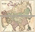 1820 Lizars Wall Map of Asia (in two panels) - Geographicus - Asia-lizars-1820.jpg 5,000 × 4,531; 6.65 MB
-
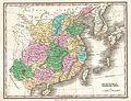 1827 Finley Map of China - Geographicus - China-finley-1827.jpg 3,000 × 2,308; 2.02 MB
-
 1837 Malte-Brun Map of China and Japan - Geographicus - China-mb-1837.jpg 2,328 × 1,758; 772 KB
-
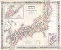
 1855 Colton Map of Japan - Geographicus - Japan-colton-1855.jpg 3,500 × 2,927; 2.86 MB
-
 1862 Johnson Map of Japan - Geographicus - Japan-johnson-1862.jpg 3,000 × 2,601; 2.2 MB
-
-
 Nan bei yang he tu. LOC gm71005215.jpg 5,106 × 7,122; 4.64 MB
-
 Nan bei yang he tu. LOC gm71005215.tif 5,106 × 7,122; 104.04 MB
-
-
 Admiralty Chart No 452 Yezo Island (Hokkaido), Published 1882.jpg 16,193 × 10,887; 50.53 MB
-
 Atlas Van der Hagen-KW1049B13 053-IAPONIA REGNVM.jpeg 5,500 × 4,120; 2.99 MB
-
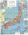
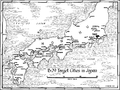 B-29 target cities in Japan.png 1,138 × 852; 131 KB
-
 Battlefields in the Russo Japanese War.jpg 1,220 × 1,610; 1.66 MB
-
 Brockhaus and Efron Encyclopedic Dictionary b82 709-0.jpg 2,127 × 2,684; 981 KB
-
 Bungyun by Japan 1878.jpg 500 × 654; 132 KB
-
 Chassiron 1858 carte japon.jpg 763 × 1,200; 271 KB
-
 China 1910.jpg 2,208 × 1,689; 1.38 MB
-
 China Korea und Japan im Massstab 1-7.500.000 LOC 2006629397 clipping matsushima.jpg 1,886 × 1,691; 2.74 MB
-
 Delisle - L'Asie.jpg 3,672 × 2,872; 9.08 MB
-
 Homann map of Japan (Iaponia) 1730.jpg 1,000 × 815; 795 KB
-

-
 Jap-Rus Image7.jpg 1,099 × 740; 431 KB
-
 Japan 1844.jpg 2,000 × 1,658; 3.54 MB
-
 Japan korea map 1882 by Japan.jpg 600 × 489; 173 KB
-
 Japan map Brochhaus.jpg 1,064 × 1,342; 202 KB
-
-
 Japan1821.png 1,126 × 938; 1.59 MB
-
 Karta över Japan vid 1900-talets början (ur Nordisk familjebok).jpg 2,548 × 3,480; 1.86 MB
-
 Kunyu Wanguo Quantu by Matteo Ricci Plate Japan.jpg 3,500 × 3,000; 1.47 MB
-

-

-
 L'Empire Chinois et du Japon (1833) (cropped1).jpg 1,035 × 1,986; 614 KB
-
 L'Empire Chinois et du Japon (1833).jpg 4,977 × 3,681; 5.98 MB
-
 Lange diercke sachsen asien japan.jpg 1,564 × 1,526; 1.22 MB
-
 Letts-Popular-Atlas-1883-Russia-in-Asia-Chinese-Empire-etc.jpg 6,744 × 5,982; 8.81 MB
-

-
 Map of Asia in 1700 by Guillaume de L'Isle.jpg 7,647 × 5,826; 13.98 MB
-
 Map of Japan 1855.jpg 1,872 × 2,310; 599 KB
-

-
 Map-of-Japan-1707-William-Adams-Visits-Shogun.png 3,203 × 2,197; 10.08 MB
-
 Mapa východní Asie.jpg 2,150 × 1,781; 1.3 MB
-
 Maps of the Far East, illustrating Russo-Japanese War (2709958051).jpg 1,265 × 2,000; 2.83 MB
-
 Matteo Ricci Far East 1602 Larger.jpg 1,925 × 2,463; 1.62 MB
-
 Mea du japon1704.jpg 2,328 × 1,701; 1.78 MB
-
 Mer Orientale 1700.jpg 626 × 608; 379 KB
-
 Military Strength in the Russo Japanese War.jpg 1,723 × 1,158; 127 KB
-
 Mongolie. L'Empire Chinois et du Japon (1833) (cropped).jpg 1,839 × 1,498; 1,020 KB
-
 PYH2011050209790001300 P2.jpg 500 × 334; 79 KB
-
 Rozhestvenskii Voyage.jpg 831 × 639; 71 KB
-
 Sea of japan in ricci world map.jpg 1,035 × 777; 1.1 MB
-
 Stielers Handatlas 1891 62 NE.jpg 1,250 × 1,250; 687 KB
-
 Stielers Handatlas 1891 63.jpg 5,050 × 4,250; 6.22 MB
-
 The mikado's empire (1894) (14597607818).jpg 2,032 × 3,320; 1.48 MB
-
 William Adams 1707 map of Japan.jpg 784 × 558; 280 KB
-
 Zyutei bankoku zenzu 1855.jpg 466 × 466; 135 KB
-
 Карта Дальнего Востока 1904.jpg 2,940 × 1,926; 3.99 MB
-
 Табурин - Театр военных действий.jpg 3,124 × 2,240; 3.29 MB

.png)
.png)


.jpg)


_-_Geographicus_-_Tartary-t-1814.jpg)


_-_Geographicus_-_Asia-lizars-1820.jpg)


_-_Geographicus_-_Japan-j-64.jpg)

_-_Geographicus_-_SinoJapanese-japan-1910.jpg)
,_Published_1882.jpg)


_1730.jpg)
.jpg)


.jpg)


_(cropped1).jpg)
.jpg)


_in_1837_from_Malte-Brun_Map_of_China_and_Japan_(cropped).jpg)


.jpg)


_(cropped).jpg)


_(14597607818).jpg)


